Catholic church building, wayside cross
Location: Saint-Amans-Valtoret
GPS coordinates: 43.48072,2.48716
Latest update: November 28, 2025 12:36
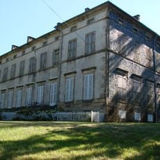
Château de Soult-Berg
1 km
Château de Saint-Amans-Valtoret
211 m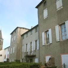
Château de Gos
3.4 km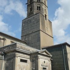
Église Notre-Dame de Saint-Amans-Soult
541 m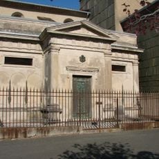
Chapelle funéraire de la famille Soult
556 m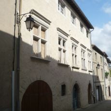
Caserne de gendarmerie de Saint-Amans-Soult
525 m
Scenic viewpoint
3.9 km
Wayside cross
125 m
Menhir du Roucan
2.5 km
Wayside cross
564 m
Croix de la Roque
1.7 km
Statue de Philomène
3.4 km
Wayside cross
454 m
Wayside cross
358 m
Wayside cross
463 m
Catholic church building, wayside cross
1.2 km
Four à verre
4.2 km
Catholic church building, wayside cross
308 m
Wayside cross
593 m
Menhir des Amalrics
1.8 km
Menhir dit Peyre-Pause
1.8 km
Moulin de Peyrellès
3.5 km
Stele, memorial
4.4 km
Moulinas
4.4 km
Waterfall
2.9 km
Cascade Du Mas Naffre
2.2 km
Cascade de Crussinac
3.6 km
Waterfall
3.1 kmVisited this place? Tap the stars to rate it and share your experience / photos with the community! Try now! You can cancel it anytime.
Discover hidden gems everywhere you go!
From secret cafés to breathtaking viewpoints, skip the crowded tourist spots and find places that match your style. Our app makes it easy with voice search, smart filtering, route optimization, and insider tips from travelers worldwide. Download now for the complete mobile experience.

A unique approach to discovering new places❞
— Le Figaro
All the places worth exploring❞
— France Info
A tailor-made excursion in just a few clicks❞
— 20 Minutes