
Saint-Amans-Valtoret, commune in Tarn, France
Location: canton of Saint-Amans-Soult
Location: Tarn
Location: arrondissement of Castres
Elevation above the sea: 576 m
Shares border with: Lasfaillades, Albine, Anglès, Bout-du-Pont-de-Larn, Pont-de-Larn, Rouairoux, Saint-Amans-Soult, Sauveterre, Le Vintrou
Phone: +33563983028
Email: mairie.st.amans.valtoret@wanadoo.fr
GPS coordinates: 43.48083,2.49139
Latest update: June 10, 2025 18:13

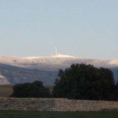
Pic de Nore
6.7 km
Pic de Nore transmitter
6.6 km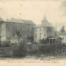
Château de Caylus
6.1 km
Château d'Hautpoul
9.1 km
Château de Soult-Berg
924 m
Château de Sauveterre
5.1 km
Château de Montlédier
6.8 kmChâteau de Saint-Amans-Valtoret
138 m
Église Saint-Sauveur de Mazamet
9.4 km
Temple Saint-Jacques de Mazamet
9.3 km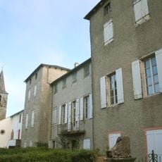
Château de Gos
3.3 km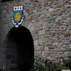
Portail Bas
10.7 km
Golf de la Barouge
8.9 km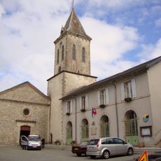
Église Notre-Dame-de-l'Assomption d'Anglès
10.8 km
Église Notre-Dame de Saint-Amans-Soult
531 m
Chapelle funéraire de la famille Soult
547 m
Mémorial des Aviateurs
5.1 km
Église Saint-Jean-Baptiste de Pont-de-Larn
7.3 km
Espace Apollo
9.5 km
Église Notre-Dame de Mazamet
9.2 km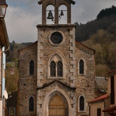
Église Saint-Louis de Cambounès
12.5 km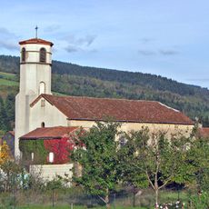
Église Saint-Louis de Lacabarède
7.5 km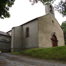
Église Notre-Dame-des-Neiges de Bouisset
10.5 km
Montagne Noire
6.7 km
Église Saint-André d'Aussillon-Village
9.6 km
Église Notre-Dame du Rialet
9.3 km
Église Saint-Martin de la Souque
10.8 km
Maison dite Jamme de la Goutine
9.7 kmVisited this place? Tap the stars to rate it and share your experience / photos with the community! Try now! You can cancel it anytime.
Discover hidden gems everywhere you go!
From secret cafés to breathtaking viewpoints, skip the crowded tourist spots and find places that match your style. Our app makes it easy with voice search, smart filtering, route optimization, and insider tips from travelers worldwide. Download now for the complete mobile experience.

A unique approach to discovering new places❞
— Le Figaro
All the places worth exploring❞
— France Info
A tailor-made excursion in just a few clicks❞
— 20 Minutes