Pic de Nore, Mountain summit in Aude, France
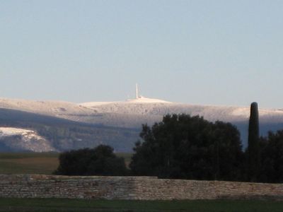
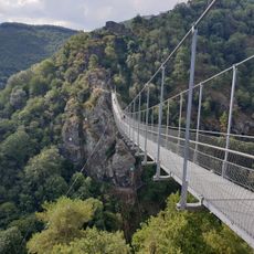
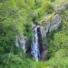
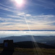
Pic de Nore is a mountain summit in the Aude region that rises to approximately 1,200 meters and features several hiking trails and mountain biking routes. The peak is located within the Montagne Noire range and offers access to different outdoor activities.
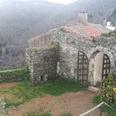
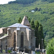
The mountain has served as a natural boundary point between different regions of southern France for centuries. Throughout history, the location acted as a dividing line during various territorial changes in the area.
The summit attracts hikers and outdoor enthusiasts who gather to enjoy the views and experience the landscape. The mountain draws people seeking connection with nature and the mountains of southern France.
Multiple hiking routes lead to the summit from various starting points, with popular trails beginning near Saint-Amans-Soult. The best time to visit is during warmer months when trails are dry and conditions are more favorable for outdoor activities.
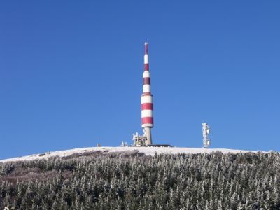
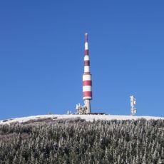
A large transmission tower stands at the peak and provides communications infrastructure for the surrounding region. This tower is visible from a distance and becomes part of the landscape when reaching the summit.
Location: Aude
Elevation above the sea: 1,211 m
GPS coordinates: 43.42442,2.46265
Latest update: December 10, 2025 15:52
Gouffre de Cabrespine
7.3 km
Footbridge of Mazamet
9.1 km
Passerelle de Mazamet
9.1 km
Limousis cave
9.9 km
Pic de Nore transmitter
65 m
Château d'Hautpoul
8.9 km
Château de Soult-Berg
5.9 km
Château de Sauveterre
9.2 km
Glacière de Pradelles-Cabardès
2.6 kmChâteau de Saint-Amans-Valtoret
6.7 km
Château de Roquefère, Roquefère
8.9 km
Église Saint-Sernin de Cubserviès
7.3 kmDolmen de la Jagantière
9.6 km
Cubserviès
8 km
Château de Citou
8.1 km
Château de Gos
3.9 km
Chapelle Saint-Jean de Citou
8.4 kmÉglise Saint-Jean-Baptiste de Pradelles-Cabardès
2.2 km
Église Saint-André de Roquefère
7.8 km
Croix du lavoir
2.7 km
Église Notre-Dame de Saint-Amans-Soult
6.2 km
Chapelle funéraire de la famille Soult
6.2 km
Mémorial des Aviateurs
5.1 km
Montagne Noire
52 m
Église Sainte-Foy de Roquefère
8.9 km
Église Saint-Saturnin de Trassanel
9 km
Église Saint-Jean-Baptiste de Citou
8.2 km
Old Church of Saint-Sauveur, Mazamet
9.3 kmVisited this place? Tap the stars to rate it and share your experience / photos with the community! Try now! You can cancel it anytime.
Discover hidden gems everywhere you go!
From secret cafés to breathtaking viewpoints, skip the crowded tourist spots and find places that match your style. Our app makes it easy with voice search, smart filtering, route optimization, and insider tips from travelers worldwide. Download now for the complete mobile experience.
A unique approach to discovering new places❞
— Le Figaro
All the places worth exploring❞
— France Info
A tailor-made excursion in just a few clicks❞
— 20 Minutes