High water mark
Location: Bezirk Mitte
Location: Saarbrücken
Inscription: WASSERSTAND|13 MAI 1970
GPS coordinates: 49.23645,6.98050
Latest update: November 20, 2025 03:21
French embassy
340 m
Bürgerpark Hafeninsel
260 m
Congresshalle
529 m
St. Jakob
438 m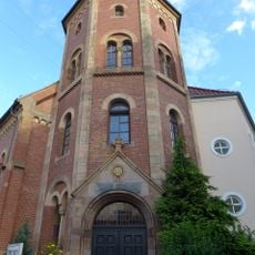
Immanuelkirche (Saarbrücken)
300 m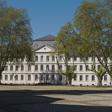
Comeniushaus
538 m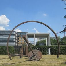
Wanderung eines Caspar David
414 m
Rondell
174 m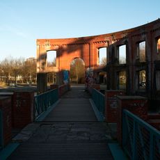
Wassertor
267 m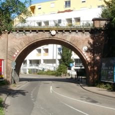
Railway bridge St. Johanner Straße
351 m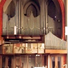
Späth-Orgel in St. Jakob
430 m
Malstatter Markt
500 m
Mutter Saar und ihre Kinder
502 m
Sculpture, Work of art
346 m
Ludwigstrasse60
441 m
Wappen der Stadt Malstatt-Burbach 1897-1909
469 m
Mapped 66117
409 m
Der erste Mann am Hochofen
366 m
Wandskulptur
277 m
Saarbrücker Kopf
500 m
Work of art, sculpture
440 m
Relief sculpture, Work of art
321 m
Dead end street, scenic viewpoint
163 m
War memorial, memorial
503 m
Memorial
306 m
High water mark
1 m
Irene Bernard
442 m
Leander Bernard
442 mReviews
Visited this place? Tap the stars to rate it and share your experience / photos with the community! Try now! You can cancel it anytime.
Discover hidden gems everywhere you go!
From secret cafés to breathtaking viewpoints, skip the crowded tourist spots and find places that match your style. Our app makes it easy with voice search, smart filtering, route optimization, and insider tips from travelers worldwide. Download now for the complete mobile experience.

A unique approach to discovering new places❞
— Le Figaro
All the places worth exploring❞
— France Info
A tailor-made excursion in just a few clicks❞
— 20 Minutes