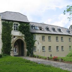
Burg Hemmersbach
1.7 km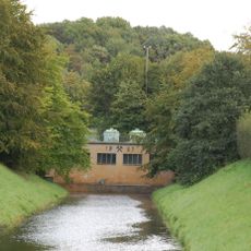
Ville-Stollen
1.4 km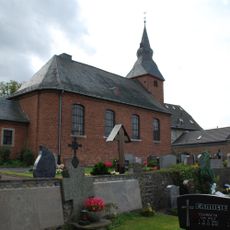
St. Cyriakus
1.8 km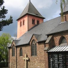
St. Clemens
967 m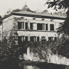
Burg Boisdorf
1.9 km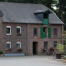
Horremer Mühle
1.7 km
Stadtwald Horrem
1.8 km
Waldflächen an Burg Hemmersbach
1.8 km
Alte Erftschlinge nordwestlich der Kläranlage zwischen Horrem und Sindorf
2.4 km
Röttgenhalde und landwirtschaftliche Flächen bis an die A4
535 m
Standort der ehemaligen Pfarrkirche St. Antonius
1.4 km
Memorial, commemorative plaque
1.8 km
Work of art, sculpture
1.1 km
Dem Andenken unserer Krieger
1.4 km
Horremer Brücke
1.7 km
Wayside cross
1.9 km
Adolph-Kolping-Pilgerweg
1.3 km
Adolph-Kolping-Pilgerweg
1.2 km
Wayside cross, Catholic church building
381 m
Von Meyburg
1.3 km
Memorial, war memorial
1.8 km
Wolfgang Reichsgraf Berghe von Trips
1.7 km
Wayside shrine, Christianity, Catholic church building
1.2 km
Grefrath vor der Umsiedlung
2.3 km
Gedenkstein für Bottenbroich
25 m
Ehem. Schaufel eines Braunkohlebaggers
112 m
War memorial, memorial
1.2 km
Wayside cross
156 mReviews
Visited this place? Tap the stars to rate it and share your experience / photos with the community! Try now! You can cancel it anytime.
Discover hidden gems everywhere you go!
From secret cafés to breathtaking viewpoints, skip the crowded tourist spots and find places that match your style. Our app makes it easy with voice search, smart filtering, route optimization, and insider tips from travelers worldwide. Download now for the complete mobile experience.

A unique approach to discovering new places❞
— Le Figaro
All the places worth exploring❞
— France Info
A tailor-made excursion in just a few clicks❞
— 20 Minutes