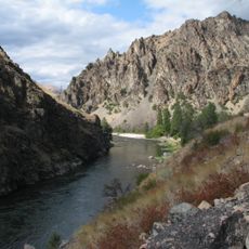
Frank Church–River of No Return Wilderness
37.7 km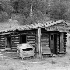
Leesburg, Idaho
43.4 km
Stripe Mountain
23 km
Chamberlain Ranger Station Historic District
43.6 km
Cold Meadows Guard Station
23.4 km
Salmon Mountain Lookout
35.5 km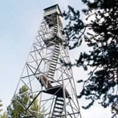
Arctic Point Fire Lookout
34.7 km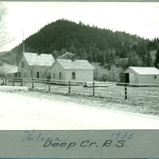
Deep Creek Ranger Station
42.3 km
Butts Creek Point Fire Lookout
8 km
Cabin Creek Ranch
30.8 km
Blacky Foster House
31.1 km
Lantz Rapids
20.3 km
Dutch Oven Rapids
22.1 km
Salmon Wild and Scenic River
33.7 km
Mist Peak
22.4 km
Devils Teeth Rapids
22.7 km
Long Tom Rapids
6.1 km
Aparejo Point
45.3 km
Little Devils Teeth Rapids
27.7 km
Arctic Point
34.8 km
Cliffside Rapids
12.2 km
Ring Creek Point
43.4 km
Middle Fork of the Salmon River
5.4 km
Earl Parrot's Cabin
13.3 km
Observation Point
39.7 km
Golden Creek Falls
20.6 km
Nugget Creek Falls
13.3 km
Veil Falls
23 kmReviews
Visited this place? Tap the stars to rate it and share your experience / photos with the community! Try now! You can cancel it anytime.
Discover hidden gems everywhere you go!
From secret cafés to breathtaking viewpoints, skip the crowded tourist spots and find places that match your style. Our app makes it easy with voice search, smart filtering, route optimization, and insider tips from travelers worldwide. Download now for the complete mobile experience.

A unique approach to discovering new places❞
— Le Figaro
All the places worth exploring❞
— France Info
A tailor-made excursion in just a few clicks❞
— 20 Minutes