Via Ferrata of Thônes, Via ferrata in Thônes, France
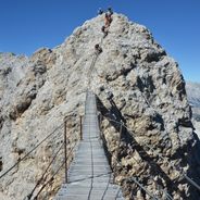
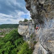
Via Ferrata La Roche à l'Agathe is an equipped climbing route near Thônes that spans approximately 1,970 feet (600 meters) with an elevation gain of around 770 feet (235 meters), featuring fixed cables, rungs, ladders, and multiple technical sections including overhangs and a suspension bridge suitable for experienced climbers.
This via ferrata was developed in the late 1990s to provide a technical and physical challenge in a natural alpine setting, with its route designed to offer varying difficulties through secure fixed points and escape routes for safety, following the broader tradition of via ferratas that originated as military paths during World War I.
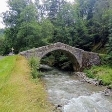
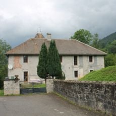
The route integrates into the mountain culture of the Haute-Savoie region, where outdoor sports combine with local traditions, and visitors often complement their climbing experience by exploring nearby villages, sampling regional cheeses like Reblochon at the cooperative du Farto, and participating in traditional markets reflecting the alpine heritage of the area.
The via ferrata requires proper safety equipment including a helmet, harness, lanyards, and gloves, and is accessible year-round except during adverse weather or maintenance periods, with the approach taking about 5 to 10 minutes from the parking area in Thônes and the complete ascent lasting between 2.5 to 4 hours depending on physical condition and chosen route variations.
Climbers frequently report encountering chamois near the suspension bridge and along the ridge during their ascent, and the final section offers two route options with the more difficult variation featuring a long overhang considered the most demanding passage, requiring substantial arm strength to complete successfully.
The community of curious travelers
AroundUs brings together thousands of curated places, local tips, and hidden gems, enriched daily by 60,000 contributors worldwide.