Victoria Valley

Log in to your account

AroundUs is a community-driven map of interesting places, built by curious explorers like you. It grows with every review, story, and photo you share.
Connect to save your favorite spots, contribute locations, and create personalized routes.
By continuing, you accept our Terms and Conditions and our Privacy Policy

Victoria Valley

Add to collection
Map
Suggest a change
Share

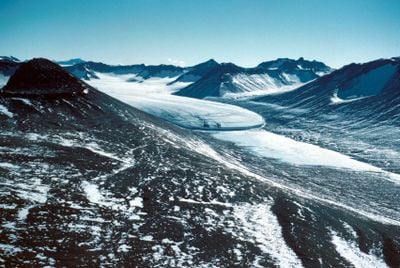
Victoria Valley, Ice-free valley in the McMurdo Dry Valleys, Antarctica

Victoria Valley extends approximately 18 miles (30 kilometers) from west to east, bordered by the Olympus Range to the south and the St John's Mountains to the north, featuring sandy desert terrain, braided stream channels, and extensive barchan sand dunes shaped by persistent katabatic winds.

The valley was named by the Victoria University of Wellington Antarctic Expedition during 1958 and 1959, honoring their sponsoring institution, and has served as an important site for scientific research on glacial history, climate change, and extremophile microbial life since the early expeditions.

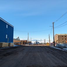
Victoria Valley serves primarily as a research site for international scientific teams conducting studies in glaciology, geology, and climate science, with the Antarctic Treaty ensuring the region remains dedicated exclusively to peaceful scientific investigation and environmental protection.

Access to Victoria Valley is typically arranged through Antarctic research programs operating from McMurdo Station, with travel conducted by helicopter or specialized over-snow vehicles during the austral summer months from December through February, and visitors must follow strict environmental protocols.

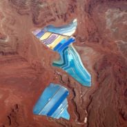
The valley hosts Lake Vida, one of the coldest and most saline lakes on Earth, which never freezes completely due to its high salt content and provides a natural laboratory for studying extremophile organisms and potential analogs for extraterrestrial life.

Location: Antarctic Treaty area

Address: Victoria Valley, Antarctica

GPS coordinates: -77.38333,161.93333

Latest update: December 2, 2025 10:38

Satellite images showing incredible locations seen from the sky

Satellite imagery has transformed how we view remote locations on Earth, offering perspectives on places that are often invisible or difficult to reach from ground level. This collection presents natural formations, artificial structures and historical sites from an aerial vantage point. From geological features like the circular Richat Structure in Mauritania's desert to ancient geoglyphs and modern engineering achievements, these images provide a distinct view of our planet's diversity. Locations documented include the geometric Nazca Lines in Peru, the pyramid structure of El Castillo in Mexico's Yucatán Peninsula and the Badlands Guardian in Alberta, a natural rock formation that resembles a head wearing headphones when seen from above. The collection also features Palm Jumeirah in Dubai, an artificial archipelago shaped like a palm tree, the vivid blue potash evaporation ponds in Utah, the pink waters of Lake Hillier in Western Australia and the volcanic island of Surtsey off Iceland. Additional examples include the Atacama Giant in Chile, a prehistoric geoglyph, the heart shaped Galesnjak island off Croatia's coast and the ship graveyard of the former Aral Sea in Uzbekistan, which documents the ecological consequences of human intervention.

Reviews

Visited this place? Tap the stars to rate it and share your experience / photos with the community! Try now! You can cancel it anytime.

« Victoria Valley - Ice-free valley in the McMurdo Dry Valleys, Antarctica » is provided by Around Us (aroundus.com). Images and texts are derived from Wikimedia project under a Creative Commons license. You are allowed to copy, distribute, and modify copies of this page, under the conditions set by the license, as long as this note is clearly visible.

Discover hidden gems everywhere you go!

From secret cafés to breathtaking viewpoints, skip the crowded tourist spots and find places that match your style. Our app makes it easy with voice search, smart filtering, route optimization, and insider tips from travelers worldwide. Download now for the complete mobile experience.

Around Us App Screenshot

A unique approach to discovering new places

Le Figaro

All the places worth exploring

France Info

A tailor-made excursion in just a few clicks

20 Minutes