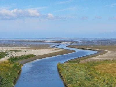
Enable Location

We need your location to show you interesting places around you

Discover nearby places

Find interesting locations and hidden gems around you

Precise directions

Get accurate directions and distances to places

Your location is never shared with other users. It's only used when you tap the location button.

Wadden Sea

Log in to your account

Start exploring — it's free

Trusted by 61,472 travelers worldwide

Continue with Google
Continue with Apple
or

We will send you a code to connect

By continuing, you accept our Terms and Conditions and our Privacy Policy

Check your inbox

We've sent a pincode in your inbox. Please enter the code below.

Wadden Sea

Wadden Sea

Description

The Mer des Wadden is a nature reserve with shallow waters along the Dutch coast, known for extensive mudflats and sandbars that become visible at low tide. The landscape supports diverse birdlife, especially during migration seasons, and is rich in small marine creatures like crabs and shellfish that support the food chain.

History

The area was designated as a protected reserve because of its important ecosystems and species diversity, and is part of a larger network of protected coastal areas. The coastline has shifted gradually over centuries through natural processes, shaping the current structure of islands and banks.

Culture

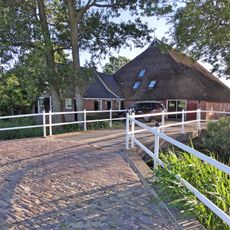
The Mer des Wadden has deep roots in the life of local communities for centuries. Fishing and shellfish gathering remain traditional practices that continue to shape how people connect with this area today.

Practical

The area is best accessed at low tide when the mudflats are walkable and wildlife is visible. Visitors should check tide times and wear appropriate footwear, as the terrain can be wet and slippery.

Did you know?

Seals regularly haul out onto the sandbars to rest, particularly during certain months when they are most active. Watching these marine mammals in their natural setting is a common activity for visitors.

Location
Operator
Rijkswaterstaat
Address
Zeedijk 1, 9079 PH Sint Jacobiparochie, Netherlands
GPS coordinates
53.23227,5.96337
Latest update
January 9, 2026 11:48

AroundUs brings together thousands of curated places, local tips, and hidden gems, enriched daily by 60,000 contributors worldwide. Discover all places nearby (Dantumadiel).

Top sights in the Netherlands: off-the-beaten-path places, historic villages and typical scenery

The Netherlands show their best features outside the big cities. This collection takes you to the islands in the North Sea like Texel, Terschelling, or Ameland, where wind, dunes, and tides shape daily life. You will also see the 18th-century windmill rows in Kinderdijk, fishing villages like...

Around this place
Show the full map
« Wadden Sea » is provided by Around Us (aroundus.com). Images and texts are derived from Wikimedia project under a Creative Commons license. You are allowed to copy, distribute, and modify copies of this page, under the conditions set by the license, as long as this note is clearly visible.

Discover hidden gems everywhere you go!

From secret cafés to breathtaking viewpoints, skip the crowded tourist spots and find places that match your style. Our app makes it easy with voice search, smart filtering, route optimization, and insider tips from travelers worldwide. Download now for the complete mobile experience.

Around Us App Screenshot

A unique approach to discovering new places

Le Figaro

All the places worth exploring

France Info

A tailor-made excursion in just a few clicks

20 Minutes

Around Us
Travel Guide & Maps
Download

Send to your phone

QR Code
1

Open the camera app on your mobile.

2

Point at the QR code with your camera. A notification will appear.

3

Tap the notification to open the link.