Macdonnell Ranges
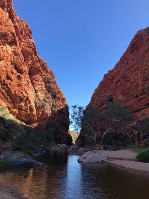
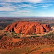
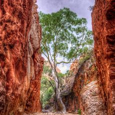
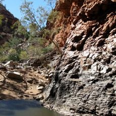
The Macdonnell Ranges are an extensive mountain chain in central Australia featuring red cliffs, gorges, and rocky formations stretching west of Alice Springs. The landscape displays warm earth tones of red, brown, and orange, interspersed with waterholes, gorges, and numerous natural walking trails suited to various skill levels.
The ranges were shaped over thousands of years by wind, rain, and heat, with water gradually carving gorges and waterholes into the rock. The region has been home to the Arrernte people for many generations and was briefly explored and settled in the late 1800s during a gold rush in areas such as Arltunga.
The ranges hold deep meaning for the local Arrernte people, who have lived here for thousands of years and continue to use the land for hunting, crafts, and spiritual practices. Ochre pits and rock art sites scattered throughout tell stories of this connection, and visitors can see paintings and carvings that depict animals, creation stories, and symbols important to the community.
The best time to visit is from April to September when the weather is cooler, as summer months can be extremely hot. Always bring plenty of water, comfortable shoes, and sun protection, and check road conditions before you go since some sections require four-wheel-drive vehicles or may be closed after heavy rain.
The eastern section contains thousands of ancient petroglyphs carved into rocks at N'Dhala Gorge, rarely seen by visitors who typically focus on the better-known western side. The abandoned mining town of Arltunga reveals how quickly a thriving settlement became ruins once the gold reserves ran out.
The community of curious travelers
AroundUs brings together thousands of curated places, local tips, and hidden gems, enriched daily by 60,000 contributors worldwide.