Enable Location

We need your location to show you interesting places around you

Discover nearby places

Find interesting locations and hidden gems around you

Precise directions

Get accurate directions and distances to places

Your location is never shared with other users. It's only used when you tap the location button.

Růžovský vrch

Log in to your account

Start exploring — it's free

Trusted by 62,916 travelers worldwide

Continue with Google
Continue with Apple
or

We will send you a code to connect

By continuing, you accept our Terms and Conditions and our Privacy Policy

Check your inbox

We've sent a pincode in your inbox. Please enter the code below.

Růžovský vrch
Discussion Reviews 1 Photos
3.8k Popularity

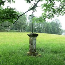
Růžovský vrch, Basalt mountain and nature reserve in Elbe Sandstone Mountains, Czech Republic.

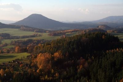
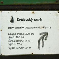
Růžovský vrch is a 619-meter basalt peak in the Elbe Sandstone Mountains with steep flanks covered by blocky volcanic debris and mixed deciduous woodland. Beech and sycamore dominate the slopes, giving the mountain its distinctive wooded character.

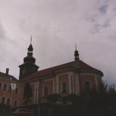
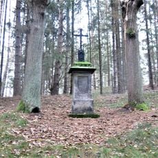
The mountain became an artistic subject in the early 19th century and drew painters including Caspar David Friedrich, who studied the landscape. A wooden observation tower appeared on the summit in the late 19th century and was later replaced by a stone structure.

The peak served as inspiration for painter Caspar David Friedrich, who created sketches during his visit in 1808 for his work 'Bohemian Landscape'.

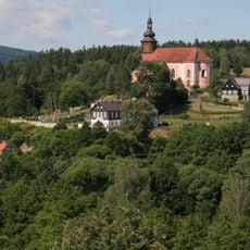
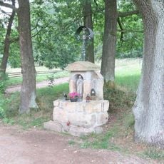
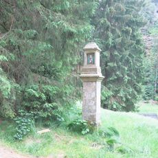
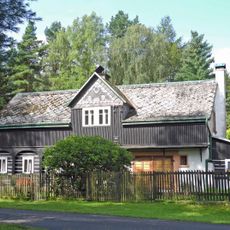
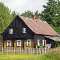
The mountain is reachable from Růžová village via a yellow-marked hiking path that climbs roughly 270 meters of elevation. The walk takes about an hour and passes through forest before reaching the summit viewpoint.

The mountain stands as an isolated basalt cone amid the sandstone plateaus and is locally compared to Mount Fuji. This unusual geological setting makes it a striking landmark in the flatter surrounding terrain.

The community of curious travelers

AroundUs brings together thousands of curated places, local tips, and hidden gems, enriched daily by 60,000 contributors worldwide.

Start exploring
Location
Location
Elevation above the sea
619.1 m
Part of
Elbe Sandstone Mountains
GPS coordinates
50.83278,14.33111
Latest update
December 11, 2025 18:07
Around this place
Dolský Mlýn
Czech Republic

Dolský Mlýn

2.1 km
Římskokatolická farnost Srbská Kamenice
Czech Republic

Římskokatolická farnost Srbská Kamenice

2 km
Church of Saint Wenceslaus
Czech Republic

Church of Saint Wenceslaus

2 km
Riedl´s conciliation cross
Czech Republic

Riedl´s conciliation cross

1.7 km
Usedlost čp. 64
Czech Republic

Usedlost čp. 64

1.8 km
Usedlost čp. 1
Czech Republic

Usedlost čp. 1

2.1 km
Kamenný most přes náhon Kamenice u Dolského mlýna
Czech Republic

Kamenný most přes náhon Kamenice u Dolského mlýna

2.1 km
Socha svatého Petra u kostela v Srbské Kamenici
Czech Republic

Socha svatého Petra u kostela v Srbské Kamenici

2 km
Královský smrk
Czech Republic

Královský smrk

2.2 km
Kříž u silnice z Kamenické Stráně do Růžové
Czech Republic

Kříž u silnice z Kamenické Stráně do Růžové

1.8 km
Gutbauerova boží muka
Czech Republic

Gutbauerova boží muka

2 km
Lávka přes Kamenici u Dolského mlýna
Czech Republic

Lávka přes Kamenici u Dolského mlýna

2.1 km
Kamenická Stráň ev. č. 33
Czech Republic

Kamenická Stráň ev. č. 33

2 km
Usedlost č.ev. 36
Czech Republic

Usedlost č.ev. 36

2 km
Usedlost č.ev. 35
Czech Republic

Usedlost č.ev. 35

2 km
Usedlost čp. 41
Czech Republic

Usedlost čp. 41

2 km
Kříž s kapličkou na rozcestí pod Pastevním vrchem v Růžové
Czech Republic

Kříž s kapličkou na rozcestí pod Pastevním vrchem v Růžové

2.2 km
Boží muka u cesty ke Královskému smrku
Czech Republic

Boží muka u cesty ke Královskému smrku

2.2 km
Hraniční kámen národního parku v Kamenické Stráni
Czech Republic

Hraniční kámen národního parku v Kamenické Stráni

2 km
Kříž u kostela v Srbské Kamenici
Czech Republic

Kříž u kostela v Srbské Kamenici

2 km
Kříž na západě Kamenické Stráně
Czech Republic

Kříž na západě Kamenické Stráně

2.2 km
Veroničin kříž
Czech Republic

Veroničin kříž

2.1 km
Kříž v Kamenické Stráni u stodoly če. 48
Czech Republic

Kříž v Kamenické Stráni u stodoly če. 48

1.9 km
Zvonička u polní cesty pod Pastevním vrchem v Růžové
Czech Republic

Zvonička u polní cesty pod Pastevním vrchem v Růžové

2.1 km
Usedlost Kamenická Stráň, č.ev. 48
Czech Republic

Usedlost Kamenická Stráň, č.ev. 48

1.9 km
Kříž na Stormově vrchu u Srbské Kamenice
Czech Republic

Kříž na Stormově vrchu u Srbské Kamenice

2 km
Srbská Kamenice 90
Czech Republic

Srbská Kamenice 90

1.9 km
Kamenická Stráň 20
Czech Republic

Kamenická Stráň 20

2 km
Show the full map
Reviews
Share your experience

No review yet

Discussions
Start a discussion...

No discussion yet

« Růžovský vrch - Basalt mountain and nature reserve in Elbe Sandstone Mountains, Czech Republic » is provided by Around Us (aroundus.com). Images and texts are derived from Wikimedia project under a Creative Commons license. You are allowed to copy, distribute, and modify copies of this page, under the conditions set by the license, as long as this note is clearly visible.

Discover hidden gems everywhere you go!

From secret cafés to breathtaking viewpoints, skip the crowded tourist spots and find places that match your style. Our app makes it easy with voice search, smart filtering, route optimization, and insider tips from travelers worldwide. Download now for the complete mobile experience.

Around Us App Screenshot

A unique approach to discovering new places

Le Figaro

All the places worth exploring

France Info

A tailor-made excursion in just a few clicks

20 Minutes

Around Us
Travel Guide & Maps
Download

Send to your phone

QR Code
1

Open the camera app on your mobile.

2

Point at the QR code with your camera. A notification will appear.

3

Tap the notification to open the link.