Enable Location

We need your location to show you interesting places around you

Discover nearby places

Find interesting locations and hidden gems around you

Precise directions

Get accurate directions and distances to places

Your location is never shared with other users. It's only used when you tap the location button.

Říčany

Log in to your account

Start exploring — it's free

Trusted by 64,917 travelers worldwide

Continue with Google
Continue with Apple
or

We will send you a code to connect

By continuing, you accept our Terms and Conditions and our Privacy Policy

Check your inbox

We've sent a pincode in your inbox. Please enter the code below.

Discussion Reviews 3 Photos
25.2k Popularity

Říčany, Administrative center in Prague-East District, Czech Republic

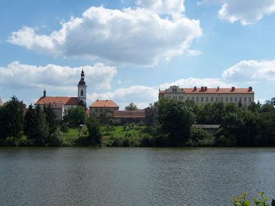
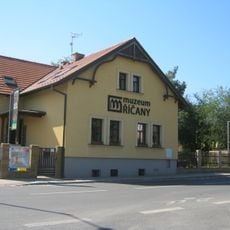
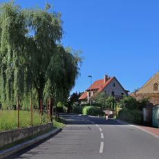
Říčany is a municipality with town privileges in Prague-East District, situated across rolling hills and valleys on the southeastern outskirts of Prague. The area comprises seven distinct neighborhoods that together form a growing residential community.

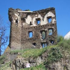
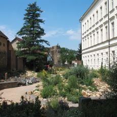
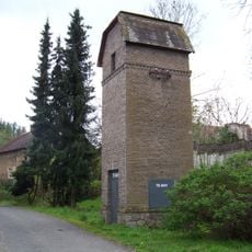
The settlement originated in the 13th century, when a stone castle was built between 1260 and 1270 as a focal point for the community. The area gained town privileges in 1289, though the castle eventually fell into ruin during later conflicts.

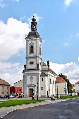
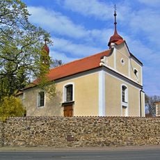
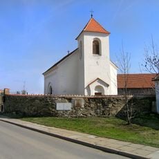
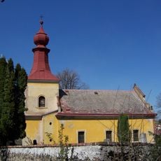
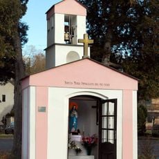
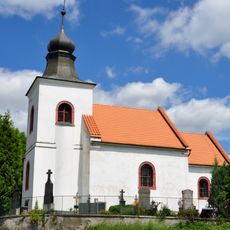
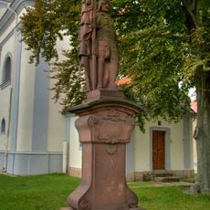
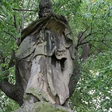
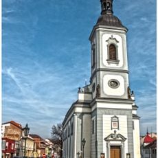
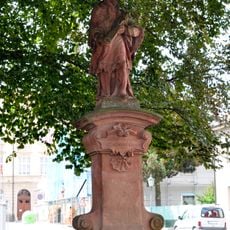
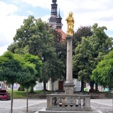
The Church of Saints Peter and Paul shapes the town center with its Baroque architecture and reflects the area's religious roots. Nearby stands a Marian column topped with a golden statue, marking a place where locals and visitors often gather.

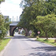
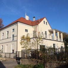
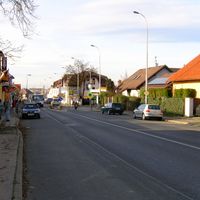
The Prague-Vienna railway and the D1 motorway link the town directly to larger cities and Prague's center with regular service. Schools and kindergartens are distributed throughout the neighborhoods, making the area accessible for families.

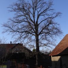
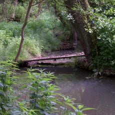
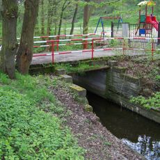
Green spaces and forests wrap around the neighborhoods, creating a setting where residents can enjoy nature while staying close to Prague's opportunities. This balance between rural surroundings and direct transport links has made it a growing choice for commuters and families.

The community of curious travelers

AroundUs brings together thousands of curated places, local tips, and hidden gems, enriched daily by 60,000 contributors worldwide.

Start exploring
Location
Inception
1289
Elevation above the sea
341 m
Reference
CZ0209538728
Shares border with
Světice, Březí, Babice, Tehov, Strančice, Nupaky, Tehovec, Popovičky, Modletice, Křenice, Prague
GPS coordinates
49.99175,14.65433
Latest update
December 20, 2025 11:27
Around this place
Říčany
Czech Republic

Říčany

183 m
Dub letní v Kolovratech
Czech Republic

Dub letní v Kolovratech

2.8 km
Muzeum Říčany
Czech Republic

Muzeum Říčany

636 m
Mýto
Czech Republic

Mýto

2.4 km
Church of Saint Andrew
Czech Republic

Church of Saint Andrew

2.7 km
Geopark Říčany
Czech Republic

Geopark Říčany

81 m
Tehov Castle
Czech Republic

Tehov Castle

3.7 km
Transformer station in Nedvězí
Czech Republic

Transformer station in Nedvězí

2.8 km
Knihovna s infocentrem Praha-Kolovraty
Czech Republic

Knihovna s infocentrem Praha-Kolovraty

3 km
Church of Saint Martin (Lipany)
Czech Republic

Church of Saint Martin (Lipany)

2.7 km
Church of Saint Bartholomew
Czech Republic

Church of Saint Bartholomew

4.3 km
Czech Republic

Rotunda svatého Václava

3.4 km
Church of Saint John the Baptist (Tehov)
Czech Republic

Church of Saint John the Baptist (Tehov)

3.8 km
Chapel of the Immaculate Conception of the Virgin Mary in Kuří
Czech Republic

Chapel of the Immaculate Conception of the Virgin Mary in Kuří

2.4 km
Church of Saint Nicholas in Otice
Czech Republic

Church of Saint Nicholas in Otice

3 km
Czech Republic

Jilm vaz v Kolovratech

2.8 km
Kolovratský mlýn
Czech Republic

Kolovratský mlýn

2.8 km
Lávka přes Pitkovický potok v Kuří proti Skalní ulici
Czech Republic

Lávka přes Pitkovický potok v Kuří proti Skalní ulici

2.3 km
Statue of Saint Wenceslaus in Říčany
Czech Republic

Statue of Saint Wenceslaus in Říčany

47 m
Socha svatého Donáta
Czech Republic

Socha svatého Donáta

2.7 km
Church of Saints Peter and Paul
Czech Republic

Church of Saints Peter and Paul

20 m
Železniční most přes říčanskou ulici Širokou u Světic
Czech Republic

Železniční most přes říčanskou ulici Širokou u Světic

2.3 km
Czech Republic

Podchod pod železniční tratí ve Světicích

2.3 km
Statue of Saint John of Nepomuk nearby the church in Říčany
Czech Republic

Statue of Saint John of Nepomuk nearby the church in Říčany

47 m
Pomník Tomáše Garrigue Masaryka na Masarykově náměstí v Říčanech
Czech Republic

Pomník Tomáše Garrigue Masaryka na Masarykově náměstí v Říčanech

197 m
Most přes Rokytku k dětskému hřišti Hájová
Czech Republic

Most přes Rokytku k dětskému hřišti Hájová

2.6 km
Budova školy v Nedvězí u Říčan
Czech Republic

Budova školy v Nedvězí u Říčan

2.8 km
Maria column in Říčany
Czech Republic

Maria column in Říčany

81 m
Show the full map
Reviews
Share your experience

No review yet

Discussions
Start a discussion...

No discussion yet

« Říčany - Administrative center in Prague-East District, Czech Republic » is provided by Around Us (aroundus.com). Images and texts are derived from Wikimedia project under a Creative Commons license. You are allowed to copy, distribute, and modify copies of this page, under the conditions set by the license, as long as this note is clearly visible.

Discover hidden gems everywhere you go!

From secret cafés to breathtaking viewpoints, skip the crowded tourist spots and find places that match your style. Our app makes it easy with voice search, smart filtering, route optimization, and insider tips from travelers worldwide. Download now for the complete mobile experience.

Around Us App Screenshot

A unique approach to discovering new places

Le Figaro

All the places worth exploring

France Info

A tailor-made excursion in just a few clicks

20 Minutes

Around Us
Travel Guide & Maps
Download

Send to your phone

QR Code
1

Open the camera app on your mobile.

2

Point at the QR code with your camera. A notification will appear.

3

Tap the notification to open the link.