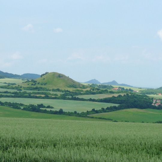
České Středohoří, Mountain range in northern Bohemia, Czech Republic.
České Středohoří is a volcanic mountain range in northern Bohemia, 80 km long and up to 25 km wide, built mainly of basalt (73.6%) with trachytic and andesitic rocks. Its cone-shaped peaks rise from a nearly flat landscape, and the Elbe cuts through it at Porta Bohemica, the narrowest point of the Elbe breakthrough.
The range's volcanic cones rose from a sandstone base in the Miocene, about 23 million years ago, along the Ohře rift. In the mid-19th century Ferdinand von Hochstetter surveyed the area for the k.k. Geological Reichsanstalt, and Josef Emanuel Hibsch later produced its first detailed geological maps; the mineral hibschite bears his name.
Villages here keep a dense network of small settlements with folk architecture in stone, timber and half-timbered styles. Pre-Slavic and Slavic hillforts and medieval castles on hilltops mark the area, and the mineral hibschite is named after geologist Josef Emanuel Hibsch, who mapped the range.
The D8 motorway between Prague and Dresden crosses the protected landscape; its final section through the České Středohoří opened in December 2016 after legal disputes delayed construction from 2007. The Elbe valley and the Porta Bohemica gorge are the main orientation features, with Litoměřice as the seat of the protected area administration.
Milešovka reaches 837 m, not 836 m, making it the highest summit of the range; the Elbe at Děčín, at 121.9 m, is the lowest point, a difference of 715.1 m. The peak rises from the left bank in the Milešovské středohoří section.
The community of curious travelers
AroundUs brings together thousands of curated places, local tips, and hidden gems, enriched daily by 95,021 contributors worldwide.


