Chest opened
+${chestReward.xp} XP
Explorer
NOUVEAU ×${chestReward.collectible.quantity}
tapez pour fermer

See the monuments around you in AR Open chests in the app

Around Us is built for your phone — point your camera at the streets and discover the monuments and places around you in augmented reality. Around Us is built for your phone — chests unlock when you walk, explore and capture nearby places.

•

Enable Location

We need your location to show you interesting places around you

Discover nearby places

Find interesting locations and hidden gems around you

Precise directions

Get accurate directions and distances to places

Your location is never shared with other users. It's only used when you tap the location button.

Hranice Abyss

Log in to your account

Start exploring — it's free

Trusted by 92,098 travelers worldwide

Continue with Google
Continue with Apple
or

We will send you a code to connect

By continuing, you accept our Terms and Conditions and our Privacy Policy

Check your inbox

We've sent a pincode in your inbox. Please enter the code below.

Hranice Abyss

Hranice Abyss, Flooded sinkhole in Hranice, Czech Republic

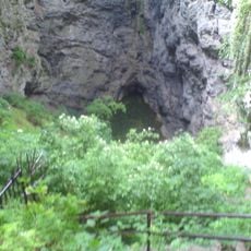
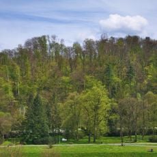
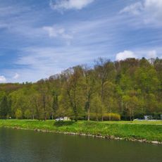
Hranice Abyss is a steep, elliptical sinkhole about 110 m long and 50 m wide, opening on a wooded slope above the Bečva River. Its dry section drops 69.5 m to the Hranice Lake, and the flooded part has been measured to 450 m, giving a confirmed total depth of 519.5 m without reaching the bottom.

The first recorded attempt to measure the depth dates from 1580. From 1900 to 1902 teacher Václav Šindela lowered a weighted probe from a boat and reached 36 metres. In 1961 Bohumír Kopecký made the first dive with a homemade apparatus; later divers reached 181 metres in 2000, and in 2022 a robot measured 450 metres of the flooded part.

The abyss is sometimes called Macůška, a nickname from before World War II that never caught on. A local legend says the Great Moravian ruler Mojmír II rode his horse into the pit so that his treacherous pursuers would follow him in the dark.

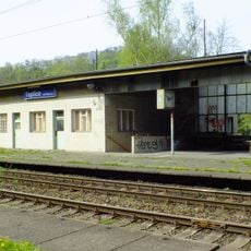
The abyss lies about 500 m from the Teplice nad Bečvou railway station on the Hranice na Moravě–Púchov line, reached by the red hiking mark that follows the Hůrka educational trail. A fence around the rim guards against falls; the pool at the bottom stays in shadow.

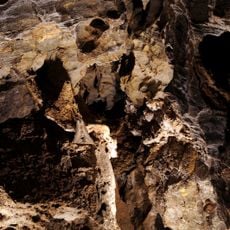
Specialized remote-controlled underwater vehicles are used for exploration in the lower sections, as human divers cannot reach the extreme depths. Research equipment has documented limestone formations created by thermal springs and chemical processes.

The community of curious travelers

AroundUs brings together thousands of curated places, local tips, and hidden gems, enriched daily by 92,098 contributors worldwide.

Start exploring
Location
GPS coordinates
49.53200,17.75078
Latest update
October 21, 2026 18:00
Reviews
Share your experience

No review yet

Discussions
Start a discussion...

No discussion yet

« Hranice Abyss - Flooded sinkhole in Hranice, Czech Republic » is provided by Around Us (aroundus.com). Images and texts are derived from Wikimedia project under a Creative Commons license. You are allowed to copy, distribute, and modify copies of this page, under the conditions set by the license, as long as this note is clearly visible.

Discover hidden gems everywhere you go!

From secret cafés to breathtaking viewpoints, skip the crowded tourist spots and find places that match your style. Our app makes it easy with voice search, smart filtering, route optimization, and insider tips from travelers worldwide. Download now for the complete mobile experience.

Around Us App Screenshot
❝

A unique approach to discovering new places❞

— Le Figaro

❝

All the places worth exploring❞

— France Info

❝

A tailor-made excursion in just a few clicks❞

— 20 Minutes

Around Us
Travel Guide & Maps
Download

Send to your phone

QR Code
1

Open the camera app on your mobile.

2

Point at the QR code with your camera. A notification will appear.

3

Tap the notification to open the link.