Enable Location

We need your location to show you interesting places around you

Discover nearby places

Find interesting locations and hidden gems around you

Precise directions

Get accurate directions and distances to places

Your location is never shared with other users. It's only used when you tap the location button.

Frýdlant nad Ostravicí

Log in to your account

Start exploring — it's free

Trusted by 63,616 travelers worldwide

Continue with Google
Continue with Apple
or

We will send you a code to connect

By continuing, you accept our Terms and Conditions and our Privacy Policy

Check your inbox

We've sent a pincode in your inbox. Please enter the code below.

Discussion Reviews 1 Photos
13k Popularity

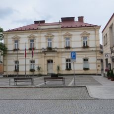
Frýdlant nad Ostravicí, Administrative center in Frýdek-Místek District, Czech Republic.

Frýdlant nad Ostravicí sits on both sides of the Ostravice River, comprising three distinct areas: Frýdlant, Nová Ves, and Lubno at roughly 357 meters above sea level. The town functions as the administrative center for its district and provides services to surrounding communities.

German settlers founded the settlement around 1300, naming it after Heydrich de Vridelanth, and it received municipal privileges in 1782. This early establishment and later official recognition shaped its development as a regional hub.

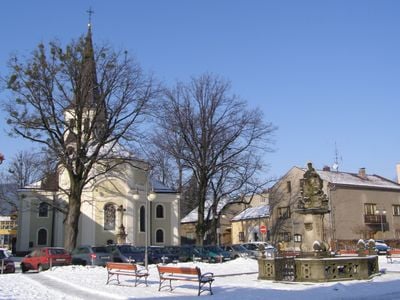
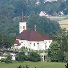
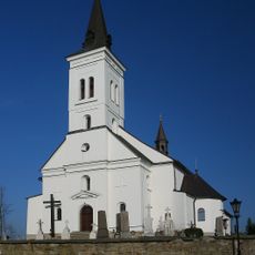
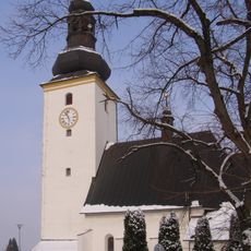
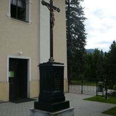
The Church of Saint Bartholomew with its Baroque design is where locals and visitors encounter the town's religious tradition. The building reflects how the community shaped its central spaces around faith and local identity over centuries.

The town connects to major cities like Ostrava and Frýdek-Místek through regular transportation links, making it accessible to visitors. As an administrative center, it offers practical services rather than extensive tourism infrastructure, so plan accordingly for your visit.

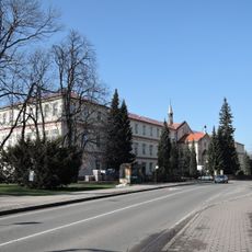
The Ostravice River divides the territory, with the left bank in Moravia and the right bank in Silesia, creating a remarkable geographic split. Visitors can walk between these two historical regions simply by crossing the river.

The community of curious travelers

AroundUs brings together thousands of curated places, local tips, and hidden gems, enriched daily by 60,000 contributors worldwide.

Start exploring
Elevation above the sea
357 m
Shares border with
Janovice, Ostravice, Pržno, Malenovice, Pstruží, Metylovice, Krásná
GPS coordinates
49.59279,18.35970
Latest update
December 7, 2025 20:42
Reviews
Share your experience

No review yet

Discussions
Start a discussion...

No discussion yet

Administrative divisions
« Frýdlant nad Ostravicí - Administrative center in Frýdek-Místek District, Czech Republic » is provided by Around Us (aroundus.com). Images and texts are derived from Wikimedia project under a Creative Commons license. You are allowed to copy, distribute, and modify copies of this page, under the conditions set by the license, as long as this note is clearly visible.

Discover hidden gems everywhere you go!

From secret cafés to breathtaking viewpoints, skip the crowded tourist spots and find places that match your style. Our app makes it easy with voice search, smart filtering, route optimization, and insider tips from travelers worldwide. Download now for the complete mobile experience.

Around Us App Screenshot

A unique approach to discovering new places

Le Figaro

All the places worth exploring

France Info

A tailor-made excursion in just a few clicks

20 Minutes

Around Us
Travel Guide & Maps
Download

Send to your phone

QR Code
1

Open the camera app on your mobile.

2

Point at the QR code with your camera. A notification will appear.

3

Tap the notification to open the link.