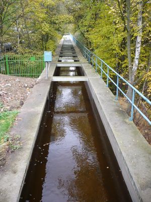
Podkrušnohorský přivaděč, Water supply system in Chomutov, Czech Republic
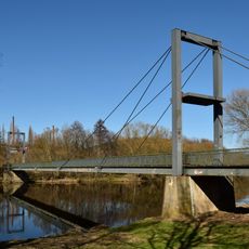
The Podkrušnohorský přivaděč is a water supply network in Northern Bohemia that spans roughly 34 kilometers through channels, underground pipes, reservoirs, and an aqueduct. The system links the area around Klasterec nad Ohří to Jirkov, delivering water to industrial facilities in the region.
Construction of this water infrastructure began in 1957 and continued until 1982 to meet industrial water demands. The project also responded to the need to control flooding that originated in the Krusne Mountains.
The water system represents a significant engineering achievement in Northern Bohemia, demonstrating the technical capabilities of Czech hydraulic engineering.
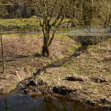
The system was designed to supply water to industrial plants while protecting surface mines from flooding. Visitors can explore various sections of the network, though much of it runs underground or through private areas.
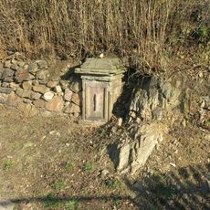
A distribution facility at kilometer 1.46 channels water through connecting conduits to the Bilina River intake structure. This technical design shows how carefully the network was engineered to manage multiple water sources simultaneously.
Location: Chomutov
GPS coordinates: 50.38313,13.21437
Latest update: December 12, 2025 09:04
Church of Saint Nicholas
1.4 km
Mikulovická lípa
1.5 km
Sládečkův dub
1.9 km
Zásadská lípa
1.6 km
Jírovec v Miřeticích
1.8 km
Mohyla 2000
2.5 km
Socha dětí u školy v Krátké ulici v Klášterci nad Ohří
2.5 km
Rectory in Mikulovice (Klášterec nad Ohří)
1.4 km
Granary in Klášterec nad Ohří
2.4 km
Sloup se sousoším Nejsvětější Trojice
1.7 km
Most ulice Pod Pivovarem přes Podmileský potok
2.2 km
Plastika Věčná píseň mládí u školy v Petlérské ulici v Klášterci nad Ohří
2 km
Chapel of the Visitation of the Virgin Mary in Suchý Důl
1.2 km
Landart Gallery Mariánské údolí
1.1 km
Květy městu
2.3 km
Rašovická lávka
1.2 km
Most přes Rašovický potok v Rašovicích před ústím
1.2 km
Kaplička V. zastavení cesty Sedmi bolestí Panny Marie v Klášterci nad Ohří
2.4 km
Kaple Panny Marie v osadě Zásada
1.6 km
Hřbitov Mikulovice
1.3 km
Kaplička VII. zastavení cesty Sedmi bolestí Panny Marie v Klášterci nad Ohří
2.3 km
Kaplička u silnice z Klášterce nad Ohří do Kadaně
1.5 km
Kaplička u silnice v osadě Zásada
1.8 km
Podstavec božích muk u V. zastavení cesty Sedmi bolestí Panny Marie v Klášterci nad Ohří
2.4 km
Kaplička VI. zastavení cesty Sedmi bolestí Panny Marie v Klášterci nad Ohří
2.3 km
Kříž na konci Žižkovy ulice v Miřeticích
2.2 km
Železniční most přes Ohři v Klášterci nad Ohří
2.3 km
Boží muka u silnice východně od Zásady
1.9 kmVisited this place? Tap the stars to rate it and share your experience / photos with the community! Try now! You can cancel it anytime.
Discover hidden gems everywhere you go!
From secret cafés to breathtaking viewpoints, skip the crowded tourist spots and find places that match your style. Our app makes it easy with voice search, smart filtering, route optimization, and insider tips from travelers worldwide. Download now for the complete mobile experience.
A unique approach to discovering new places❞
— Le Figaro
All the places worth exploring❞
— France Info
A tailor-made excursion in just a few clicks❞
— 20 Minutes