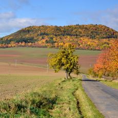
Vladař, Mountain summit in Tepelská vrchovina, Czech Republic
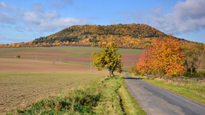
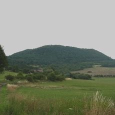
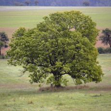
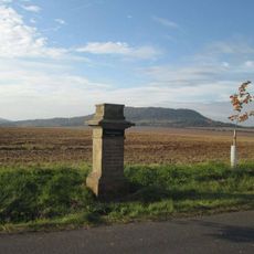
Vladař is a mountain in the Tepelská vrchovina region rising to 693 meters with a broad flat summit at its top. The steep slopes descend toward the Střela river valley below, creating a distinctive landmark in the Karlovy Vary area.
The mountain served as a defensive position during 15th century Hussite conflicts when forces clashed on its northern slope. Archaeological evidence indicates the area was inhabited during the early Iron Age, with wooden structures discovered at the mountain's base.
The mountain served as a defensive position during the Hussite Wars in 1421, when Jan Žižka successfully defended against a siege on its northern slope.
A marked red hiking trail connects the summit to Záhořice train station roughly two kilometers away. The route is straightforward and suitable for most walkers with basic fitness.
A small peat bog on the mountain's flat top once collected water for ancient settlements, showing how early communities made use of natural features. This wetland preserved organic material that revealed details about prehistoric life in the region.
GPS coordinates: 50.08007,13.21574
Latest update: December 11, 2025 11:09
Vladař
245 m
Dětská naučná stezka sovy Rozárky
1.8 km
Cesta za pověstí
847 m
Kolešovský jasan
1.8 km
Pomník Jana Žižky z Trocnova
814 m
Inundační železniční most jihozápadně od mostu přes Střelu poblíž dopravny Protivec
1.4 km
Socha Ecce Homo
2.7 km
Socha svatého Jana Nepomuckého
1 km
Socha svatého Jana Nepomuckého
2.6 km
Statue of Pietà
858 m
Vladař
287 m
Socha svatého Jana Nepomuckého severozápadně od Močidlce
2.4 km
Socha svatého Jana Nepomuckého západně od Močidlece
2.6 km
Smírčí kříž
2.3 km
Penitence cross in Protivec
1.5 km
Socha Ecce homo severně od Močidlece
2.2 km
Pomník Josefa a Friedy Heinzlových u Záhořic
1.5 km
Sousoší svaté Anny a Panny Marie
1.6 km
Usedlost čp. 6
865 m
Socha svaté Barbory jižně od Kolešova
2.2 km
Kříž na lesní cestě od trati do Záhořic
1.1 km
Kaple svatého Václava
2.2 km
Železniční most přes Střelu u stanice Protivec
1.4 km
Kříž v poli východně od Kolešova
1.8 km
Luční kaple u Protivce
1.6 km
Kříž u křižovatky východně od Vladořic
900 m
Kříž u cesty od železniční zastávky Záhořice
1.6 km
Kříž západně od Močidlece
2.2 kmVisited this place? Tap the stars to rate it and share your experience / photos with the community! Try now! You can cancel it anytime.
Discover hidden gems everywhere you go!
From secret cafés to breathtaking viewpoints, skip the crowded tourist spots and find places that match your style. Our app makes it easy with voice search, smart filtering, route optimization, and insider tips from travelers worldwide. Download now for the complete mobile experience.
A unique approach to discovering new places❞
— Le Figaro
All the places worth exploring❞
— France Info
A tailor-made excursion in just a few clicks❞
— 20 Minutes