Stříbrná Skalice

Log in to your account

AroundUs is a community-driven map of interesting places, built by curious explorers like you. It grows with every review, story, and photo you share.
Connect to save your favorite spots, contribute locations, and create personalized routes.
Continue with Google
Continue with Apple
Continue with X
Continue with Facebook
Continue with email
By continuing, you accept our Terms and Conditions and our Privacy Policy
Create an account
Add to collection
Map
Suggest a change
Share

Stříbrná Skalice, Municipality in Prague-East District, Czech Republic.

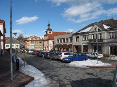
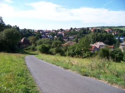
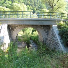
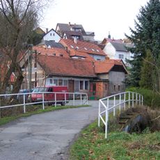
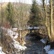
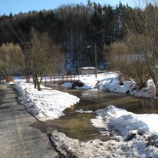
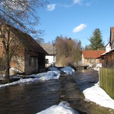
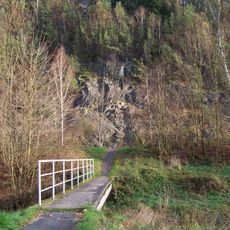
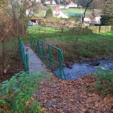
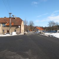
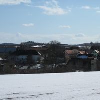
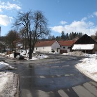
Stříbrná Skalice is a municipality in Prague-East District that stretches along the right bank of the Sázava River and reaches an elevation of 337 meters. The village sits in the Central Bohemian Region and connects to Prague through regional transportation networks.

The first written mention of the settlement dates to 1360, when silver mining under Ctibor of Skalice brought the place into prominence. This early economic activity shaped its development over several centuries.

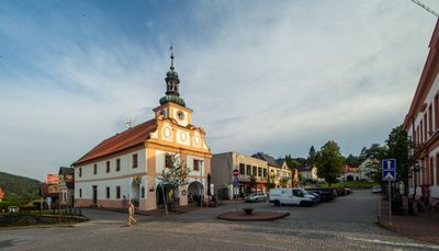
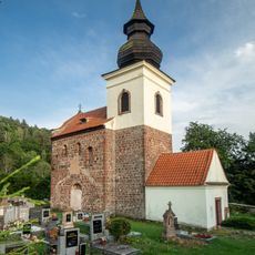
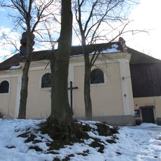
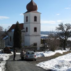
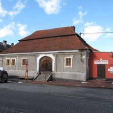
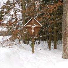
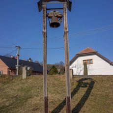
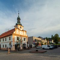
Two churches shape the village's character: a Romanesque Church of Saint James the Great from the 12th century and a Baroque Church of Saint John of Nepomuk. They reflect how the community maintained its religious and architectural traditions over the centuries.

The Sázava railway line connects the municipality to Prague's transport network and has provided regular service since 1901. Visitors can best explore the area by using regional connections and following walking paths along the river.

The village appears in the video game Kingdom Come: Deliverance under the name Pribyslavitz with detailed historical reconstruction. This game has brought the settlement to the attention of history enthusiasts and players interested in medieval Bohemian communities.

Location: Prague-East District

Location: Ржычаны

Elevation above the sea: 337 m

Reference: CZ0209533718

Shares border with: Ondřejov, Vlkančice, Černé Voděrady, Oplany, Výžerky, Chocerady

Email: obec@stribrnaskalice.cz

Website: http://stribrnaskalice.cz

GPS coordinates: 49.89773,14.84622

Latest update: December 14, 2025 21:21

Photos
Around this place
Posázavské bučiny
Czech Republic

Posázavské bučiny

2.7 km
Church of Saint James the Greater in Stříbrná Skalice
Czech Republic

Church of Saint James the Greater in Stříbrná Skalice

1 km
Church of Saint John of Nepomuk in Stříbrná Skalice
Czech Republic

Church of Saint John of Nepomuk in Stříbrná Skalice

186 m
Town hall in Stříbrná Skalice
Czech Republic

Town hall in Stříbrná Skalice

29 m
Železniční most přes Vodslivský potok
Czech Republic

Železniční most přes Vodslivský potok

1.7 km
Bridge of Na Čapík street
Czech Republic

Bridge of Na Čapík street

240 m
Church of Saint Martin
Czech Republic

Church of Saint Martin

3.8 km
Czech Republic

Mostek pod ulicí Pod farou ve Stříbrné Skalici

211 m
Most příjezdové cesty k čp. 25 ve Stříbrné Skalici
Czech Republic

Most příjezdové cesty k čp. 25 ve Stříbrné Skalici

221 m
Jubilejní památník knížete Jana II z Lichtenštejnu u křižovatky silnic východně od Oplan
Czech Republic

Jubilejní památník knížete Jana II z Lichtenštejnu u křižovatky silnic východně od Oplan

3.9 km
Pražská č. p. 10 (Stříbrná Skalice)
Czech Republic

Pražská č. p. 10 (Stříbrná Skalice)

27 m
Pomník padlým v Kostelních Střimelicích
Czech Republic

Pomník padlým v Kostelních Střimelicích

3.5 km
Czech Republic

Most přes Jevanský potok k domu Hradec čp. 12

3 km
Lípy v Hradových Střimelicích
Czech Republic

Lípy v Hradových Střimelicích

1.5 km
Dub letní
Czech Republic

Dub letní

2.1 km
World Wars memorial in Stříbrná Skalice
Czech Republic

World Wars memorial in Stříbrná Skalice

80 m
Lípa ve Stříbrné Skalici
Czech Republic

Lípa ve Stříbrné Skalici

163 m
Vrba v Hradových Střimelicích
Czech Republic

Vrba v Hradových Střimelicích

1.5 km
Czech Republic

Hruškovská lípa

1.3 km
Lávka V podhrádí - Ke Štolám
Czech Republic

Lávka V podhrádí - Ke Štolám

317 m
Pomník padlým v Oplanech
Czech Republic

Pomník padlým v Oplanech

3.4 km
Kříž západně od Oplan v lokalitě U křížku
Czech Republic

Kříž západně od Oplan v lokalitě U křížku

3.4 km
Panelová lávka pod ulicí Pod farou ve Stříbrné Skalici
Czech Republic

Panelová lávka pod ulicí Pod farou ve Stříbrné Skalici

236 m
Lávka přes Jevanský potok Na Marjánce
Czech Republic

Lávka přes Jevanský potok Na Marjánce

1.2 km
Lávka mezi ul. Sázavská a K Marjánce, mezi čp. 295 a 234
Czech Republic

Lávka mezi ul. Sázavská a K Marjánce, mezi čp. 295 a 234

1.1 km
Kaple Nanebevzetí Panny Marie v Oplanech
Czech Republic

Kaple Nanebevzetí Panny Marie v Oplanech

3.4 km
Zvonička v Kostelních Střimelicích
Czech Republic

Zvonička v Kostelních Střimelicích

3.4 km
Czech Republic

Scenic viewpoint

4.1 km
Show the full map
Reviews

Visited this place? Tap the stars to rate it and share your experience / photos with the community! Try now! You can cancel it anytime.

« Stříbrná Skalice - Municipality in Prague-East District, Czech Republic » is provided by Around Us (aroundus.com). Images and texts are derived from Wikimedia project under a Creative Commons license. You are allowed to copy, distribute, and modify copies of this page, under the conditions set by the license, as long as this note is clearly visible.

Discover hidden gems everywhere you go!

From secret cafés to breathtaking viewpoints, skip the crowded tourist spots and find places that match your style. Our app makes it easy with voice search, smart filtering, route optimization, and insider tips from travelers worldwide. Download now for the complete mobile experience.

Around Us App Screenshot

A unique approach to discovering new places

Le Figaro

All the places worth exploring

France Info

A tailor-made excursion in just a few clicks

20 Minutes