Szlak Aloisa Jiraska, Mountain hiking trail in Orlické Mountains, Czech Republic
Jiráskova cesta is a 170 km red-marked long-distance trail from Broumov to Litomyšl, crossing the Orlické Mountains. Its main section runs about 61 km from Nové Město nad Metují through Olešnice v Orlických horách to Rokytnice v Orlických horách; a further 35 km stretch leads via Zemská brána, Mladkov and Suchý vrch to Jablonné nad Orlicí. The route reaches its highest point at Velká Deštná (1115 m), where a lookout tower stands.
The oldest marked ridge path of the Orlické Mountains dates from the late 19th century. On 31 July 1921 the Klub českých turistů named the section from Nové Město nad Metují to Jablonné nad Orlicí Jiráskova horská cesta for Alois Jirásek's 70th birthday; he attended the ceremony at the Panoráma hut in Deštné. After World War II the red-marked route was extended to Broumov and Litomyšl.
The trail is named after Alois Jirásek, who attended the Benedictine Gymnasium in Broumov and later taught history in Litomyšl, the two endpoints of the route. Its opening on 31 July 1921 at the Panoráma hut in Deštné was staged as a Czech national event in a then German-speaking border region, with speeches by Jirásek and KČT chairman Guth-Jarkovský.
The route is clearly marked and hikers will find mountain lodges and viewpoints positioned along the way where they can rest. Bringing adequate supplies and sturdy gear is wise, as some sections may stretch between rest stops.
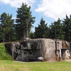
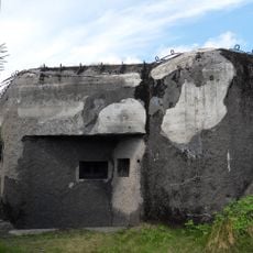
The trail passes the artillery fortress Hanička, about 300 m off the route, and bunkers R-S 87 "Průsek", R-S 74 "Na Holém" and R-S 72 "Nízká", part of the Czechoslovak Wall. A separate educational trail, Betonová hranice, explains these fortifications.
The community of curious travelers
AroundUs brings together thousands of curated places, local tips, and hidden gems, enriched daily by 92,152 contributors worldwide.