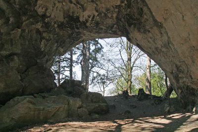
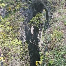
Aksamitova brána, Natural arch in Český kras, Czech Republic.
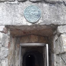
Aksamitova brána is a natural limestone archway in the Český kras landscape and stands as the largest arch formation in this protected area. The opening was created through millions of years of water erosion dissolving the rock.
Originally this was a cave entrance, until its roof collapsed in the 19th century and sealed off the underground passages beneath it. This collapse transformed it into the open arch visible today.
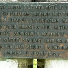
The arch took its name from Jan Axamit, linking this geological feature to local identity through personal recognition. This naming reflects how communities mark their landscape through individuals who shaped its understanding.
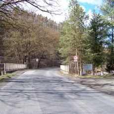
The site is accessible via marked hiking trails starting from the Popovice area, with yellow trail markers guiding visitors through the route. The walk is moderate and follows natural pathways through the karst landscape.
Nearby on Kotýz hill sits a prehistoric Bronze Age settlement with evidence of Celtic worship of the Thracian goddess Kotys. This archaeological connection shows how different cultures inhabited this landscape across millennia.
Location: Koněprusy
Location: Tmaň
GPS coordinates: 49.91720,14.04800
Latest update: December 14, 2025 16:46
Koněprusy Caves
1.4 km
Suchomasty Reservoir
1.9 km
Tmaň Castle
1.7 km
Jelínkův most
250 m
Na Voskopě
2.2 km
Church of Saint George
1.1 km
Kotýz
141 m
Chapel of Saint Blaise (Tmaň)
1.8 km
Hussite church
1.5 km
Socha svatého Vavřince u Veského rybníka v Tmani
1.6 km
Socha svatého Jana Nepomuckého u Veského rybníka v Tmani
1.6 km
Kříž u Veského rybníka v Tmani
1.6 km
V. n. Suchomasty
1.8 km
Kříž u křižovatky pod Koukolovo horou
1.3 km
Bronzový reliéf nad východem z Koněpruských jeskyní
1.3 km
Road bridge over the Suchomastský potok nearby Havlíčkův Mlýn
549 m
Památník vyhlášení stratotypu Klonk u Suchomast
2.2 km
Bridge over the Suchomasty Reservoir
1.6 km
Pomník padlým v Tmani
1.5 km
World War I memorial in Koněprusy
1.2 km
Kříž u silnice na západním okraji Koněprus
1 km
Křížek severovýchodně od Tmaně
800 m
Kříž v Křižatkách
1.3 km
Kříž v Tmani pod vrchem Lejškov
1.9 km
Kříž u Tmaně u kostela svatého Jiří
1.1 km
Turistická lávka u Havlíčkova mlýna
312 m
Lávka k prameni u Havlíčkova mlýna
343 m
Kaple v Koněprusech
1.2 kmVisited this place? Tap the stars to rate it and share your experience / photos with the community! Try now! You can cancel it anytime.
Discover hidden gems everywhere you go!
From secret cafés to breathtaking viewpoints, skip the crowded tourist spots and find places that match your style. Our app makes it easy with voice search, smart filtering, route optimization, and insider tips from travelers worldwide. Download now for the complete mobile experience.
A unique approach to discovering new places❞
— Le Figaro
All the places worth exploring❞
— France Info
A tailor-made excursion in just a few clicks❞
— 20 Minutes