Enable Location

We need your location to show you interesting places around you

Discover nearby places

Find interesting locations and hidden gems around you

Precise directions

Get accurate directions and distances to places

Your location is never shared with other users. It's only used when you tap the location button.

Křížový vrch

Log in to your account

Start exploring — it's free

Trusted by 63,637 travelers worldwide

Continue with Google
Continue with Apple
or

We will send you a code to connect

By continuing, you accept our Terms and Conditions and our Privacy Policy

Check your inbox

We've sent a pincode in your inbox. Please enter the code below.

Discussion Reviews 1 Photos
2.6k Popularity

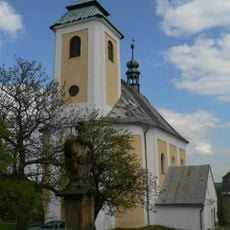
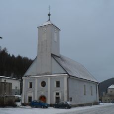
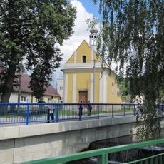
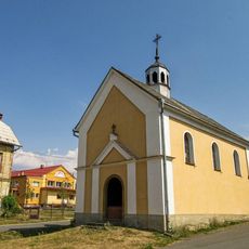
Křížový vrch, Stations of the Cross in Ruda, Czech Republic

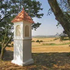
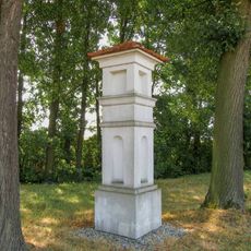
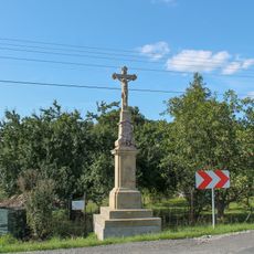
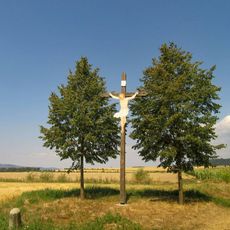
Křížový vrch is a pilgrimage site with fourteen stations arranged along a mountain path depicting the final moments of Jesus. The route connects these stops as visitors climb from one to the next.

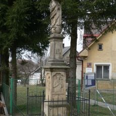
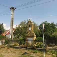
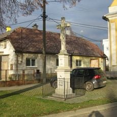
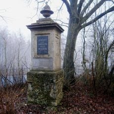
The site was created in the 18th century when pilgrimage paths became increasingly important across the Bohemian region. The stations were later recognized as an official monument, reflecting their lasting role in religious practice.

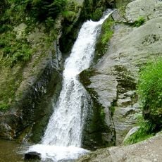
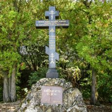
People come here to walk the pilgrimage path, stopping at each station for prayer and reflection as they climb. The site draws both religious pilgrims and visitors interested in understanding local spiritual traditions.

Multiple paths lead to the top, allowing visitors to choose a route that suits their fitness level and available time. The site is accessible and does not require special equipment for a comfortable visit.

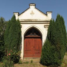
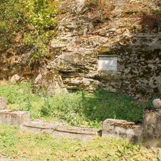
The stations have been maintained and restored by local believers over generations, with old craftsmanship techniques preserved throughout. This ongoing care by the community makes the site more than a monument, but a living expression of local devotion.

The community of curious travelers

AroundUs brings together thousands of curated places, local tips, and hidden gems, enriched daily by 60,000 contributors worldwide.

Start exploring
Location
Elevation above the sea
589 m
GPS coordinates
49.86280,17.17830
Latest update
December 12, 2025 16:41
Around this place
Rešovské vodopády
Czech Republic

Rešovské vodopády

3.1 km
Horní Dlouhá Loučka Castle
Czech Republic

Horní Dlouhá Loučka Castle

4.8 km
Church of Our Lady of the Snow
Czech Republic

Church of Our Lady of the Snow

599 m
Pravoslavný kříž v Dlouhé Loučce
Czech Republic

Pravoslavný kříž v Dlouhé Loučce

3.7 km
Church of Saint Catherine
Czech Republic

Church of Saint Catherine

3.7 km
Church of Saint Florian (Oskava)
Czech Republic

Church of Saint Florian (Oskava)

4.9 km
Church of Saint Anthony of Padua
Czech Republic

Church of Saint Anthony of Padua

3.6 km
Sloup se sochou Panny Marie
Czech Republic

Sloup se sochou Panny Marie

4.8 km
Socha Panny Marie Immaculaty
Czech Republic

Socha Panny Marie Immaculaty

3.6 km
Dub na vyhlídce
Czech Republic

Dub na vyhlídce

2 km
Památník Hermanna Langera v Oskavě na okraji lesa
Czech Republic

Památník Hermanna Langera v Oskavě na okraji lesa

4.6 km
Pomník padlým v Rešově
Czech Republic

Pomník padlým v Rešově

3.7 km
Chapel of Saint Anthony of Padua
Czech Republic

Chapel of Saint Anthony of Padua

1.9 km
Pomník padlým v Plinkoutu na křižovatce
Czech Republic

Pomník padlým v Plinkoutu na křižovatce

2.8 km
Pamětní kříž před kaplí ve středu Břevence
Czech Republic

Pamětní kříž před kaplí ve středu Břevence

1.9 km
Pomník Obětem 1.světové války v Rudě
Czech Republic

Pomník Obětem 1.světové války v Rudě

710 m
Kašna v Dolní Dlouhé Loučce ve středu obce
Czech Republic

Kašna v Dolní Dlouhé Loučce ve středu obce

5.1 km
Kříž v Šumvaldě u hlavní silnice
Czech Republic

Kříž v Šumvaldě u hlavní silnice

3.4 km
Cross in Plinkout opposite the chapel in the village
Czech Republic

Cross in Plinkout opposite the chapel in the village

2.9 km
Kaple svatého Jana Nepomuckého v Plinkoutu
Czech Republic

Kaple svatého Jana Nepomuckého v Plinkoutu

2.9 km
Kaple svaté Anny v Šumvaldu u hlavní silnice
Czech Republic

Kaple svaté Anny v Šumvaldu u hlavní silnice

4.6 km
Boží muka u Plinkoutu vedle polní cesty
Czech Republic

Boží muka u Plinkoutu vedle polní cesty

2.3 km
Boží muka v Šumvaldu na severním okraji obce
Czech Republic

Boží muka v Šumvaldu na severním okraji obce

2.9 km
Sloup se sochou Panny Marie ve středu Dolní Dlouhé Loučky
Czech Republic

Sloup se sochou Panny Marie ve středu Dolní Dlouhé Loučky

5 km
Pomník padlým na hřbitově u Křivé
Czech Republic

Pomník padlým na hřbitově u Křivé

3.8 km
Kříž v Dolní Libině na rozcestí
Czech Republic

Kříž v Dolní Libině na rozcestí

5 km
Dřevěný kříž na okraji Dolní Dlouhé Loučky
Czech Republic

Dřevěný kříž na okraji Dolní Dlouhé Loučky

4.4 km
Pomník padlým v Nemrlově u silnice
Czech Republic

Pomník padlým v Nemrlově u silnice

3.4 km
Show the full map
Reviews
Share your experience

No review yet

Discussions
Start a discussion...

No discussion yet

« Křížový vrch - Stations of the Cross in Ruda, Czech Republic » is provided by Around Us (aroundus.com). Images and texts are derived from Wikimedia project under a Creative Commons license. You are allowed to copy, distribute, and modify copies of this page, under the conditions set by the license, as long as this note is clearly visible.

Discover hidden gems everywhere you go!

From secret cafés to breathtaking viewpoints, skip the crowded tourist spots and find places that match your style. Our app makes it easy with voice search, smart filtering, route optimization, and insider tips from travelers worldwide. Download now for the complete mobile experience.

Around Us App Screenshot

A unique approach to discovering new places

Le Figaro

All the places worth exploring

France Info

A tailor-made excursion in just a few clicks

20 Minutes

Around Us
Travel Guide & Maps
Download

Send to your phone

QR Code
1

Open the camera app on your mobile.

2

Point at the QR code with your camera. A notification will appear.

3

Tap the notification to open the link.