Enable Location

We need your location to show you interesting places around you

Discover nearby places

Find interesting locations and hidden gems around you

Precise directions

Get accurate directions and distances to places

Your location is never shared with other users. It's only used when you tap the location button.

Lom Chlum

Log in to your account

Start exploring — it's free

Trusted by 68,091 travelers worldwide

Continue with Google
Continue with Apple
or

We will send you a code to connect

By continuing, you accept our Terms and Conditions and our Privacy Policy

Check your inbox

We've sent a pincode in your inbox. Please enter the code below.

Discussion Reviews 1 Photos
1.7k Popularity

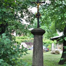
Lom Chlum, Natural monument in Dolní Lomnice, Czech Republic

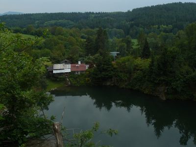
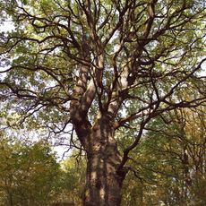
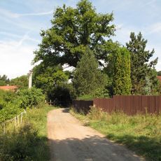
Lom Chlum is a protected natural area in Dolní Lomnice that covers 8.15 hectares and includes a flooded former quarry. This submerged excavation site now provides habitat for frogs, toads, snakes, and other wildlife that thrive in and around standing water.

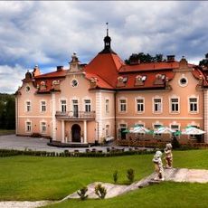
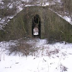
The site operated as an active stone quarry until the early 1960s, when extraction stopped and the land sat dormant. A sculptor named Slavoj Nejdl and a graphic artist named Vratislav Hlavatý then purchased the property and transformed it for artistic and conservation purposes.

The site became a gathering place for artists and writers during the 1960s who came here to work and create. The landscape and character of this location found their way into literary works of the era.

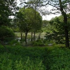
The area is accessible via walking paths where visitors can observe local wildlife and natural features throughout the site. Visiting at different seasons offers varying perspectives, as the habitats and the animals that occupy them shift with weather and temperature changes.

The former quarry buildings were converted into a hacienda with a terrace, blending industrial heritage with modern artistic life. This transformation demonstrates how an exhausted work site became a vibrant space for creativity and nature protection.

The community of curious travelers

AroundUs brings together thousands of curated places, local tips, and hidden gems, enriched daily by 60,000 contributors worldwide.

Start exploring
Location
Inception
February 25, 1992
GPS coordinates
49.91210,14.69320
Latest update
December 14, 2025 13:05
Around this place
Berchtold Castle
Czech Republic

Berchtold Castle

2.6 km
Hotel zámek Berchtold
Czech Republic

Hotel zámek Berchtold

2.6 km
Božkovské jezírko
Czech Republic

Božkovské jezírko

1.7 km
Kaple svatého Vojtěcha
Czech Republic

Kaple svatého Vojtěcha

2.6 km
Most dálnice D1 přes Mnichovku v Hrusicích
Czech Republic

Most dálnice D1 přes Mnichovku v Hrusicích

2.5 km
Socha svatého Jana Nepomuckého
Czech Republic

Socha svatého Jana Nepomuckého

297 m
Dub v Lojovicích
Czech Republic

Dub v Lojovicích

2.6 km
World wars memorial in Senohraby
Czech Republic

World wars memorial in Senohraby

2.6 km
Kovový kříž u památné lípy v Senohrabech
Czech Republic

Kovový kříž u památné lípy v Senohrabech

2.6 km
Belfry in Senohraby
Czech Republic

Belfry in Senohraby

2.6 km
Lojovický dub
Czech Republic

Lojovický dub

2.6 km
Topol v Mnichovicích
Czech Republic

Topol v Mnichovicích

2.5 km
Chapel of Saint Wenceslaus
Czech Republic

Chapel of Saint Wenceslaus

1.4 km
Jasan v Lojovicích
Czech Republic

Jasan v Lojovicích

2.6 km
Lípa v Senohrabech
Czech Republic

Lípa v Senohrabech

2.6 km
Stone cross in Senohraby
Czech Republic

Stone cross in Senohraby

2.6 km
Bridge of Hlavní street over D1 highway in Mirošovice
Czech Republic

Bridge of Hlavní street over D1 highway in Mirošovice

2.2 km
Obrázek Madony v Senohrabech
Czech Republic

Obrázek Madony v Senohrabech

2.6 km
Podchod pod železniční tratí u Sportovní ulice v Mnichovicích
Czech Republic

Podchod pod železniční tratí u Sportovní ulice v Mnichovicích

2.4 km
Underpass of Mnichovice train station
Czech Republic

Underpass of Mnichovice train station

2.5 km
Most silnice I/3 přes Kunický potok v Mirošovicích
Czech Republic

Most silnice I/3 přes Kunický potok v Mirošovicích

1.2 km
Bridge of D1 highway over road Všešímy - Božkov
Czech Republic

Bridge of D1 highway over road Všešímy - Božkov

1.6 km
Lávka Karlín - V Lipách v Mirošovicích
Czech Republic

Lávka Karlín - V Lipách v Mirošovicích

1.4 km
World War I memorial in Mirošovice
Czech Republic

World War I memorial in Mirošovice

1.3 km
Most Senohrabské ulice v Mirošovicích přes Kunický potok
Czech Republic

Most Senohrabské ulice v Mirošovicích přes Kunický potok

1.7 km
Kříž v Božkově
Czech Republic

Kříž v Božkově

2.3 km
Bell tower in Mirošovice
Czech Republic

Bell tower in Mirošovice

1.4 km
Podchod Vilová - Prorážecí v Mnichovicích
Czech Republic

Podchod Vilová - Prorážecí v Mnichovicích

2.6 km
Show the full map
Reviews
Share your experience

No review yet

Discussions
Start a discussion...

No discussion yet

« Lom Chlum - Natural monument in Dolní Lomnice, Czech Republic » is provided by Around Us (aroundus.com). Images and texts are derived from Wikimedia project under a Creative Commons license. You are allowed to copy, distribute, and modify copies of this page, under the conditions set by the license, as long as this note is clearly visible.

Discover hidden gems everywhere you go!

From secret cafés to breathtaking viewpoints, skip the crowded tourist spots and find places that match your style. Our app makes it easy with voice search, smart filtering, route optimization, and insider tips from travelers worldwide. Download now for the complete mobile experience.

Around Us App Screenshot

A unique approach to discovering new places

Le Figaro

All the places worth exploring

France Info

A tailor-made excursion in just a few clicks

20 Minutes

Around Us
Travel Guide & Maps
Download

Send to your phone

QR Code
1

Open the camera app on your mobile.

2

Point at the QR code with your camera. A notification will appear.

3

Tap the notification to open the link.