Opatřilka - Červený lom, Natural monument in Prague, Czech Republic
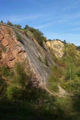
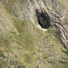
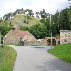
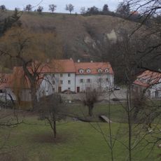
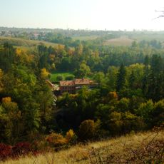
Opatřilka - Červený lom is a natural monument in Prague's Prokopske and Dalejske valleys with limestone cliffs and former quarry areas spanning about 8 hectares. The site displays various geological layers and different habitats, from exposed rock faces to vegetated slopes.
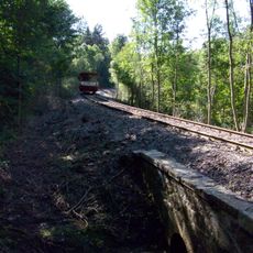
Limestone quarrying began in the early 1800s to supply building materials for local settlements and continued through the 1940s. This extraction activity permanently shaped the landscape and created the current rock formations.
The name Barrandien honors French geologist Joachim Barrande, whose work highlighted the scientific importance of this area. Today visitors can observe the rock layers directly and understand why this place drew scientific attention.
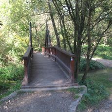
Access to the site is through marked hiking trails in green, with the main entry point at Reporyjskie Square reachable by public transportation. The area suits day visitors and the paths are generally open to walkers.
The cliff faces contain fossil remains from multiple geological time periods that have long fascinated scientists. These fossil deposits make the site special for anyone interested in paleontology and ancient life.
Location: Prague
Inception: September 1, 1982
GPS coordinates: 50.03470,14.34950
Latest update: December 14, 2025 17:03
Dobrá voda
546 m
Butovice Gord
751 m
Klukovické koupaliště
915 m
Klukovická jeskyně
908 m
Horův mlýn
877 m
Mlýn Rohlov
109 m
Opatřilka
184 m
Na Troníčku
570 m
Most přes Prokopský potok na kraji lesa severně od butovického hradiště
889 m
Most ulice K dobré vodě přes Dalejský potok pod zastávkou Praha-Holyně
208 m
Chapel of Saint John the Baptist in Holyně
751 m
Pomník padlým v 1. světové válce v Holyni
643 m
Dům čp. 302
896 m
Motýli
616 m
Railway bridge over Do Klukovic street
882 m
Fontána Keltský bojovník
786 m
Kříž u kaple v Holyni
758 m
Railway bridge over Dalejský potok near Praha-Holyně station
123 m
Obelisky
761 m
Pomník padlým na konci Habartovské ulice v Klukovicích
936 m
Kříž u cesty nad údolím Dalejského potoka
411 m
Ford under K dobré vodě 16 in Holyně
759 m
Kříž v ulici Za Knotkem v Holyni
292 m
Kaplička v ulici U Smolnic v Holyni
788 m
Kříž u polní cesty západně od Holyně
923 m
Železniční most přes Dalejský potok severně od mlýna Rohlov
79 m
Most trati 173 přes potok V Ladech
537 m
Holyně - Opatřilka footbridge
126 mVisited this place? Tap the stars to rate it and share your experience / photos with the community! Try now! You can cancel it anytime.
Discover hidden gems everywhere you go!
From secret cafés to breathtaking viewpoints, skip the crowded tourist spots and find places that match your style. Our app makes it easy with voice search, smart filtering, route optimization, and insider tips from travelers worldwide. Download now for the complete mobile experience.
A unique approach to discovering new places❞
— Le Figaro
All the places worth exploring❞
— France Info
A tailor-made excursion in just a few clicks❞
— 20 Minutes