Enable Location

We need your location to show you interesting places around you

Discover nearby places

Find interesting locations and hidden gems around you

Precise directions

Get accurate directions and distances to places

Your location is never shared with other users. It's only used when you tap the location button.

Osypané břehy

Log in to your account

Start exploring — it's free

Trusted by 62,472 travelers worldwide

Continue with Google
Continue with Apple
or

We will send you a code to connect

By continuing, you accept our Terms and Conditions and our Privacy Policy

Check your inbox

We've sent a pincode in your inbox. Please enter the code below.

Osypané břehy, Natural monument near Strážnice, Czech Republic.

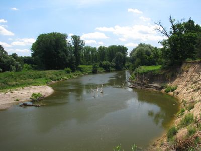
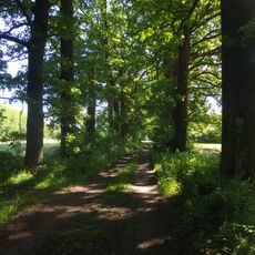
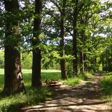
Osypané břehy is a protected area along the Morava River near Strážnice featuring three river meanders with adjacent forests and steep sandy banks reaching up to 13 meters in height. The site covers approximately 76 hectares and sits about 3 kilometers northwest of town.

The area received official protection in 1999 and preserves natural geological formations from the younger Quaternary period with flood clays and silts. These sediment layers were created over millennia by river activity along the Morava banks.

The location served as a filming site for Karel Zeman's film Journey to the Beginning of Time, which featured its natural geological formations. Visitors can still see the same landscapes that appeared in this classic Czech production.

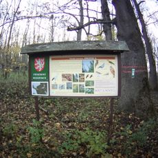
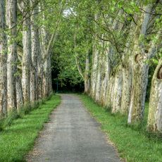
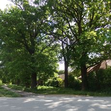
The best way to visit is to start at a local information center in Strážnice to learn about access points and trail conditions before exploring the protected area. The terrain is relatively flat and accessible for walking visitors.

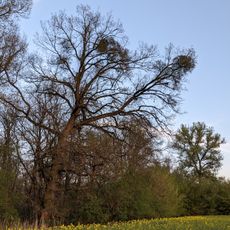
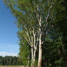
The sandy banks support specialized plants adapted to sandy soil as well as more than 50 spider species and around 70 ground beetle varieties. This small ecosystem serves as a haven for organisms with highly specific habitat requirements.

The community of curious travelers

AroundUs brings together thousands of curated places, local tips, and hidden gems, enriched daily by 60,000 contributors worldwide.

Start exploring
Location
Inception
1999
GPS coordinates
48.91880,17.27840
Latest update
December 13, 2025 12:23
Around this place
Strážnice Chateau
Czech Republic

Strážnice Chateau

2.8 km
Žilkův dub
Czech Republic

Žilkův dub

2.5 km
Oskovec
Czech Republic

Oskovec

2 km
Chain bridge in Strážnice
Czech Republic

Chain bridge in Strážnice

3 km
Muzeum vesnice jihovýchodní Moravy
Czech Republic

Muzeum vesnice jihovýchodní Moravy

2.9 km
Plavební komora Strážnice I
Czech Republic

Plavební komora Strážnice I

2.9 km
Plavební komora Strážnice II
Czech Republic

Plavební komora Strážnice II

3 km
Oskovec II
Czech Republic

Oskovec II

2.3 km
Průžkův mlýn
Czech Republic

Průžkův mlýn

3 km
Pomník Jana Amose Komenského za kostelem Nanebevzetí ve Strážnici
Czech Republic

Pomník Jana Amose Komenského za kostelem Nanebevzetí ve Strážnici

3.1 km
Pomník lesního Maxmiliána Haigera
Czech Republic

Pomník lesního Maxmiliána Haigera

506 m
Socha svatého Floriána v ulici Staré Město ve Strážnici
Czech Republic

Socha svatého Floriána v ulici Staré Město ve Strážnici

2.9 km
Dům čp. 735
Czech Republic

Dům čp. 735

3 km
Pivovar
Czech Republic

Pivovar

3 km
Dubové stromořadí I.
Czech Republic

Dubové stromořadí I.

1.9 km
Platanové stromořadí - Hlavní alej I Strážnice
Czech Republic

Platanové stromořadí - Hlavní alej I Strážnice

1.1 km
Usedlost čp. 12 z Vyškovce
Czech Republic

Usedlost čp. 12 z Vyškovce

2.9 km
Chapel of Saint Roch
Czech Republic

Chapel of Saint Roch

3.1 km
Dubové stromořadí Strážnice Žabné
Czech Republic

Dubové stromořadí Strážnice Žabné

2.6 km
Platanové stromořadí Mucharov II. - Strážnice
Czech Republic

Platanové stromořadí Mucharov II. - Strážnice

1.6 km
Dubové stromořadí II
Czech Republic

Dubové stromořadí II

2 km
Stromořadí platanů,dubů a jírovců - Mucharov Strážnice
Czech Republic

Stromořadí platanů,dubů a jírovců - Mucharov Strážnice

1.4 km
Dub u Veličky ve Strážnici
Czech Republic

Dub u Veličky ve Strážnici

863 m
Chapel with the picture of Virgin Mary
Czech Republic

Chapel with the picture of Virgin Mary

3.1 km
Busta Vítězslava Volavého u zámku ve Strážnici
Czech Republic

Busta Vítězslava Volavého u zámku ve Strážnici

2.9 km
Boží muka v Areálu vinohradnických staveb ve Skanzenu Strážnice
Czech Republic

Boží muka v Areálu vinohradnických staveb ve Skanzenu Strážnice

2.8 km
Chapel of Saint John of Nepomuk in the chateau garden
Czech Republic

Chapel of Saint John of Nepomuk in the chateau garden

2.9 km
Kaplička svatého Jana Nepomuckého u cesty k zámku ve Strážnici
Czech Republic

Kaplička svatého Jana Nepomuckého u cesty k zámku ve Strážnici

2.9 km
Show the full map
« Osypané břehy - Natural monument near Strážnice, Czech Republic » is provided by Around Us (aroundus.com). Images and texts are derived from Wikimedia project under a Creative Commons license. You are allowed to copy, distribute, and modify copies of this page, under the conditions set by the license, as long as this note is clearly visible.

Discover hidden gems everywhere you go!

From secret cafés to breathtaking viewpoints, skip the crowded tourist spots and find places that match your style. Our app makes it easy with voice search, smart filtering, route optimization, and insider tips from travelers worldwide. Download now for the complete mobile experience.

Around Us App Screenshot

A unique approach to discovering new places

Le Figaro

All the places worth exploring

France Info

A tailor-made excursion in just a few clicks

20 Minutes

Around Us
Travel Guide & Maps
Download

Send to your phone

QR Code
1

Open the camera app on your mobile.

2

Point at the QR code with your camera. A notification will appear.

3

Tap the notification to open the link.