Talmberk, Medieval castle ruins in Central Bohemian Region, Czech Republic
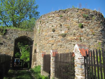
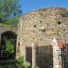
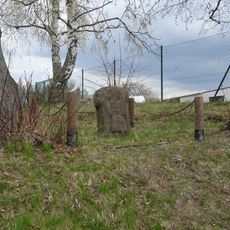
Talmberk is a castle ruin in the Samopše area of Central Bohemia featuring stone walls with Gothic elements and defensive structures. The remnants stand on elevated terrain and reveal the original layout of a medieval fortification.
The castle first appeared in records in 1297 under William of Talmberk's control and served as a fortification for centuries. It was completely abandoned in 1533 and never reoccupied afterward.
The ruins show how medieval Czech lords built fortifications to control the surrounding lands. They remain a symbol of the region's defensive heritage from centuries past.
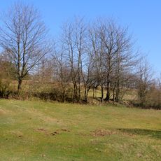
The ruins can be reached by following marked hiking trails through the countryside of Kutná Hora District. Bring sturdy shoes and allow time to explore, as the terrain is uneven and some paths require careful footing.
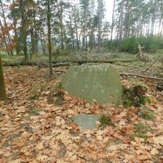
Local people collected stones from the structure for building materials over many centuries, which eventually led to a major collapse in 1933. This process shows how communities repurposed the castle as a practical source of stone.
Location: Samopše
GPS coordinates: 49.86690,14.95530
Latest update: December 7, 2025 19:32
Talmberk Castle
44 m
Rataje nad Sázavou Castle
2.8 km
Vraník
3.1 km
Church of the Assumption of the Virgin Mary in Úžice
1.4 km
Kamenná stéla v Mrchojedech
958 m
Church of Saint Matthew
2.8 km
Chapel of Virgin Mary (Nechyba)
3.4 km
Vila čp. 177
2.9 km
Jubilejní památník knížete Jana II. z Lichtenštejna v Ratajích
1.2 km
Sousoší svatého Jana Nepomuckého v Ratajích
2.8 km
Chapel of Saint Anthony
2.6 km
City walls in Rataje nad Sázavou
2.8 km
Sklářská huť František
3.4 km
Chapel of Saint Wenceslaus
2.4 km
Road bridge over the Sázava in Ledečko
2.1 km
Reliéfy v hřbitovní zdi u kostela v Ratajích
2.8 km
Dub u Navrátilů v Mrchojedech
1.1 km
Kaple svaté Anny v Ledečku
1.9 km
Plastika Pirkenštejský ptáček v předzámčí v Ratajích
2.8 km
Kašna na náměstí v Ratajích
2.8 km
Pamětní deska nad portálem zámku v Ratajích
2.8 km
Pomník padlým v Ledečku
1.9 km
Sloup svatého Prokopa u křižovatky silnic "Na Vítkovicích" severně od Ratají nad Sázavou
1.2 km
Železniční most Rataje nad Sázavou - Ledečko
2.4 km
Kříž na náměstí v Ratajích
2.8 km
Kříž v Ledečku v lokalitě Na Ostrově
2.1 km
Kříž u kostela v Ratajích
2.8 km
Kašna u bývalého pivovaru v Ratajích
2.7 kmVisited this place? Tap the stars to rate it and share your experience / photos with the community! Try now! You can cancel it anytime.
Discover hidden gems everywhere you go!
From secret cafés to breathtaking viewpoints, skip the crowded tourist spots and find places that match your style. Our app makes it easy with voice search, smart filtering, route optimization, and insider tips from travelers worldwide. Download now for the complete mobile experience.
A unique approach to discovering new places❞
— Le Figaro
All the places worth exploring❞
— France Info
A tailor-made excursion in just a few clicks❞
— 20 Minutes