Enable Location

We need your location to show you interesting places around you

Discover nearby places

Find interesting locations and hidden gems around you

Precise directions

Get accurate directions and distances to places

Your location is never shared with other users. It's only used when you tap the location button.

Znojmo Reservoir

Log in to your account

Start exploring — it's free

Trusted by 62,477 travelers worldwide

Continue with Google
Continue with Apple
or

We will send you a code to connect

By continuing, you accept our Terms and Conditions and our Privacy Policy

Check your inbox

We've sent a pincode in your inbox. Please enter the code below.

Znojmo Reservoir

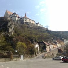
Znojmo Reservoir, reservoir in Znojmo, Czech Republic

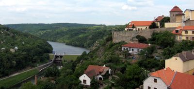
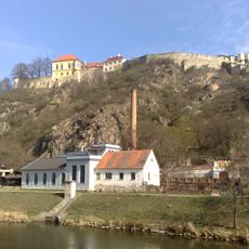
The Znojmo Reservoir is a large body of water in southern Czech Republic near the town of Znojmo, stretching approximately 5 kilometers with depths reaching about 17 meters. The water rests within a valley surrounded by green hills and fields, creating open views across the landscape.

The reservoir was constructed between 1962 and 1966 to manage water flow and control flooding in the region. The flooding of the valley resulted in the removal of structures including the Trauznický Mill, two bridges, and recreational cabins that once occupied the area.

The reservoir was once a valley with villages and a historic pub called 'Pod Obří hlavou' that locals frequented. Today, the area serves as a gathering place where residents spend weekends for barbecues and outdoor activities, reflecting how the community values this space in their daily life.

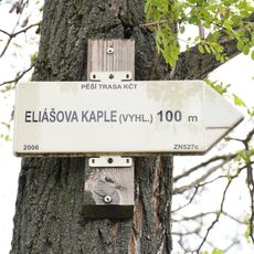
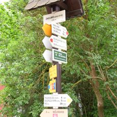
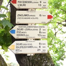
The reservoir is easily accessible from Znojmo by car or bicycle, with several local routes leading to the water that suit visitors of all ages. The area is best suited for swimming, boating, and fishing during warmer months, while walking and cycling trails extend into the surrounding forests and hills throughout the year.

The reservoir serves as a drinking water supply for Znojmo and surrounding communities, making it essential to the region's practical needs. The dam itself is a notable example of mid-20th-century engineering that demonstrates the technical achievements of that era.

The community of curious travelers

AroundUs brings together thousands of curated places, local tips, and hidden gems, enriched daily by 60,000 contributors worldwide.

Start exploring
Location
Inception
1966
GPS coordinates
48.85280,16.03610
Latest update
February 9, 2026 08:22
Around this place
Ducal Rotunda of the Virgin Mary and St Catherine
Czech Republic

Ducal Rotunda of the Virgin Mary and St Catherine

619 m
Znojmo Castle
Czech Republic

Znojmo Castle

568 m
Chapel of Saint Wenceslaus
Czech Republic

Chapel of Saint Wenceslaus

705 m
Church of Saint Hippolytus
Czech Republic

Church of Saint Hippolytus

651 m
Church of Saint Anthony of Padua (Znojmo)
Czech Republic

Church of Saint Anthony of Padua (Znojmo)

612 m
Loupežnická věž
Czech Republic

Loupežnická věž

724 m
Stará vodárna
Czech Republic

Stará vodárna

409 m
Stations of the Cross in Znojmo-Hradiště
Czech Republic

Stations of the Cross in Znojmo-Hradiště

730 m
Pomník k výročí založení města u znojemského hradu
Czech Republic

Pomník k výročí založení města u znojemského hradu

561 m
Statue of Immaculata in Znojmo
Czech Republic

Statue of Immaculata in Znojmo

593 m
Sousoší Kalvárie
Czech Republic

Sousoší Kalvárie

722 m
Chapel-shrine in Mikulášské náměstí, Znojmo
Czech Republic

Chapel-shrine in Mikulášské náměstí, Znojmo

723 m
Socha svatého Jana Nepomuckého u hradu
Czech Republic

Socha svatého Jana Nepomuckého u hradu

569 m
Kaple svatého Jana Nepomuckého
Czech Republic

Kaple svatého Jana Nepomuckého

605 m
Kaple proroka Eliáše
Czech Republic

Kaple proroka Eliáše

451 m
Rozcestník Gránické údolí - křížová cesta
Czech Republic

Rozcestník Gránické údolí - křížová cesta

725 m
Hradní 7
Czech Republic

Hradní 7

571 m
Monastery of Knights of the Cross with the Red Star in Hradiště
Czech Republic

Monastery of Knights of the Cross with the Red Star in Hradiště

665 m
Fara svatého Mikuláše
Czech Republic

Fara svatého Mikuláše

726 m
Rozcestník Hradiště - MHD, odb.
Czech Republic

Rozcestník Hradiště - MHD, odb.

688 m
Kaple Svatého Václava na Mikulášském náměstí ve Znojmě
Czech Republic

Kaple Svatého Václava na Mikulášském náměstí ve Znojmě

715 m
Rozcestník Eliášova kaple vyhl.
Czech Republic

Rozcestník Eliášova kaple vyhl.

549 m
Rozcestník Znojmo - údolí Dyje
Czech Republic

Rozcestník Znojmo - údolí Dyje

511 m
Rozcestník Pod Karolininými sady
Czech Republic

Rozcestník Pod Karolininými sady

565 m
Kaplička se sochou Krista před kostelem Svatého Mikuláše ve Znojmě
Czech Republic

Kaplička se sochou Krista před kostelem Svatého Mikuláše ve Znojmě

722 m
Rozcestník Hradiště - okraj
Czech Republic

Rozcestník Hradiště - okraj

558 m
Rozcestník Pod Kramerovou vilou
Czech Republic

Rozcestník Pod Kramerovou vilou

435 m
Rozcestník Jubilejní cesta - rozc.
Czech Republic

Rozcestník Jubilejní cesta - rozc.

611 m
Show the full map
« Znojmo Reservoir - reservoir in Znojmo, Czech Republic » is provided by Around Us (aroundus.com). Images and texts are derived from Wikimedia project under a Creative Commons license. You are allowed to copy, distribute, and modify copies of this page, under the conditions set by the license, as long as this note is clearly visible.

Discover hidden gems everywhere you go!

From secret cafés to breathtaking viewpoints, skip the crowded tourist spots and find places that match your style. Our app makes it easy with voice search, smart filtering, route optimization, and insider tips from travelers worldwide. Download now for the complete mobile experience.

Around Us App Screenshot

A unique approach to discovering new places

Le Figaro

All the places worth exploring

France Info

A tailor-made excursion in just a few clicks

20 Minutes

Around Us
Travel Guide & Maps
Download

Send to your phone

QR Code
1

Open the camera app on your mobile.

2

Point at the QR code with your camera. A notification will appear.

3

Tap the notification to open the link.