Geopark Ralsko, National geopark in northern Bohemia, Czech Republic.
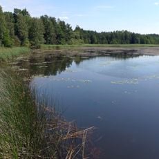
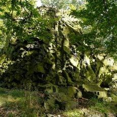
Geopark Ralsko covers 294 km² of the Ralská pahorkatina highlands in the Česká Lípa district, spanning the former Ralsko military training ground and land around Břehyňský rybník and Máchovo jezero. Its highest point is Ralsko hill at 698 m, a nature reserve, and the area holds reserves such as Břehyně-Pecopala and Jestřebské slatiny.
The geopark was established in 2013 and received National Geopark certification in 2016 from the Czech Republic. This recognition marked its role as a significant site for geological education and conservation efforts.
The geopark's name comes from Ralsko hill (698 m), whose summit area is a nature reserve. The landscape also holds the abandoned village of Jabloneček: of its 105 houses, only two stood in 2016, and the Proměny festival that year brought land-art, music and theatre there for a single day. The geopark's logo was chosen in a 2015 competition that drew 120 designs from children and adults.
The geopark's area overlaps in part with the Kokořínsko – Máchův kraj Protected Landscape Area, and its highest point is Ralsko hill at 698 m, a nature reserve. The geopark administration runs excursions and seminars for the public, specialists and school groups. The former military area was long closed to the public, so many sites are reached on marked trails from surrounding villages such as Kuřívody, Doksy and Hamr na Jezeře.
The abandoned village of Jabloneček lost 103 of its 105 houses; only two stood in 2016. That May, the Proměny festival brought land-art, music, theatre and food there for a single day, using art to symbolically return life to the empty site.
The community of curious travelers
AroundUs brings together thousands of curated places, local tips, and hidden gems, enriched daily by 92,672 contributors worldwide.