Enable Location

We need your location to show you interesting places around you

Discover nearby places

Find interesting locations and hidden gems around you

Precise directions

Get accurate directions and distances to places

Your location is never shared with other users. It's only used when you tap the location button.

V chobotech

Log in to your account

Start exploring — it's free

Trusted by 61,503 travelers worldwide

Continue with Google
Continue with Apple
or

We will send you a code to connect

By continuing, you accept our Terms and Conditions and our Privacy Policy

Check your inbox

We've sent a pincode in your inbox. Please enter the code below.

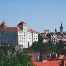
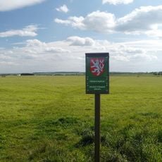
V chobotech, Medieval hillfort in Čejetičky, Czech Republic.

Description

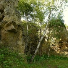
V chobotek is a medieval hillfort located in Čejetičky with earthen ramparts forming defensive structures across the elevated site. The fortification features a perimeter defined by preserved embankments and terraced areas that protected the settlement in earlier times.

History

The fortification originated during the early medieval period as a defensive settlement for local populations in the region. Its strategic location helped control important pathways and provided protection during a time of frequent territorial conflicts.

Culture

The site holds meaning as a window into how medieval Czech communities organized themselves and defended their territory. Walking through the earthen ramparts, you can sense the practical purpose these structures served for the people who built them.

Practical

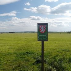
The site is accessible year-round and can be visited independently without special preparation beyond standard outdoor walking gear. The terrain is uneven in places, so sturdy footwear helps you navigate the earthen ramparts and surrounding ground safely.

Did you know?

Archaeological digs at this location uncovered everyday objects and tools that reveal how residents lived and worked during medieval times. These discoveries provide a detailed picture of domestic life that goes beyond what the earthworks alone can show.

Location
Elevation above the sea
255 m
GPS coordinates
50.40216,14.87152
Latest update
December 14, 2025 15:02

AroundUs brings together thousands of curated places, local tips, and hidden gems, enriched daily by 60,000 contributors worldwide. Discover all places nearby (Čejetičky).

Around this place
Castle in Mladá Boleslav
Czech Republic

Castle in Mladá Boleslav

2.2 km
Saint Nicholas church in Vinec
Czech Republic

Saint Nicholas church in Vinec

1.1 km
Letecké muzeum Metoděje Vlacha
Czech Republic

Letecké muzeum Metoděje Vlacha

2 km
Rácov Castle
Czech Republic

Rácov Castle

1.1 km
Lom u Chrástu
Czech Republic

Lom u Chrástu

1.9 km
Bezděčín
Czech Republic

Bezděčín

1.9 km
Socha rytíře vpravo na u brány do dvora domu 2 ve Vinecké ulici v Čejeticích
Czech Republic

Socha rytíře vpravo na u brány do dvora domu 2 ve Vinecké ulici v Čejeticích

995 m
Monument to the aircraft of Metoděj Vlach
Czech Republic

Monument to the aircraft of Metoděj Vlach

2.1 km
Řehnice čp. 18
Czech Republic

Řehnice čp. 18

1.7 km
Neuberk Castle
Czech Republic

Neuberk Castle

1 km
Socha rytíře vlevo u brány do dvora domu 2 ve Vinecké ulici v Čejeticích
Czech Republic

Socha rytíře vlevo u brány do dvora domu 2 ve Vinecké ulici v Čejeticích

990 m
Wayside cross in Řehnice
Czech Republic

Wayside cross in Řehnice

1.8 km
Kříž u domu 35 v Chrástu
Czech Republic

Kříž u domu 35 v Chrástu

1.4 km
Sloup mezi ulicemi Štyrsova a Pod Borkem
Czech Republic

Sloup mezi ulicemi Štyrsova a Pod Borkem

2.1 km
Vinec 45
Czech Republic

Vinec 45

837 m
Bridge over the Jizera in Vinec
Czech Republic

Bridge over the Jizera in Vinec

702 m
Dub v parku Neuberk
Czech Republic

Dub v parku Neuberk

1.1 km
Bridge of Nádražní street in Čejetičky over the Jizera
Czech Republic

Bridge of Nádražní street in Čejetičky over the Jizera

1.4 km
Pomník padlým v 1. světové válce v Čejetičkách
Czech Republic

Pomník padlým v 1. světové válce v Čejetičkách

1.3 km
Bridge of Nádražní street over the Klenice
Czech Republic

Bridge of Nádražní street over the Klenice

2.1 km
Pipeline bridge over the Jizera in Čejetičky
Czech Republic

Pipeline bridge over the Jizera in Čejetičky

1.4 km
Pamětní deska židovským spoluobčanům na hradě v Mladé Boleslavi
Czech Republic

Pamětní deska židovským spoluobčanům na hradě v Mladé Boleslavi

2.2 km
Pamětní deska obětem okupace 1939-45 na nádraží v Mladé Boleslavi
Czech Republic

Pamětní deska obětem okupace 1939-45 na nádraží v Mladé Boleslavi

1.3 km
Vinecké lípy
Czech Republic

Vinecké lípy

755 m
Pamětní kříž u kostela svatého Mikuláše ve Vinci
Czech Republic

Pamětní kříž u kostela svatého Mikuláše ve Vinci

1.1 km
Wayside cross in Nádražní street in Čejetičky
Czech Republic

Wayside cross in Nádražní street in Čejetičky

1.4 km
Pomník padlým v Chrástu
Czech Republic

Pomník padlým v Chrástu

1.4 km
Bezděčín
Czech Republic

Bezděčín

1.8 km
Show the full map
« V chobotech - Medieval hillfort in Čejetičky, Czech Republic » is provided by Around Us (aroundus.com). Images and texts are derived from Wikimedia project under a Creative Commons license. You are allowed to copy, distribute, and modify copies of this page, under the conditions set by the license, as long as this note is clearly visible.

Discover hidden gems everywhere you go!

From secret cafés to breathtaking viewpoints, skip the crowded tourist spots and find places that match your style. Our app makes it easy with voice search, smart filtering, route optimization, and insider tips from travelers worldwide. Download now for the complete mobile experience.

Around Us App Screenshot

A unique approach to discovering new places

Le Figaro

All the places worth exploring

France Info

A tailor-made excursion in just a few clicks

20 Minutes

Around Us
Travel Guide & Maps
Download

Send to your phone

QR Code
1

Open the camera app on your mobile.

2

Point at the QR code with your camera. A notification will appear.

3

Tap the notification to open the link.