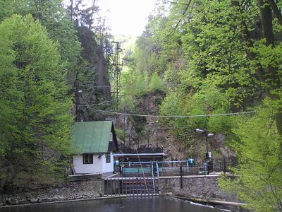
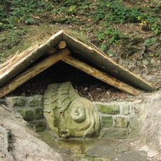
Štola Myší díra, Mining adit in Litice nad Orlicí, Czech Republic.
Štola Myší díra is a 36-meter mining adit in Litice nad Orlicí featuring narrow passages and original wooden supports throughout its underground route. The tunnel demonstrates extraction methods used by workers and exposes geological layers that were encountered during mineral removal.
This mining passage developed in the late medieval period as part of mineral extraction activities in Eastern Bohemia and the region's industrial growth. The adit records centuries of ore and mineral production in the Pardubice area.
The adit holds official status as a Czech cultural monument, preserving evidence of how miners worked in these tight spaces using traditional methods. Visitors can observe the marks and traces left by generations of workers who extracted minerals from this underground passage.
Access requires permission from local authorities and visits are typically arranged through guided tours only. Travelers should contact the local municipality or cultural authorities to inquire about current conditions and visiting arrangements.
The name Myší díra translates literally to mouse hole, referring to the remarkably tight dimensions of the passage. This naming choice reflects how local people perceived the cramped conditions miners faced while working underground.
The community of curious travelers
AroundUs brings together thousands of curated places, local tips, and hidden gems, enriched daily by 60,000 contributors worldwide.