Enable Location

We need your location to show you interesting places around you

Discover nearby places

Find interesting locations and hidden gems around you

Precise directions

Get accurate directions and distances to places

Your location is never shared with other users. It's only used when you tap the location button.

Koráb

Log in to your account

Start exploring — it's free

Trusted by 63,855 travelers worldwide

Continue with Google
Continue with Apple
or

We will send you a code to connect

By continuing, you accept our Terms and Conditions and our Privacy Policy

Check your inbox

We've sent a pincode in your inbox. Please enter the code below.

Koráb
Discussion Reviews 1 Photos
1.3k Popularity

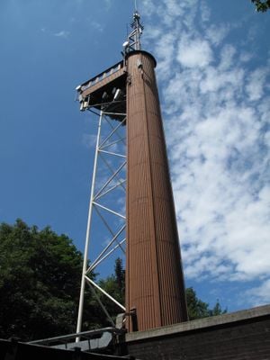
Koráb, Observation tower in Kdyně, Czech Republic

The Koráb tower is a 50 meter (164 ft) tall steel structure with an observation deck at approximately 30 meters (98 ft) height, also functioning as a television transmitter. The platform provides views of the Šumava mountains and, under clear conditions, extends toward the Alps.

The original site featured a wooden structure with a mountain lodge, which was replaced in 1992 by the current steel construction. This rebuild established it as a broadcast and television transmission point.

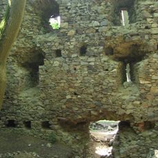
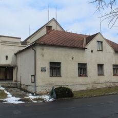
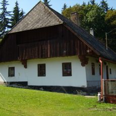
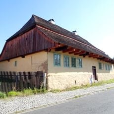
The mountain lodge at the base displays furnishings in the traditional Chodsko style, showcasing how the local community expresses its connection to the region through interior design. These pieces reflect the aesthetic preferences and craft traditions that characterize western Bohemia.

Reaching the observation platform requires climbing 144 stairs, a moderate effort for most visitors. The location is best visited during stable weather to enjoy the expansive views it offers.

The project was overseen by the uranium industry institute of Ostrov nad Ohří and directed by architect Josef Egert. This industrial connection reveals how technical institutions were involved in developing the area's infrastructure.

The community of curious travelers

AroundUs brings together thousands of curated places, local tips, and hidden gems, enriched daily by 60,000 contributors worldwide.

Start exploring
Location
Height
50 m
GPS coordinates
49.39542,13.07524
Latest update
December 14, 2025 17:41
Around this place
Castle Nový Herštejn
Czech Republic

Castle Nový Herštejn

2.3 km
Saint Nicholas church
Czech Republic

Saint Nicholas church

2.1 km
Chapel of Blessed Karl of Austria
Czech Republic

Chapel of Blessed Karl of Austria

1 km
Synagogue in Kdyně
Czech Republic

Synagogue in Kdyně

2.8 km
Herštýn
Czech Republic

Herštýn

2.2 km
Stromořadí na Šibenici
Czech Republic

Stromořadí na Šibenici

1.8 km
Hora (natural monument)
Czech Republic

Hora (natural monument)

1.4 km
Železniční most přes silnici III/0225 a Andělici v Dobříkově
Czech Republic

Železniční most přes silnici III/0225 a Andělici v Dobříkově

2.6 km
Socha ženy před bývalým hotelem na Náměstí ve Kdyni
Czech Republic

Socha ženy před bývalým hotelem na Náměstí ve Kdyni

2.6 km
Chapel of Our Lady of Sorrows
Czech Republic

Chapel of Our Lady of Sorrows

2.2 km
Socha muže před bývalým hotelem na Náměstí ve Kdyni
Czech Republic

Socha muže před bývalým hotelem na Náměstí ve Kdyni

2.6 km
Usedlost čp. 14
Czech Republic

Usedlost čp. 14

3.2 km
Dům čp. 62
Czech Republic

Dům čp. 62

2.6 km
Chapel of Saint John of Nepomuk
Czech Republic

Chapel of Saint John of Nepomuk

2.4 km
Former spinning mill in Kdyně
Czech Republic

Former spinning mill in Kdyně

2.7 km
Evangelická fara v Kdyni
Czech Republic

Evangelická fara v Kdyni

2.7 km
Usedlost čp. 1
Czech Republic

Usedlost čp. 1

3.1 km
Starokdyňská 89
Czech Republic

Starokdyňská 89

2.2 km
Boží muka na rozcestí "U křížku" severně od Kdyně
Czech Republic

Boží muka na rozcestí "U křížku" severně od Kdyně

2.4 km
Chapel of Saint Martin
Czech Republic

Chapel of Saint Martin

2.4 km
Boží muka na křižovatce ulic Dělnická - Americká - Školní - Herštýnská v Kdyni
Czech Republic

Boží muka na křižovatce ulic Dělnická - Americká - Školní - Herštýnská v Kdyni

2.5 km
Pomník padlým v I. světové válce u silnice Kdyně - Podzámčí
Czech Republic

Pomník padlým v I. světové válce u silnice Kdyně - Podzámčí

3.1 km
Usedlost čp. 18
Czech Republic

Usedlost čp. 18

3.2 km
Kříž v Dobříkově
Czech Republic

Kříž v Dobříkově

2.2 km
Kříž v Brnířově u návsi
Czech Republic

Kříž v Brnířově u návsi

2.3 km
Chapel of Saint Joseph
Czech Republic

Chapel of Saint Joseph

1.1 km
Radnice v Kdyni
Czech Republic

Radnice v Kdyni

2.6 km
Kaple Nejsvětější Trojice na Podzámčí
Czech Republic

Kaple Nejsvětější Trojice na Podzámčí

3.1 km
Show the full map
Reviews
Share your experience

No review yet

Discussions
Start a discussion...

No discussion yet

« Koráb - Observation tower in Kdyně, Czech Republic » is provided by Around Us (aroundus.com). Images and texts are derived from Wikimedia project under a Creative Commons license. You are allowed to copy, distribute, and modify copies of this page, under the conditions set by the license, as long as this note is clearly visible.

Discover hidden gems everywhere you go!

From secret cafés to breathtaking viewpoints, skip the crowded tourist spots and find places that match your style. Our app makes it easy with voice search, smart filtering, route optimization, and insider tips from travelers worldwide. Download now for the complete mobile experience.

Around Us App Screenshot

A unique approach to discovering new places

Le Figaro

All the places worth exploring

France Info

A tailor-made excursion in just a few clicks

20 Minutes

Around Us
Travel Guide & Maps
Download

Send to your phone

QR Code
1

Open the camera app on your mobile.

2

Point at the QR code with your camera. A notification will appear.

3

Tap the notification to open the link.