Enable Location

We need your location to show you interesting places around you

Discover nearby places

Find interesting locations and hidden gems around you

Precise directions

Get accurate directions and distances to places

Your location is never shared with other users. It's only used when you tap the location button.

Naučná stezka Údolím Bystřice

Log in to your account

Start exploring — it's free

Trusted by travelers worldwide

Continue with Google
Continue with Apple
or

We will send you a code to connect

By continuing, you accept our Terms and Conditions and our Privacy Policy

Check your inbox

We've sent a pincode in your inbox. Please enter the code below.

Naučná stezka Údolím Bystřice

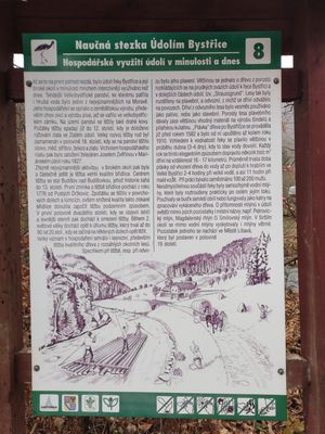
Naučná stezka Údolím Bystřice, Educational trail through Bystřice Valley in Olomouc Region, Czech Republic.

Description

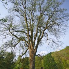
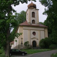
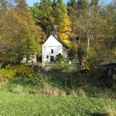
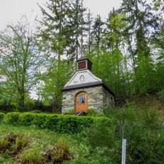
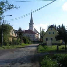
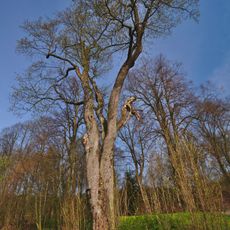
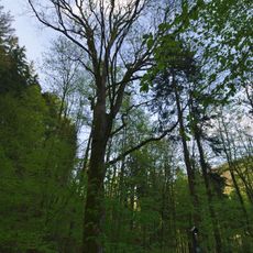
This educational trail is a marked walking route through the Bystřice River valley in the Olomouc Region, connecting two railway stations with informative stops positioned along the path. The route passes through river bends, rocky outcrops, and woodland areas that form the valley landscape.

History

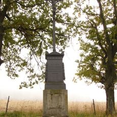
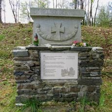
The valley was a location of military significance during the Seven Years War, with a notable engagement occurring in the area during 1758. This event reflects the region's broader involvement in the broader conflicts of the period.

Culture

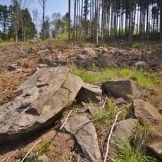
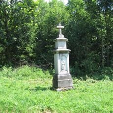
The signposted information covers local geological layers, river ecosystems, and meadow habitats that visitors can observe directly as they walk. These displays help explain how the landscape has been shaped by natural forces over time.

Practical

The trail can be accessed from railway stations at both endpoints, allowing hikers flexibility in choosing their starting point. The path is walkable year-round and includes designated stops where visitors can read the information panels.

Did you know?

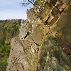
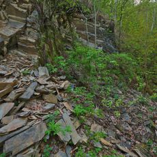
The trail passes Malý Rabštýn, a rocky outcrop where conglomerate cliffs rise approximately 40 meters (130 feet) above the river and attract rock climbers. The cliff face has multiple established climbing routes with varying levels of difficulty.

GPS coordinates
49.74016,17.44522
Latest update
December 13, 2025 17:05

AroundUs brings together thousands of curated places, local tips, and hidden gems, enriched daily by 60,000 contributors worldwide. Discover all places nearby (Czech Republic).

Around this place
Malý Rabštýn
Czech Republic

Malý Rabštýn

2 km
Church of the Exaltation of the Holy Cross
Czech Republic

Church of the Exaltation of the Holy Cross

5.8 km
Kamenné proudy u Domašova
Czech Republic

Kamenné proudy u Domašova

1.1 km
Hrubovodské sutě
Czech Republic

Hrubovodské sutě

5.1 km
Windmill in Město Libavá
Czech Republic

Windmill in Město Libavá

5.6 km
Nad tratí
Czech Republic

Nad tratí

2.8 km
Church of the Assumption of the Virgin Mary (Moravský Beroun)
Czech Republic

Church of the Assumption of the Virgin Mary (Moravský Beroun)

6 km
Javor klen u Smilovského mlýna
Czech Republic

Javor klen u Smilovského mlýna

5.4 km
Památník založení 53. PTP (pracovně-technického praporu) na náměstí v Libavé
Czech Republic

Památník založení 53. PTP (pracovně-technického praporu) na náměstí v Libavé

5.9 km
Jáhnův kříž
Czech Republic

Jáhnův kříž

5.9 km
Statue of John of Nepomuk in Norberčany
Czech Republic

Statue of John of Nepomuk in Norberčany

4.6 km
Church of Saint Anne (Domašov nad Bystřicí)
Czech Republic

Church of Saint Anne (Domašov nad Bystřicí)

245 m
Socha Panna Marie Immaculata
Czech Republic

Socha Panna Marie Immaculata

6 km
Pomník bitvy 30. 6. 1758
Czech Republic

Pomník bitvy 30. 6. 1758

2.2 km
Church of Saint Anthony of Padua
Czech Republic

Church of Saint Anthony of Padua

4.6 km
Church of Saint Bartholomew
Czech Republic

Church of Saint Bartholomew

5.3 km
Pomník padlým ve Smilově u bývalého hřbitova
Czech Republic

Pomník padlým ve Smilově u bývalého hřbitova

5.4 km
Chapel of the Nativity of the Virgin Mary
Czech Republic

Chapel of the Nativity of the Virgin Mary

4.9 km
Kaple v Hrubé Vodě u Smilovského mlýna
Czech Republic

Kaple v Hrubé Vodě u Smilovského mlýna

5.3 km
Church Saints Peter and Paul
Czech Republic

Church Saints Peter and Paul

2.9 km
Javor u kostela
Czech Republic

Javor u kostela

258 m
Javor klen u Hrubovodských sutí
Czech Republic

Javor klen u Hrubovodských sutí

5.8 km
Fara
Czech Republic

Fara

6.1 km
Dům čp. 199
Czech Republic

Dům čp. 199

5.9 km
Pamětní kříž u křižovatky silnic jihovýchodně od Nové Vésky
Czech Republic

Pamětní kříž u křižovatky silnic jihovýchodně od Nové Vésky

3.7 km
Lípa v Moravském Berouně
Czech Republic

Lípa v Moravském Berouně

6 km
Kříž v Domašově nad Bystřicí na náměstí
Czech Republic

Kříž v Domašově nad Bystřicí na náměstí

209 m
Kříž v Domašově nad Bystřicí před kostelem svaté Anny
Czech Republic

Kříž v Domašově nad Bystřicí před kostelem svaté Anny

239 m
Show the full map
« Naučná stezka Údolím Bystřice - Educational trail through Bystřice Valley in Olomouc Region, Czech Republic » is provided by Around Us (aroundus.com). Images and texts are derived from Wikimedia project under a Creative Commons license. You are allowed to copy, distribute, and modify copies of this page, under the conditions set by the license, as long as this note is clearly visible.

Discover hidden gems everywhere you go!

From secret cafés to breathtaking viewpoints, skip the crowded tourist spots and find places that match your style. Our app makes it easy with voice search, smart filtering, route optimization, and insider tips from travelers worldwide. Download now for the complete mobile experience.

Around Us App Screenshot

A unique approach to discovering new places

Le Figaro

All the places worth exploring

France Info

A tailor-made excursion in just a few clicks

20 Minutes

Around Us
Travel Guide & Maps
Download

Send to your phone

QR Code
1

Open the camera app on your mobile.

2

Point at the QR code with your camera. A notification will appear.

3

Tap the notification to open the link.