Enable Location

We need your location to show you interesting places around you

Discover nearby places

Find interesting locations and hidden gems around you

Precise directions

Get accurate directions and distances to places

Your location is never shared with other users. It's only used when you tap the location button.

Claremont High School Historic District

Log in to your account

Start exploring — it's free

Trusted by 63,051 travelers worldwide

Continue with Google
Continue with Apple
or

We will send you a code to connect

By continuing, you accept our Terms and Conditions and our Privacy Policy

Check your inbox

We've sent a pincode in your inbox. Please enter the code below.

Claremont High School Historic District
Discussion Reviews 1 Photos
1.5k Popularity

Claremont High School Historic District, Historic district in Hickory, United States.

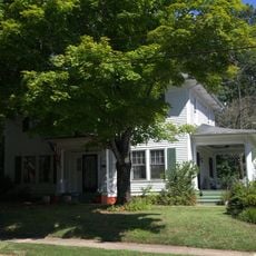
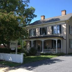
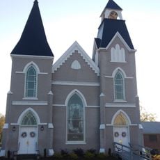
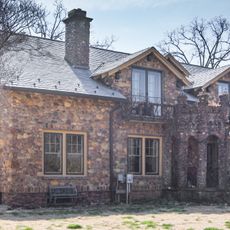
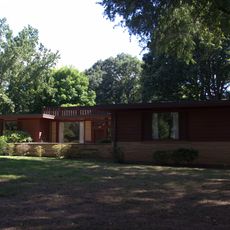
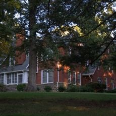
Claremont High School Historic District is a residential neighborhood in Hickory containing 172 buildings and 3 structures with Queen Anne, Colonial Revival, Tudor Revival, and Bungalow architectural styles. These homes define the visual character of the area across multiple city blocks.

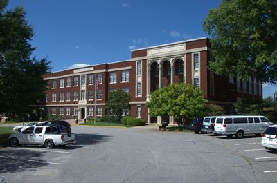
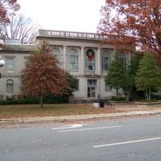
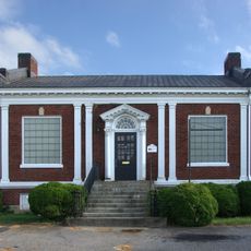
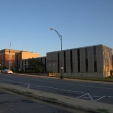
The district began in the late 19th century, transitioning from farmland into an urban residential area through three distinct development phases. The former high school building, built in 1925 with its distinctive H-shaped layout, anchors this historic transformation.

The neighborhood housed business owners, professionals, and educators whose civic participation shaped Hickory's development. Their homes reflect the social standing and values that defined life in this district across generations.

The district is best explored on foot to observe the architectural details across different styles and home designs throughout the neighborhood. Daytime visits work best for seeing the building features, landscaping, and street layout clearly.

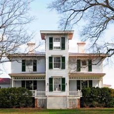
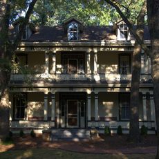
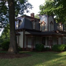
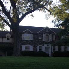
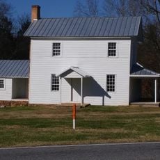
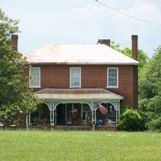
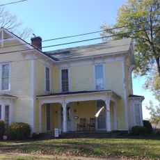
Two remarkable homes anchor the neighborhood's story: Maple Grove from 1875 and the Shuler-Harper House from 1887. These early residences reveal how the district's first residents expressed their prosperity and taste through their architecture.

The community of curious travelers

AroundUs brings together thousands of curated places, local tips, and hidden gems, enriched daily by 60,000 contributors worldwide.

Start exploring
Location
GPS coordinates
35.73560,-81.34470
Latest update
December 14, 2025 14:40
Around this place
Bunker Hill Covered Bridge
United States of America

Bunker Hill Covered Bridge

20.8 km
Waldensian Presbyterian Church
United States of America

Waldensian Presbyterian Church

19.7 km
Hightower Hall
United States of America

Hightower Hall

21.9 km
Catawba County Courthouse
United States of America

Catawba County Courthouse

13.7 km
Shuford House
United States of America

Shuford House

1.2 km
St. John's Lutheran Church
United States of America

St. John's Lutheran Church

14.4 km
First Presbyterian Church
United States of America

First Presbyterian Church

401 m
Propst House
United States of America

Propst House

3.1 km
Oakwood Historic District
United States of America

Oakwood Historic District

218 m
Hickory Municipal Building
United States of America

Hickory Municipal Building

412 m
Reinhardt-Craig House, Kiln and Pottery Shop
United States of America

Reinhardt-Craig House, Kiln and Pottery Shop

20.7 km
Kenworth Historic District
United States of America

Kenworth Historic District

1.6 km
St. Paul's Reformed Church
United States of America

St. Paul's Reformed Church

12 km
Houck's Chapel
United States of America

Houck's Chapel

2.4 km
Elliott–Carnegie Library
United States of America

Elliott–Carnegie Library

313 m
Dr. Glenn R. Frye House
United States of America

Dr. Glenn R. Frye House

758 m
Clement Geitner House
United States of America

Clement Geitner House

359 m
Grace Reformed Church
United States of America

Grace Reformed Church

13.8 km
Jean-Pierre Auguste Dalmas House
United States of America

Jean-Pierre Auguste Dalmas House

20 km
Lee & Helen George House
United States of America

Lee & Helen George House

1.2 km
Hickory Southwest Downtown Historic District
United States of America

Hickory Southwest Downtown Historic District

626 m
Newton Downtown Historic District
United States of America

Newton Downtown Historic District

13.7 km
Bost-Burris House
United States of America

Bost-Burris House

11.5 km
John Alfred Moretz House
United States of America

John Alfred Moretz House

2.4 km
Abraham Anthony Farm
United States of America

Abraham Anthony Farm

18.2 km
Foil–Cline House
United States of America

Foil–Cline House

13.9 km
Gigi's Parlor
United States of America

Gigi's Parlor

667 m
North Carolina Route 1006 Bridge
United States of America

North Carolina Route 1006 Bridge

23.2 km
Show the full map
Reviews
Share your experience

No review yet

Discussions
Start a discussion...

No discussion yet

« Claremont High School Historic District - Historic district in Hickory, United States » is provided by Around Us (aroundus.com). Images and texts are derived from Wikimedia project under a Creative Commons license. You are allowed to copy, distribute, and modify copies of this page, under the conditions set by the license, as long as this note is clearly visible.

Discover hidden gems everywhere you go!

From secret cafés to breathtaking viewpoints, skip the crowded tourist spots and find places that match your style. Our app makes it easy with voice search, smart filtering, route optimization, and insider tips from travelers worldwide. Download now for the complete mobile experience.

Around Us App Screenshot

A unique approach to discovering new places

Le Figaro

All the places worth exploring

France Info

A tailor-made excursion in just a few clicks

20 Minutes

Around Us
Travel Guide & Maps
Download

Send to your phone

QR Code
1

Open the camera app on your mobile.

2

Point at the QR code with your camera. A notification will appear.

3

Tap the notification to open the link.