Enable Location

We need your location to show you interesting places around you

Discover nearby places

Find interesting locations and hidden gems around you

Precise directions

Get accurate directions and distances to places

Your location is never shared with other users. It's only used when you tap the location button.

Upton State Forest

Log in to your account

Start exploring — it's free

Trusted by 61,956 travelers worldwide

Continue with Google
Continue with Apple
or

We will send you a code to connect

By continuing, you accept our Terms and Conditions and our Privacy Policy

Check your inbox

We've sent a pincode in your inbox. Please enter the code below.

Upton State Forest

Upton State Forest, State forest in Worcester County, US

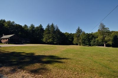
Upton State Forest is a state forest in Worcester County that covers extensive grounds with numerous trails for walking and outdoor activities. The property sits in a rural area between several towns and features open woodland for exploration.

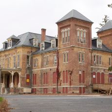
The land was developed during the Great Depression by the Civilian Conservation Corps, a work program that left behind buildings and infrastructure. These structures were later recognized as historically important to the region and officially documented.

The forest shows traces of past settlement with old stone walls and abandoned house sites scattered throughout, visible as you walk the trails. These remains tell the story of people who lived here long ago and add a sense of history to every visit.

Visitors can access the property via Westboro Road and park free of charge; gates are open from sunrise to sunset. Wear appropriate clothing for a wooded setting and allow enough time to explore the various paths at a comfortable pace.

Beaver families live in the forest and have built visible structures along the West River that you may spot while walking. Additionally, the remains of an old sawmill lie hidden under the forest floor and were uncovered during past investigations.

The community of curious travelers

AroundUs brings together thousands of curated places, local tips, and hidden gems, enriched daily by 60,000 contributors worldwide.

Start exploring
Location
GPS coordinates
42.20920,-71.60810
Latest update
December 12, 2025 09:07
Around this place
Westborough State Hospital
United States of America

Westborough State Hospital

10.2 km
Lyman School for Boys
United States of America

Lyman School for Boys

8.9 km
Hopkinton State Park
United States of America

Hopkinton State Park

8.1 km
Willard House and Clock Museum
United States of America

Willard House and Clock Museum

6.3 km
Grafton Inn
United States of America

Grafton Inn

6.4 km
Bancroft Memorial Library
United States of America

Bancroft Memorial Library

10.4 km
Farnumsville Historic District
United States of America

Farnumsville Historic District

7.4 km
Memorial Hall
United States of America

Memorial Hall

10.4 km
George Clapp House
United States of America

George Clapp House

6 km
Nathan Fisher House
United States of America

Nathan Fisher House

8.5 km
Fisherville Historic District
United States of America

Fisherville Historic District

8 km
Prospect Heights Historic District
United States of America

Prospect Heights Historic District

10.3 km
Maples Cottage
United States of America

Maples Cottage

8.6 km
Ash Street School
United States of America

Ash Street School

8.1 km
Grafton Public Library
United States of America

Grafton Public Library

6.4 km
Jonah Warren House
United States of America

Jonah Warren House

4.4 km
Rockdale Common Housing District
United States of America

Rockdale Common Housing District

7.1 km
Ethan Allen House and Gun Shop
United States of America

Ethan Allen House and Gun Shop

8.7 km
South Union School
United States of America

South Union School

9.2 km
Upton Town Hall
United States of America

Upton Town Hall

4.1 km
Grafton Common Historic District
United States of America

Grafton Common Historic District

6.4 km
Vintonville Historic District
United States of America

Vintonville Historic District

6.4 km
Azariah Newton House
United States of America

Azariah Newton House

7.6 km
Upton Center Historic District
United States of America

Upton Center Historic District

4 km
North Avenue Rural Historic District
United States of America

North Avenue Rural Historic District

9.9 km
Grafton Inn
United States of America

Grafton Inn

6.3 km
Joseph Lothrop House
United States of America

Joseph Lothrop House

8.4 km
Lake Chauncy Public Beach
United States of America

Lake Chauncy Public Beach

9.1 km
Show the full map
« Upton State Forest - State forest in Worcester County, US » is provided by Around Us (aroundus.com). Images and texts are derived from Wikimedia project under a Creative Commons license. You are allowed to copy, distribute, and modify copies of this page, under the conditions set by the license, as long as this note is clearly visible.

Discover hidden gems everywhere you go!

From secret cafés to breathtaking viewpoints, skip the crowded tourist spots and find places that match your style. Our app makes it easy with voice search, smart filtering, route optimization, and insider tips from travelers worldwide. Download now for the complete mobile experience.

Around Us App Screenshot

A unique approach to discovering new places

Le Figaro

All the places worth exploring

France Info

A tailor-made excursion in just a few clicks

20 Minutes

Around Us
Travel Guide & Maps
Download

Send to your phone

QR Code
1

Open the camera app on your mobile.

2

Point at the QR code with your camera. A notification will appear.

3

Tap the notification to open the link.