Enable Location

We need your location to show you interesting places around you

Discover nearby places

Find interesting locations and hidden gems around you

Precise directions

Get accurate directions and distances to places

Your location is never shared with other users. It's only used when you tap the location button.

Hopkinton State Park

Log in to your account

Start exploring — it's free

Trusted by 61,956 travelers worldwide

Continue with Google
Continue with Apple
or

We will send you a code to connect

By continuing, you accept our Terms and Conditions and our Privacy Policy

Check your inbox

We've sent a pincode in your inbox. Please enter the code below.

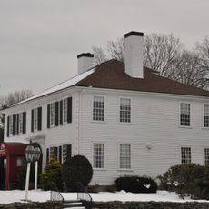
Hopkinton State Park, Nature reserve in Massachusetts, United States.

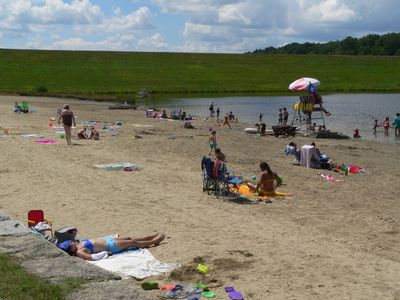
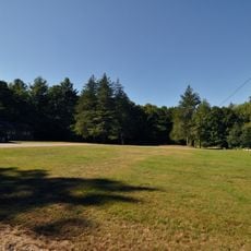
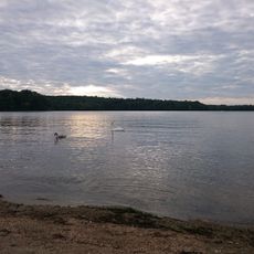
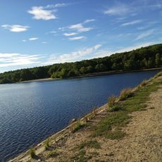
Hopkinton State Park is a nature reserve covering roughly 1,245 acres of forest, trails, and water features, with a large reservoir open to non-motorized boats and a separate swimming pond. The grounds include supervised beaches, multiple picnic areas with grills, and more than ten miles of hiking paths suitable for different skill levels.

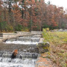
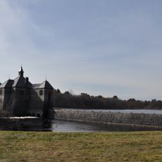
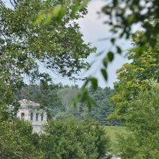
The land originally served as a water supply reservoir for the Boston area before being converted to a state park in 1947. This transformation marked a shift from industrial use to public recreation and environmental conservation.

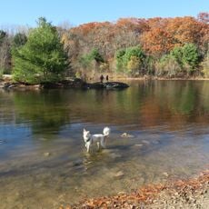
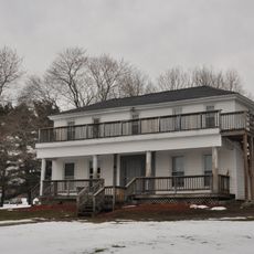
The park serves as a gathering place where locals walk, fish, or spend time with family in a natural setting. The wooded shorelines and open spaces offer residents a way to connect with nature while staying close to their communities.

The park is easily accessible with parking and paths suited for visitors of varying abilities. Timing your visit by season and weather is helpful, as conditions on the water and trails can vary significantly throughout the year.

The park features two separate water areas managed differently: the main reservoir allows unrestricted boating and water sports, while a dedicated swimming pond offers supervised bathing. This arrangement lets the park accommodate different water activities without them interfering with each other.

The community of curious travelers

AroundUs brings together thousands of curated places, local tips, and hidden gems, enriched daily by 60,000 contributors worldwide.

Start exploring
Location
Inception
1947
GPS coordinates
42.24920,-71.52550
Latest update
December 9, 2025 18:44
Around this place
New England Compounding Center meningitis outbreak
United States of America

New England Compounding Center meningitis outbreak

8.5 km
Westborough State Hospital
United States of America

Westborough State Hospital

9.1 km
Sri Lakshmi Temple
United States of America

Sri Lakshmi Temple

7.1 km
Callahan State Park
United States of America

Callahan State Park

9.2 km
Ashland State Park
United States of America

Ashland State Park

4.7 km
Upton State Forest
United States of America

Upton State Forest

8.1 km
Framingham Reservoir No. 1 Dam and Gatehouse
United States of America

Framingham Reservoir No. 1 Dam and Gatehouse

8.3 km
United States of America

John J. Carroll Water Treatment Plant

8.6 km
First Baptist Church
United States of America

First Baptist Church

9.1 km
Nathan Fisher House
United States of America

Nathan Fisher House

9.1 km
Sudbury Dam Historic District
United States of America

Sudbury Dam Historic District

6.9 km
Maples Cottage
United States of America

Maples Cottage

9.3 km
Concord Square Historic District
United States of America

Concord Square Historic District

9.4 km
J.D.C. Bradley House
United States of America

J.D.C. Bradley House

7.6 km
Ashland Town House
United States of America

Ashland Town House

5.1 km
Jonah Warren House
United States of America

Jonah Warren House

6.4 km
East Holliston Historic District
United States of America

East Holliston Historic District

9.5 km
Moses Ellis House
United States of America

Moses Ellis House

8.8 km
South Union School
United States of America

South Union School

2.1 km
Vintonville Historic District
United States of America

Vintonville Historic District

7.2 km
Azariah Newton House
United States of America

Azariah Newton House

9.2 km
Isaac Bullard House
United States of America

Isaac Bullard House

7.8 km
Irving Square Historic District
United States of America

Irving Square Historic District

9.4 km
Southborough Center Historic District
United States of America

Southborough Center Historic District

6.3 km
Boston Paint Ball
United States of America

Boston Paint Ball

8 km
Joseph Lothrop House
United States of America

Joseph Lothrop House

9.1 km
Lake Chauncy Public Beach
United States of America

Lake Chauncy Public Beach

8.3 km
Hopkinton Reservoir Beach
United States of America

Hopkinton Reservoir Beach

1.3 km
Show the full map
« Hopkinton State Park - Nature reserve in Massachusetts, United States » is provided by Around Us (aroundus.com). Images and texts are derived from Wikimedia project under a Creative Commons license. You are allowed to copy, distribute, and modify copies of this page, under the conditions set by the license, as long as this note is clearly visible.

Discover hidden gems everywhere you go!

From secret cafés to breathtaking viewpoints, skip the crowded tourist spots and find places that match your style. Our app makes it easy with voice search, smart filtering, route optimization, and insider tips from travelers worldwide. Download now for the complete mobile experience.

Around Us App Screenshot

A unique approach to discovering new places

Le Figaro

All the places worth exploring

France Info

A tailor-made excursion in just a few clicks

20 Minutes

Around Us
Travel Guide & Maps
Download

Send to your phone

QR Code
1

Open the camera app on your mobile.

2

Point at the QR code with your camera. A notification will appear.

3

Tap the notification to open the link.