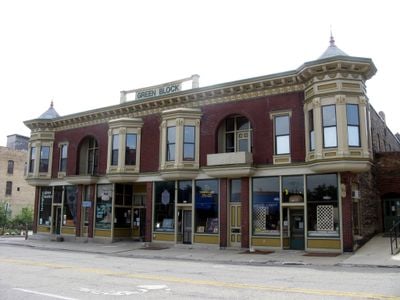
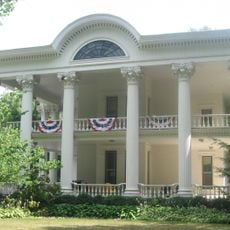
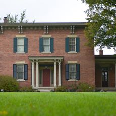
·

Enable Location

We need your location to show you interesting places around you

Discover nearby places

Find interesting locations and hidden gems around you

Precise directions

Get accurate directions and distances to places

Your location is never shared with other users. It's only used when you tap the location button.

Green Block

Log in to your account

Start exploring — it's free

Trusted by 62,752 travelers worldwide

Continue with Google
Continue with Apple
or

We will send you a code to connect

By continuing, you accept our Terms and Conditions and our Privacy Policy

Check your inbox

We've sent a pincode in your inbox. Please enter the code below.

Green Block

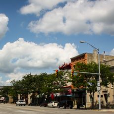
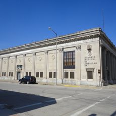
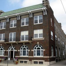
The Green Block is a commercial building in Elkhart, Indiana built in 1895, located on East Lexington Street. It features late 19th-century design with solid brick walls, tall narrow windows, and decorative trim that has remained largely unchanged since its construction.

The building was constructed in 1895 during Elkhart's growth as an industrial city. It served as a commercial center for decades and is now listed on the National Register of Historic Places, recognizing its importance to the city's development.

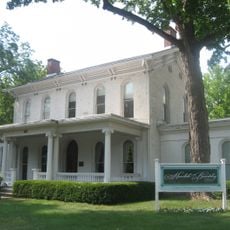
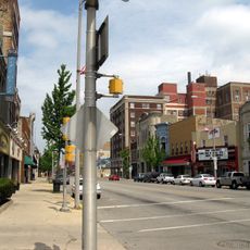
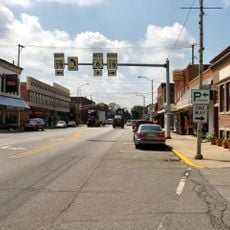
The name reflects its role as a commercial gathering place where local shopkeepers served the community for generations. Walking past today, you can sense how this building anchored everyday life and business activity in Elkhart's downtown.

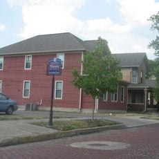
The Green Block is located directly on East Lexington Street in downtown Elkhart and is easily accessible on foot. The area is surrounded by other historic buildings, allowing you to explore several landmarks during a single walk.

The name Green Block likely refers to an original owner or distinctive visual feature of the structure. These naming details reveal how local buildings gained identity through individual connections and community associations over time.

The community of curious travelers

AroundUs brings together thousands of curated places, local tips, and hidden gems, enriched daily by 60,000 contributors worldwide.

Start exploring
Location
GPS coordinates
41.68639,-85.97222
Latest update
February 9, 2026 08:19
Around this place
RV/MH Hall of Fame
United States of America

RV/MH Hall of Fame

9.1 km
Ruthmere Mansion
United States of America

Ruthmere Mansion

778 m
The Lerner Theatre
United States of America

The Lerner Theatre

282 m
Charles Gerard Conn Mansion
United States of America

Charles Gerard Conn Mansion

1.2 km
Dr. Havilah Beardsley House
United States of America

Dr. Havilah Beardsley House

927 m
Mark L. and Harriet E. Monteith House
United States of America

Mark L. and Harriet E. Monteith House

1.2 km
Elkhart County Courthouse
United States of America

Elkhart County Courthouse

15.8 km
Goshen Historic District
United States of America

Goshen Historic District

16.4 km
Midwest Museum of American Art
United States of America

Midwest Museum of American Art

361 m
Solomon Fowler Mansion
United States of America

Solomon Fowler Mansion

12.4 km
Elkhart Downtown Commercial Historic District
United States of America

Elkhart Downtown Commercial Historic District

221 m
Bridge Street Bridge
United States of America

Bridge Street Bridge

1.9 km
Beardsley Avenue Historic District
United States of America

Beardsley Avenue Historic District

697 m
Fort Wayne Street Bridge
United States of America

Fort Wayne Street Bridge

14.6 km
Goshen Carnegie Public Library
United States of America

Goshen Carnegie Public Library

16.2 km
Emmanuel C. Bickel House
United States of America

Emmanuel C. Bickel House

1 km
William and Helen Koerting House
United States of America

William and Helen Koerting House

3.1 km
Eller-Hosford House
United States of America

Eller-Hosford House

16.7 km
Bristol-Washington Township School
United States of America

Bristol-Washington Township School

12.3 km
Garth Stroup Home
United States of America

Garth Stroup Home

17 km
Historic YWCA building
United States of America

Historic YWCA building

139 m
Downtown Nappanee Historic District
United States of America

Downtown Nappanee Historic District

16.4 km
Morehous Residential Historic District
United States of America

Morehous Residential Historic District

1.9 km
Joseph and Sarah Puterbaugh Farm
United States of America

Joseph and Sarah Puterbaugh Farm

5.6 km
Joseph J. Rohrer Farm
United States of America

Joseph J. Rohrer Farm

16.1 km
State Street-Division Street Historic District
United States of America

State Street-Division Street Historic District

630 m
NIBCO water and Ice Park
United States of America

NIBCO water and Ice Park

173 m
Elkhart County Historical Museum
United States of America

Elkhart County Historical Museum

13.2 km
Show the full map
« Green Block » is provided by Around Us (aroundus.com). Images and texts are derived from Wikimedia project under a Creative Commons license. You are allowed to copy, distribute, and modify copies of this page, under the conditions set by the license, as long as this note is clearly visible.

Discover hidden gems everywhere you go!

From secret cafés to breathtaking viewpoints, skip the crowded tourist spots and find places that match your style. Our app makes it easy with voice search, smart filtering, route optimization, and insider tips from travelers worldwide. Download now for the complete mobile experience.

Around Us App Screenshot

A unique approach to discovering new places

Le Figaro

All the places worth exploring

France Info

A tailor-made excursion in just a few clicks

20 Minutes

Around Us
Travel Guide & Maps
Download

Send to your phone

QR Code
1

Open the camera app on your mobile.

2

Point at the QR code with your camera. A notification will appear.

3

Tap the notification to open the link.