Possum Bottom Covered Bridge

Log in to your account

AroundUs is a community-driven map of interesting places, built by curious explorers like you. It grows with every review, story, and photo you share.
Connect to save your favorite spots, contribute locations, and create personalized routes.
Continue with Google
Continue with Apple
Continue with X
Continue with Facebook
Continue with email
By continuing, you accept our Terms and Conditions and our Privacy Policy
Create an account
Add to collection
Map
Suggest a change
Share

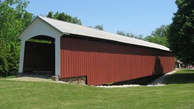
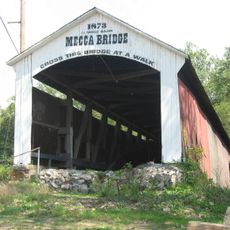
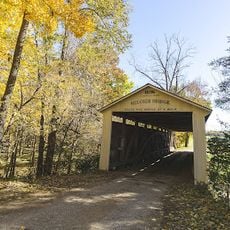
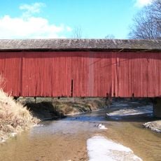
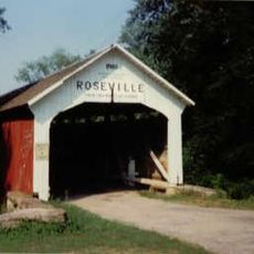
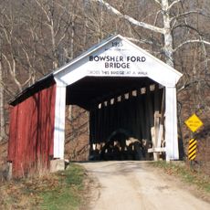
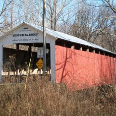
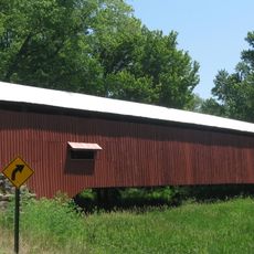
Possum Bottom Covered Bridge, Covered bridge in Helt Township, Indiana.

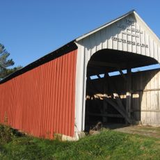
Possum Bottom Covered Bridge is a timber structure crossing Little Raccoon Creek with a single span design. Its wooden framework showcases the engineering approach common to 19th-century American bridge construction.

The bridge was built in 1876 using proven Burr Arch Truss design and served traffic for nearly a century. It stopped functioning in 1973 and was relocated to a new location.

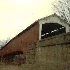
The bridge received recognition on the National Register of Historic Places in 1994, representing the engineering methods and transportation infrastructure of the 19th century.

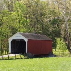
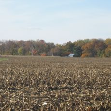
This bridge sits in a rural setting north of a major highway and is accessible by car. Plan for quiet observation, as the location is remote with limited facilities or attractions nearby.

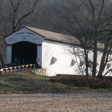
The structure was known by multiple names including Jackson's Ford and Hillsdale, reflecting its role in local history. Today it sits in a relocated setting where it remains accessible to those interested in heritage structures.

Location: Helt Township

GPS coordinates: 39.79722,-87.45333

Latest update: December 14, 2025 18:41

Photos
Around this place
Jackson Covered Bridge
United States of America

Jackson Covered Bridge

17.3 km
Vincennes Historic District
United States of America

Vincennes Historic District

14.7 km
West Union Covered Bridge
United States of America

West Union Covered Bridge

11.9 km
Sim Smith Covered Bridge
United States of America

Sim Smith Covered Bridge

10.8 km
Mecca Covered Bridge
United States of America

Mecca Covered Bridge

13.4 km
Melcher Covered Bridge
United States of America

Melcher Covered Bridge

10.2 km
Rockville Chautauqua Pavilion
United States of America

Rockville Chautauqua Pavilion

19.1 km
Harry Evans Covered Bridge
United States of America

Harry Evans Covered Bridge

20.3 km
Roseville-Coxville Covered Bridge
United States of America

Roseville-Coxville Covered Bridge

21.1 km
Phillips Covered Bridge
United States of America

Phillips Covered Bridge

11.5 km
Mill Creek Covered Bridge
United States of America

Mill Creek Covered Bridge

14.7 km
Clinton Covered Bridge
United States of America

Clinton Covered Bridge

16.4 km
Marshall Covered Bridge
United States of America

Marshall Covered Bridge

14.5 km
Bowsher Ford Covered Bridge
United States of America

Bowsher Ford Covered Bridge

17.1 km
Catlin Covered Bridge
United States of America

Catlin Covered Bridge

18.4 km
Joseph Finney House
United States of America

Joseph Finney House

17 km
Zacke Cox Covered Bridge
United States of America

Zacke Cox Covered Bridge

18.3 km
Vermillion County Jail and Sheriff's Residence
United States of America

Vermillion County Jail and Sheriff's Residence

7.8 km
W. H. York Round Barn
United States of America

W. H. York Round Barn

17.1 km
Rush Creek Covered Bridge
United States of America

Rush Creek Covered Bridge

16.4 km
Eugene Covered Bridge
United States of America

Eugene Covered Bridge

19.2 km
Vermillion County Courthouse
United States of America

Vermillion County Courthouse

10.4 km
Rockville Historic District
United States of America

Rockville Historic District

19.4 km
Newport Covered Bridge
United States of America

Newport Covered Bridge

10.6 km
Wabash Township Graded School
United States of America

Wabash Township Graded School

13.1 km
Salem Methodist Episcopal Church
United States of America

Salem Methodist Episcopal Church

8.6 km
Clinton Downtown Historic District
United States of America

Clinton Downtown Historic District

16 km
William Hill Polygonal Barn
United States of America

William Hill Polygonal Barn

17.4 km
Show the full map
Reviews

Visited this place? Tap the stars to rate it and share your experience / photos with the community! Try now! You can cancel it anytime.

« Possum Bottom Covered Bridge - Covered bridge in Helt Township, Indiana » is provided by Around Us (aroundus.com). Images and texts are derived from Wikimedia project under a Creative Commons license. You are allowed to copy, distribute, and modify copies of this page, under the conditions set by the license, as long as this note is clearly visible.

Discover hidden gems everywhere you go!

From secret cafés to breathtaking viewpoints, skip the crowded tourist spots and find places that match your style. Our app makes it easy with voice search, smart filtering, route optimization, and insider tips from travelers worldwide. Download now for the complete mobile experience.

Around Us App Screenshot

A unique approach to discovering new places

Le Figaro

All the places worth exploring

France Info

A tailor-made excursion in just a few clicks

20 Minutes