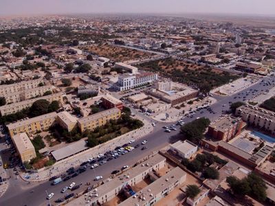
Nouakchott, Capital city on Atlantic coast, Mauritania
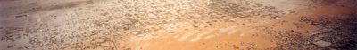
Nouakchott sits on sandy ground between the Sahara and the Atlantic, with residential quarters spreading outward from the administrative center. Streets run in wide grids across the flat landscape while low buildings scatter over broad expanses.
The city grew from a small fishing village of roughly 15,000 people into a large urban center after Mauritania gained independence in 1960. Rapid growth brought residents from different parts of the country who settled here permanently.
The National Museum holds artifacts and textiles from across the region along with documents tracing the nomadic past of the population. Its displays offer insight into traditional ways of life and craftsmanship practiced by the different ethnic communities in the country.
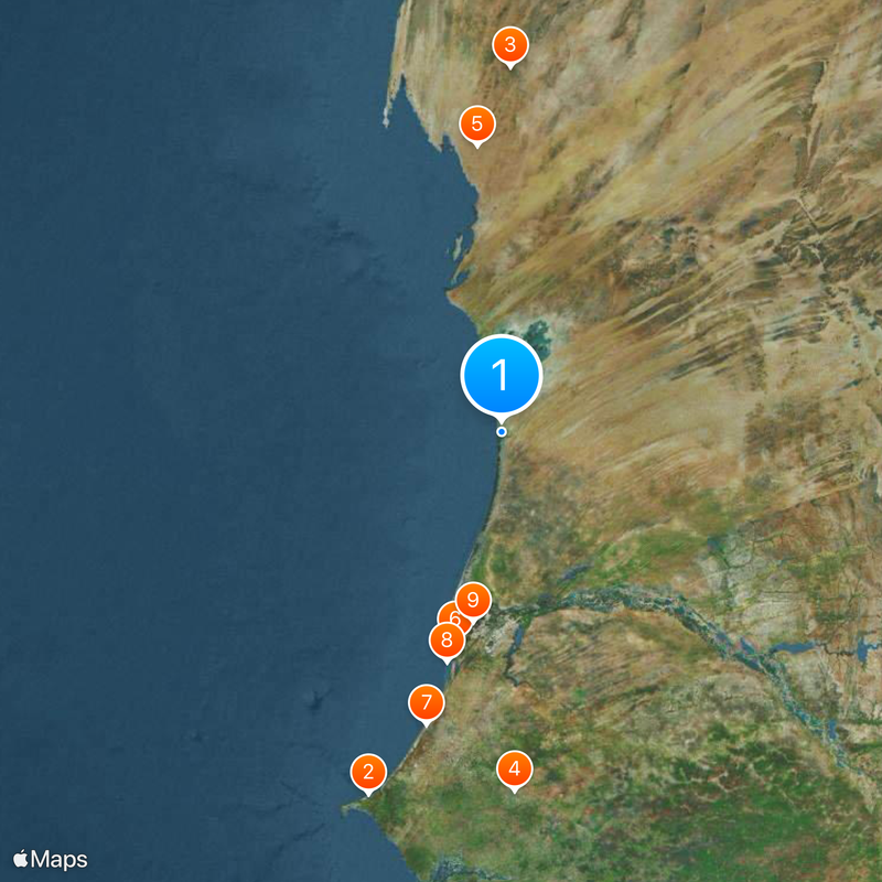
The port sits roughly 8 kilometers from the city center and handles copper and petroleum shipments through specialized terminals. Visitors should carry enough water when exploring as the dry climate and open landscape offer little shade.
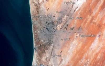
Three separate administrative regions divide the city, with some neighborhoods sitting below sea level and requiring special construction techniques. This particular topography makes certain building methods necessary to prevent flooding during the rainy season.
Location: Nouakchott-Nord Region
Location: Nouakchott-Ouest Region
Location: Nouakchott-Sud Region
Elevation above the sea: 7 m
Website: https://crn.mr
GPS coordinates: 18.07924,-15.97801
Latest update: December 4, 2025 19:02
Lake Retba
384.8 km
Economy of Mauritania
358.1 km
Great Mosque of Touba
357.8 km
Banc d'Arguin National Park
282.1 km
Diama Dam
212.6 km
Lompoul desert
301 km
Faidherbe Bridge
235.3 km
Djoudj National Bird Sanctuary
191 km
Ship graveyard of Nouadhibou
332.6 km
Stade Olympique
2.9 km
Langue de Barbarie National Park
253.9 km
Biffeche
215.4 km
Stade Lat-Dior
382.6 km
Mosque Saudique
1.2 km
National Museum of Mauritania
785 m
Guembeul Natural Reserve
246.3 km
National Library of Mauritania
807 m
Musée régional de Thiès
379.3 km
Island of Saint-Louis
236.2 km
Usine des eaux de Mbakhana
225.2 km
Ras Nouadhibou lighthouse
320.1 km
Mosque Marocaine
422 m
Ibn Abbas Mosque
557 m
Musée Régional de Thiès
379.4 km
Nouadhibou Mosque
337 km
Statue of Louis Faidherbe in Saint-Louis
235.4 km
Ancien orphelinat des Sœurs de Saint-Joseph de Cluny, Saint-Louis
235.7 km
Eglise Notre-Dame-de-Lourdes, Saint-Louis
235.3 kmVisited this place? Tap the stars to rate it and share your experience / photos with the community! Try now! You can cancel it anytime.
Discover hidden gems everywhere you go!
From secret cafés to breathtaking viewpoints, skip the crowded tourist spots and find places that match your style. Our app makes it easy with voice search, smart filtering, route optimization, and insider tips from travelers worldwide. Download now for the complete mobile experience.
A unique approach to discovering new places❞
— Le Figaro
All the places worth exploring❞
— France Info
A tailor-made excursion in just a few clicks❞
— 20 Minutes