Radal Siete Tazas National Park, Nature reserve in Maule Region, Chile
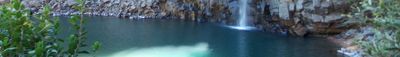
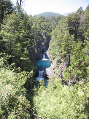
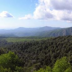
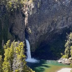
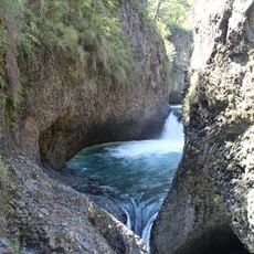
Radal Siete Tazas is a national park in Curicó Province in Chile that covers roughly 5,000 hectares of protected land dominated by mountain forest with volcanic bedrock. The river Claro de Molina runs through the area and shapes several natural water pools and waterfalls set between steep basalt cliffs.
The area was first designated as a nature reserve in 1996 and gained national park status in 2008 to protect the geological formations and native vegetation in the long term. Archaeological findings from the late 1980s and early 1990s document earlier human settlements in the region by hunter-gatherer groups several centuries ago.
The river Claro de Molina carved seven successive pools through volcanic rock over centuries, shaping formations that still resemble large natural bowls today. Trails follow the waterfalls through dense forest where visitors hear the rushing water from different angles and witness the power of erosion firsthand.
The park opens from Tuesday through Sunday between 8:30 in the morning and 4:30 in the afternoon, with entrance tickets to be purchased online in advance. Paths to the waterfalls can become slippery when wet, so sturdy footwear is recommended, and during winter months access may be limited.
The protected area sits in an ecological transition zone where dry vegetation from the north gradually mixes with humid forests from the south and provides habitat for rare animal species like pumas and pudus. The ancient stone grinding tools discovered at several archaeological sites show the use of natural resources by earlier inhabitants of these mountains.
The community of curious travelers
AroundUs brings together thousands of curated places, local tips, and hidden gems, enriched daily by 60,000 contributors worldwide.