Enable Location

We need your location to show you interesting places around you

Discover nearby places

Find interesting locations and hidden gems around you

Precise directions

Get accurate directions and distances to places

Your location is never shared with other users. It's only used when you tap the location button.

Log in to your account

Start exploring — it's free

Trusted by 60,651 travelers worldwide

Continue with Google
Continue with Apple
or

We will send you a code to connect

By continuing, you accept our Terms and Conditions and our Privacy Policy

Check your inbox

We've sent a pincode in your inbox. Please enter the code below.

Matucana District

Matucana District, Mountain district in Huarochirí Province, Peru.

Description

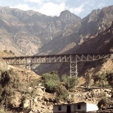
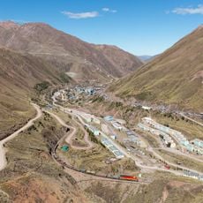
Matucana District is a mountain territory in Huarochirí Province covering about 179 square kilometers across elevations from 2,378 meters to over 5,000 meters. The land slopes and undulates, cut by valleys and ridgelines that create compartmented landscapes.

History

The district was founded in 1647 and grew after gold was discovered in hills that once held sacred Inca sites. This find shifted the area toward economic activity and settlement expansion in the highlands.

Culture

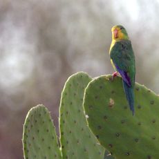
The settlement maintains agricultural traditions visible in daily farm work across hillsides and terraced fields. Local customs tied to crop cycles and community land use shape how residents spend their days.

Practical

The district sits roughly 74 kilometers from Lima along the Central Highway, making access straightforward. Basic services operate in the main villages, though visitors should account for the high elevation and mountain terrain.

Did you know?

The peak called Yana Yana rises above 5,300 meters and creates distinct climate zones that shift as you move across the district. These elevation changes allow farmers to grow different crops suited to each zone's temperature and moisture.

Capital city
Matucana
Elevation above the sea
2,378 m
Shares border with
Carampoma District, San Mateo District, San Damian District, Surco District, San Mateo de Otao District, San Juan de Iris District
GPS coordinates
-11.84473,-76.38606
Latest update
December 20, 2025 14:46

AroundUs brings together thousands of curated places, local tips, and hidden gems, enriched daily by 60,000 contributors worldwide. Discover all places nearby (Huarochirí Province).

« Matucana District - Mountain district in Huarochirí Province, Peru » is provided by Around Us (aroundus.com). Images and texts are derived from Wikimedia project under a Creative Commons license. You are allowed to copy, distribute, and modify copies of this page, under the conditions set by the license, as long as this note is clearly visible.

Discover hidden gems everywhere you go!

From secret cafés to breathtaking viewpoints, skip the crowded tourist spots and find places that match your style. Our app makes it easy with voice search, smart filtering, route optimization, and insider tips from travelers worldwide. Download now for the complete mobile experience.

Around Us App Screenshot

A unique approach to discovering new places

Le Figaro

All the places worth exploring

France Info

A tailor-made excursion in just a few clicks

20 Minutes

Around Us
Travel Guide & Maps
Download

Send to your phone

QR Code
1

Open the camera app on your mobile.

2

Point at the QR code with your camera. A notification will appear.

3

Tap the notification to open the link.