Tres Arroyos Partido, Administrative division in Buenos Aires Province, Argentina.
Tres Arroyos Partido is an administrative region in Buenos Aires Province that covers a large area divided into several settlements and bordered by roughly 100 kilometers of Atlantic coastline with beaches. The landscape combines coastal areas with inland territories, creating a varied geography where different towns and communities are connected.
This administrative district was established in 1884 under Dardo Rocha's leadership, separating what had been a larger territory into distinct administrative units. The creation reflected broader changes in how Buenos Aires Province was organized during that period.
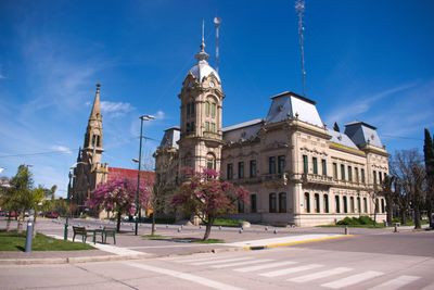
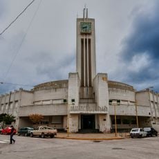
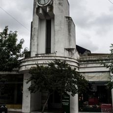
The area is home to descendants of Danish and Dutch immigrants, whose heritage appears in local customs and the buildings you see throughout the settlements. This cultural background shapes how communities here have developed and how they live together today.
The main town, Tres Arroyos city, sits inland and can be reached via its local airport and road network that connects to other areas. The region has basic infrastructure linking the various settlements and providing access to the coastal areas.
The Arroyo Seco archaeological site holds over 40 ancient skeletons and artifacts from around 9,000 years ago, revealing that the region was home to some of Argentina's earliest human settlements. These remains provide windows into the early lives and cultures that inhabited this land long before modern settlement.
The community of curious travelers
AroundUs brings together thousands of curated places, local tips, and hidden gems, enriched daily by 60,000 contributors worldwide.