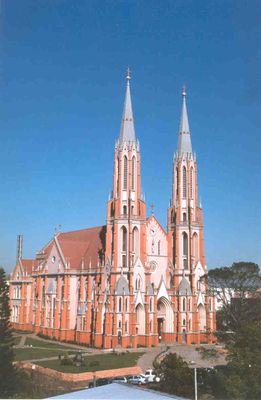
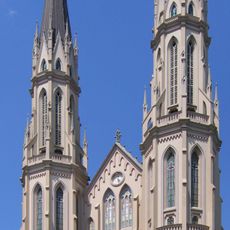
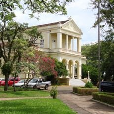
Venâncio Aires, Municipality in Rio Grande do Sul, Brazil
The city stands at 115 meters above sea level and extends over 772 square kilometers in the southern region of Brazil.
The territory transformed from Faxinal dos Tamancos to Venâncio Aires in 1891, named after lawyer Venâncio de Oliveira Ayres.
German and Italian immigrants established agricultural settlements along the Sampaio stream valley, forming the foundation of local farming traditions.
The municipality maintains medical facilities, civil registration offices, and essential services under the administration of Mayor Jarbas Daniel da Rosa.
November 2024 floods caused destruction to 306 residences and brought agricultural losses exceeding 70 million Brazilian reais.
Location: Rio Grande do Sul
Inception: May 11, 1891
Elevation above the sea: 115 m
Shares border with: Boqueirão do Leão, Mato Leitão, Bom Retiro do Sul, Cruzeiro do Sul, General Câmara, Passo do Sobrado, Santa Clara do Sul, Santa Cruz do Sul, Sério, Sinimbu, Taquari, Vale Verde
Website: http://venancioaires.rs.gov.br
GPS coordinates: -29.60583,-52.19194
Latest update: May 27, 2025 08:44
Christ the Protector
49.4 km
Viaduto do Exército
68.2 km
St. John the Baptist Cathedral
26 km
Ponte Ernesto Dornelles
86.6 km
Estádio Parque Esportivo Montanha dos Vinhedos
81.1 km
Château D'Eau
83.5 km
Fandango Bridge
85 km
Ponte do Império
61 km
Bom Jesus Church
59.4 km
Igreja Matriz Nossa Senhora do Rosário
46.3 km
Private Reserve of Natural Heritage of University of Santa Cruz do Sul
41.3 km
Museu do Pão
75.9 km
Museu de Arte Sacra de Rio Pardo
46 km
Quarta Colônia State Park
105.6 km
Usina Termoelétrica (Museu Carvão 01)
70.5 km
Museum Aristides Carlos Rodrigues
58.2 km
Museu da Uva e do Vinho Primo Slomp
98.4 km
Teatro União
59.3 km
Igreja Nossa Senhora do Rosário
97.7 km
Igreja São Pedro - Antiga Matriz
99.8 km
Casa de Artes Regina Simonis
26 km
Antiga Escola Militar
45.7 km
Igreja Matriz de Santo Amaro
46.6 km
Prefeitura Municipal
25.9 km
Banco Pelotense
83.5 km
Núcleo urbano de Santa Tereza
65.7 km
Calçamento de Pedra, antigo, da rua da Ladeira, abrangendo o trecho situado entre a esquina da rua Andrade Neves e a praça da Matriz
46.1 km
Ponte do Imperador
100.1 kmReviews
Visited this place? Tap the stars to rate it and share your experience / photos with the community! Try now! You can cancel it anytime.
Discover hidden gems everywhere you go!
From secret cafés to breathtaking viewpoints, skip the crowded tourist spots and find places that match your style. Our app makes it easy with voice search, smart filtering, route optimization, and insider tips from travelers worldwide. Download now for the complete mobile experience.
A unique approach to discovering new places❞
— Le Figaro
All the places worth exploring❞
— France Info
A tailor-made excursion in just a few clicks❞
— 20 Minutes