Guaíra, Administrative division in Paraná, Brazil
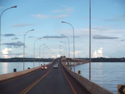
Guaíra sits along the Paraná River, which forms the natural border between Brazil and Paraguay, with multiple transportation links crossing the waterway. The city serves as a regional administrative center with schools, healthcare facilities, and government offices supporting residents across southwestern Paraná.
The city was established in 1955 and grew from a settlement into a regional administrative center for local governance. Its location near the international bridge to Paraguay made it a strategic point for cross-border trade and exchange.
The people here blend traditions from indigenous communities, Portuguese settlers, and immigrants from various backgrounds, which shows in local celebrations and daily life. You notice this diversity especially at markets and public spaces where people from different origins gather.
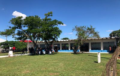
The city has schools, health centers, and administrative offices that visitors can reach easily since everything is centrally located. The river provides several crossing options, and the infrastructure is geared toward travelers between Brazil and Paraguay.
The international bridge directly connects Brazil to Paraguay, making this city an important hub for goods and travelers. The daily flow of people crossing through shapes the city's character and shows its role as a crossroads between two nations.
Location: Paraná
Elevation above the sea: 280 m
Shares border with: Terra Roxa, Altônia, Mercedes, Mundo Novo
Address: Guaíra, State of Paraná, 85980-000, Brazil
Website: http://guaira.pr.gov.br
GPS coordinates: -24.08000,-54.25583
Latest update: December 17, 2025 11:18
Guaíra Falls
3 km
Ayrton Senna Bridge
1.3 km
Área de Proteção Ambiental das Ilhas e Várzeas do Rio Paraná
2.2 kmSão Camilo Biological Reserve
43.4 kmMuseu Histórico Willy Barth
87.9 kmSalto da Dúvida
42.3 km
Ponte Ulysses Guimarães
1.3 kmSalto Nhá Bárbara
29.7 kmQuilombo Manoel Ciriáco dos Santos
4.1 kmMuseu Histórico Padre José Gaertner
57 kmParque Estadual de São Camilo
48 kmCentro Histórico Cultural Bragadense
60.7 kmParque Nacional da Ilha Grande
587 mMemorial em homenagem às vítimas da COVID19 Pérola (PR)
65.5 kmCafé com Trilha - Sitio Faria
36.4 kmPortal de Quatro Pontes
62.8 kmAeroporto Balduino Helmuth Jope
52.9 kmTeatro Municipal Ludovico Riedi
47.9 kmPalco
47.9 kmTeatro Municipal de Marechal Cândido Rondon
58.3 kmGasparzinho
47.6 kmBalneário de Santa Helena
84.7 kmEstátua de São Cristóvão
60.6 kmMarechal Cândido Rondon
56.8 kmEstátua de Cristo Semeador
47.9 kmScenic viewpoint
83.4 kmMirante do pôr do sol
36.4 kmCachoeira da Pedreira
57.3 kmVisited this place? Tap the stars to rate it and share your experience / photos with the community! Try now! You can cancel it anytime.
Discover hidden gems everywhere you go!
From secret cafés to breathtaking viewpoints, skip the crowded tourist spots and find places that match your style. Our app makes it easy with voice search, smart filtering, route optimization, and insider tips from travelers worldwide. Download now for the complete mobile experience.
A unique approach to discovering new places❞
— Le Figaro
All the places worth exploring❞
— France Info
A tailor-made excursion in just a few clicks❞
— 20 Minutes