Nova Andradina, Agricultural municipality in Mato Grosso do Sul, Brazil.
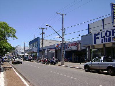
Nova Andradina is an agricultural municipality in Mato Grosso do Sul that extends across a large area and sits at elevation in the region. The town consists of several districts, with Nova Casa Verde serving as a notable secondary settlement within the municipality.
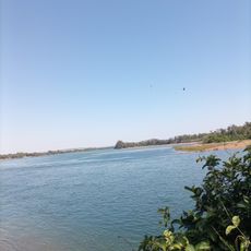
The settlement was founded in 1938 when an entrepreneur established a port on the Paraná River to develop the region. This early investment connected the town to river trade and set the foundation for its growth as a regional hub.
The settlement grew around a chapel dedicated to Mary, which remains the spiritual center of the community today. This building reflects the religious foundations that shaped the town from its earliest days.
The town spreads across multiple districts that can be explored by car or on foot depending on distances and visitor interests. Travelers should plan time to see the agricultural lands and river areas that define the region.
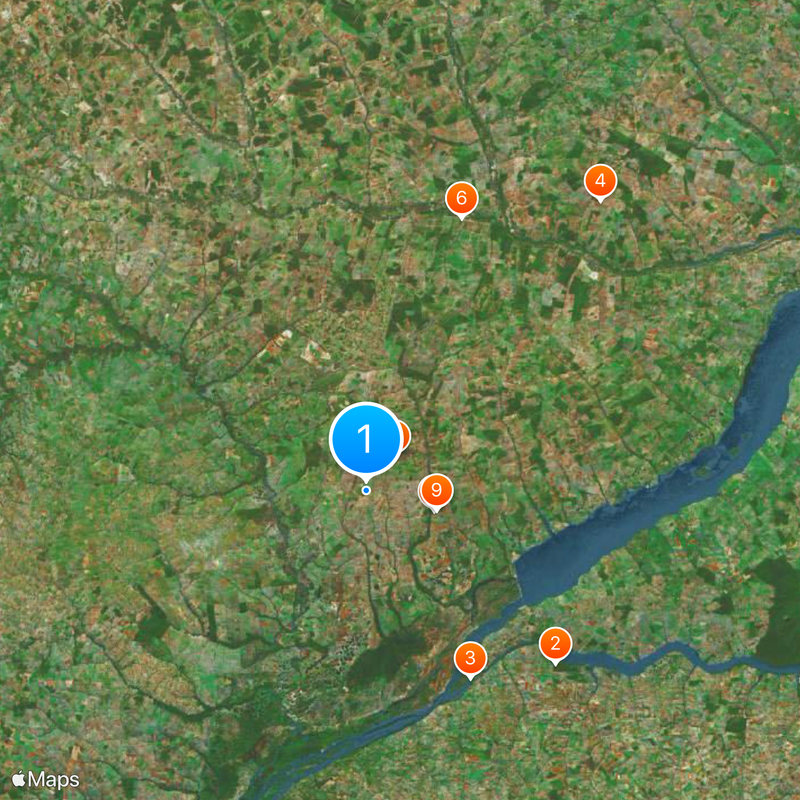
The town has become an economic and cultural hub connecting nine neighboring municipalities in the southeastern part of the state. This central role makes it a crossroads for exchange between different areas of the region.
Location: Mato Grosso do Sul
Inception: December 20, 1958
Elevation above the sea: 380 m
Shares border with: Ribas do Rio Pardo, Anaurilândia, Angélica, Bataguassu, Batayporã, Ivinhema, Nova Alvorada do Sul, Novo Horizonte do Sul, Taquarussu
Website: http://novaandradina.ms.gov.br
GPS coordinates: -22.23278,-53.34278
Latest update: December 14, 2025 01:14
Caiuá Ecological Station
64.5 km
Encontro dos Rios
53.9 km
Represa de Cima
94.2 km
Sem Nome
11.4 km
Barragem 2
73.1 km
Barragem 3
17.9 km
Barragem 1
18.4 km
Barragem 2
18.5 km
Sem Nome
108.3 km
Barragem 1
65.2 km
Barragem 01
96.7 km
Barragem de Terra
92.3 km
Barragem 2
85.7 km
Barragem 03
93.8 km
Barragem do Machado
56.6 km
Barragem 02
97.1 km
Barragem 1
71.9 km
Barragem Sem Nome
36.6 km
Sem Nome
11.4 km
Barragem B1
69.8 km
Barragem 2
69.2 km
Barragem 1
69.1 km
Museu Histórico e Cultural Antonio Joaquim de Moura Andrade
3 km
Museu da Memória Regional
52.4 km
Balneário Bono
68 km
C.T.G
70.7 km
Anfiteatro Avelino Antonio Colla
69.8 km
Scenic viewpoint
57.5 kmVisited this place? Tap the stars to rate it and share your experience / photos with the community! Try now! You can cancel it anytime.
Discover hidden gems everywhere you go!
From secret cafés to breathtaking viewpoints, skip the crowded tourist spots and find places that match your style. Our app makes it easy with voice search, smart filtering, route optimization, and insider tips from travelers worldwide. Download now for the complete mobile experience.
A unique approach to discovering new places❞
— Le Figaro
All the places worth exploring❞
— France Info
A tailor-made excursion in just a few clicks❞
— 20 Minutes