Enable Location

We need your location to show you interesting places around you

Discover nearby places

Find interesting locations and hidden gems around you

Precise directions

Get accurate directions and distances to places

Your location is never shared with other users. It's only used when you tap the location button.

Dourados

Log in to your account

Join the adventure

Create your free account and start exploring (like 60k+ others)

We will send you a code to connect

or
Continue with Google
Continue with Apple
By continuing, you accept our Terms and Conditions and our Privacy Policy

Check your inbox

We've sent a pincode in your inbox. Please enter the code below.

Dourados, Agricultural municipality in Mato Grosso do Sul, Brazil.

Description

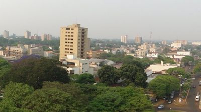
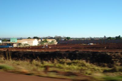
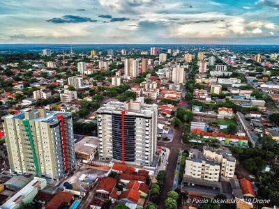
Dourados is a municipality in the southwestern part of Mato Grosso do Sul, surrounded by wide croplands and small forest patches. The urban zone concentrates around a central business axis with wide streets and low buildings, while residential neighborhoods extend outward.

History

The town emerged in the nineteen thirties as a settlement for migrants from southern Brazil and Japan. Decades later, it developed into an important agricultural center that introduced soy and cattle ranching on a large scale.

Culture

The name derives from a golden-yellow river fish that once lived in the waters of the region. Guarani culture remains visible through several indigenous reserves nearby, where visitors can find traditional handcraft work.

Practical

Most visitor services are located in the central part of town, which is manageable on foot. Several parks and public squares offer shade during the hottest hours of the day, when temperatures can rise considerably.

Did you know?

The municipality hosts one of the largest urban indigenous communities in Brazil on the city edge. Visitors often notice the bilingual signs combining Portuguese with Guarani, especially near the reserves.

i
i
Inception
1935
i
Elevation above the sea
430 m
i
Shares border with
Caarapó, Fátima do Sul, Laguna Carapã, Ponta Porã, Rio Brilhante, Douradina, Deodápolis, Maracaju, Itaporã
i
GPS coordinates
-22.22083,-54.80583
i
Latest update
December 13, 2025 15:48

AroundUs brings together thousands of curated places, local tips, and hidden gems, enriched daily by 60,000 contributors worldwide. Discover all places nearby (Mato Grosso do Sul).

Reviews

Visited this place? Tap the stars to rate it and share your experience / photos with the community! Try now! You can cancel it anytime.

« Dourados - Agricultural municipality in Mato Grosso do Sul, Brazil » is provided by Around Us (aroundus.com). Images and texts are derived from Wikimedia project under a Creative Commons license. You are allowed to copy, distribute, and modify copies of this page, under the conditions set by the license, as long as this note is clearly visible.

Discover hidden gems everywhere you go!

From secret cafés to breathtaking viewpoints, skip the crowded tourist spots and find places that match your style. Our app makes it easy with voice search, smart filtering, route optimization, and insider tips from travelers worldwide. Download now for the complete mobile experience.

Around Us App Screenshot

A unique approach to discovering new places

Le Figaro

All the places worth exploring

France Info

A tailor-made excursion in just a few clicks

20 Minutes