Enable Location

We need your location to show you interesting places around you

Discover nearby places

Find interesting locations and hidden gems around you

Precise directions

Get accurate directions and distances to places

Your location is never shared with other users. It's only used when you tap the location button.

Aquidauana

Log in to your account

Start exploring — it's free

Trusted by 63,130 travelers worldwide

Continue with Google
Continue with Apple
or

We will send you a code to connect

By continuing, you accept our Terms and Conditions and our Privacy Policy

Check your inbox

We've sent a pincode in your inbox. Please enter the code below.

Discussion Reviews 1 Photos
32k Popularity

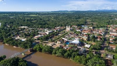
Aquidauana, Gateway municipality to Pantanal in Mato Grosso do Sul, Brazil.

Aquidauana is a municipality in Mato Grosso do Sul that serves as a gateway to the Pantanal wetlands. The landscape features the Serra de Maracaju mountains and the Aquidauana River, which winds through floodplain areas and creates diverse ecosystems.

The settlement was founded in 1892 by five cattle ranchers and grew from a military post established during the Paraguayan War. It gained status as a formal municipality in 1918.

The Terena people live in several communities across the municipality, maintaining their language, crafts, and ceremonies as part of daily life. Their presence shapes local traditions and gives the region its distinctive character.

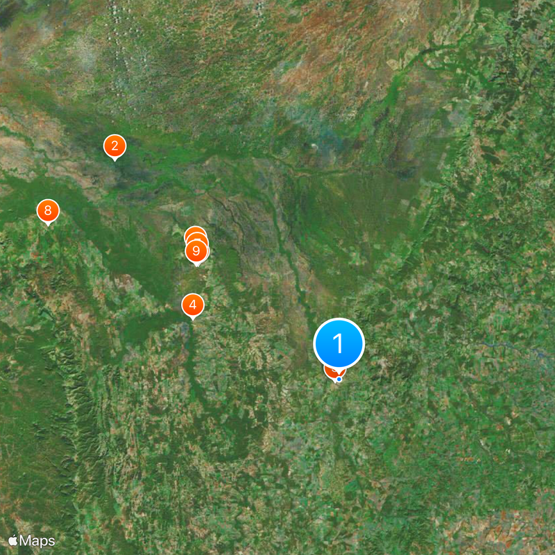
The MS 450 highway connects the area to the Piraputanga Park Road and provides access to natural attractions and lodges along river basins. Plan your visit during the dry season from May to October, when river routes and forest trails are more accessible.

Rock carvings left by hunter-gatherers from pre-colonial times are visible throughout the region. These marks provide evidence of early human settlements that existed in this part of Brazil.

The community of curious travelers

AroundUs brings together thousands of curated places, local tips, and hidden gems, enriched daily by 60,000 contributors worldwide.

Start exploring
Inception
1892
Elevation above the sea
149 m
Shares border with
Rio Negro, Anastácio, Corguinho, Corumbá, Dois Irmãos do Buriti, Miranda, Rio Verde de Mato Grosso, Terenos
GPS coordinates
-20.47083,-55.78694
Latest update
December 20, 2025 00:52
Reviews
Share your experience

No review yet

Discussions
Start a discussion...

No discussion yet

« Aquidauana - Gateway municipality to Pantanal in Mato Grosso do Sul, Brazil » is provided by Around Us (aroundus.com). Images and texts are derived from Wikimedia project under a Creative Commons license. You are allowed to copy, distribute, and modify copies of this page, under the conditions set by the license, as long as this note is clearly visible.

Discover hidden gems everywhere you go!

From secret cafés to breathtaking viewpoints, skip the crowded tourist spots and find places that match your style. Our app makes it easy with voice search, smart filtering, route optimization, and insider tips from travelers worldwide. Download now for the complete mobile experience.

Around Us App Screenshot

A unique approach to discovering new places

Le Figaro

All the places worth exploring

France Info

A tailor-made excursion in just a few clicks

20 Minutes

Around Us
Travel Guide & Maps
Download

Send to your phone

QR Code
1

Open the camera app on your mobile.

2

Point at the QR code with your camera. A notification will appear.

3

Tap the notification to open the link.