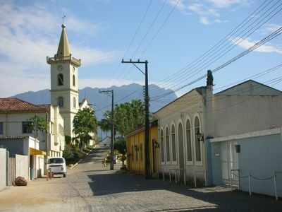
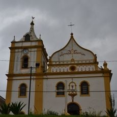
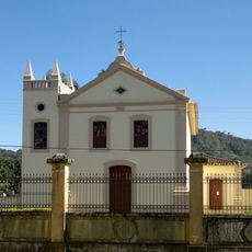
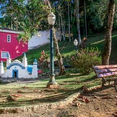
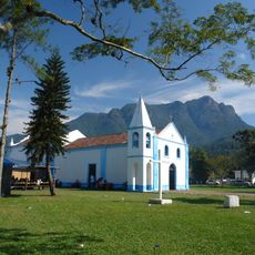
Morretes, Colonial municipality in Paraná, Brazil
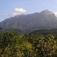
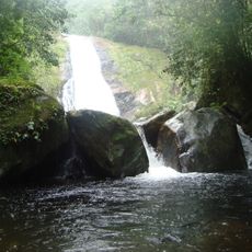
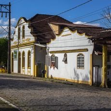
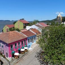
Morretes is a municipality in Paraná situated between the Atlantic Forest mountains and the coastal region, featuring rivers and waterfalls as natural elements. Colonial-era buildings stand preserved along the Nhundiaquara River, forming the core of the settlement.
Jesuits founded the settlement in 1733 on the shores of Paranaguá Bay. This location became crucial for trade routes connecting the coast with inland territories.
The signature dish barreado, a slow-cooked meat stew prepared in clay vessels over many hours, embodies the culinary traditions of this region. This preparation method has been passed down through families and remains central to local food culture today.
The best way to reach Morretes is via the scenic train journey from Curitiba, covering roughly 74 kilometers through Atlantic Forest views and mountain passages with tunnels. Visitors should book this route in advance as it is a popular attraction in itself.
The Serra Verde Express train connecting Morretes and Curitiba includes a dedicated pet wagon with panoramic windows and waterproof beds designed for animal passengers. This detail reflects an unusual thoughtfulness toward traveling companions of all kinds.
Location: Paraná
Elevation above the sea: 8.48 m
Shares border with: São José dos Pinhais, Guaratuba, Antonina, Campina Grande do Sul, Paranaguá, Piraquara, Quatro Barras
Website: http://morretes.pr.gov.br
GPS coordinates: -25.47694,-48.83389
Latest update: December 19, 2025 23:05
Conjunto Marumbi
8.8 km
Pico do Marumbi State Park
9 km
Serra Verde Express
9.6 km
Graciosa State Park
13.7 kmRoberto Ribas Lange State Park
16.7 km
Pau Oco State Park
12.1 km
Igreja do Nossa Senhora do Pilar
13.2 km
Viaduto do Carvalho
9.9 km
Igreja do Bom Jesus do Saivá
12.9 kmAcervo da Farmácia Internacional de Antonina
13.5 km
Fonte da Carioca
13.5 km
Ponte São João
11 km
Igreja de São Sebastião de Porto de Cima
6.2 km
Residência Dona Siroba
6.1 kmReserva Ecológica do Instituto Agronômico do Paraná
5 km
Historic center of Antonina
12.9 kmMuseu do Parque Estadual Do Pico Marumbi
9.5 kmPortal da Graciosa - Dom Pedro
19.6 kmPonte de Ferro
13.1 kmPonte de Ferro
6.2 kmOratório Anjo da Guarda
19.5 kmSalto do Sagrado
14.2 kmCachoeira Roda d'Água
15.3 kmRio de Bóia - Início da Descida
9.1 kmBoia Cross
6.3 kmComplexo Turístico de Porto de Cima
6.3 kmSerra da Graciosa
15.1 kmPasseio de Catamarã
13.8 kmVisited this place? Tap the stars to rate it and share your experience / photos with the community! Try now! You can cancel it anytime.
Discover hidden gems everywhere you go!
From secret cafés to breathtaking viewpoints, skip the crowded tourist spots and find places that match your style. Our app makes it easy with voice search, smart filtering, route optimization, and insider tips from travelers worldwide. Download now for the complete mobile experience.
A unique approach to discovering new places❞
— Le Figaro
All the places worth exploring❞
— France Info
A tailor-made excursion in just a few clicks❞
— 20 Minutes