Cananéia, Coastal municipality in São Paulo, Brazil
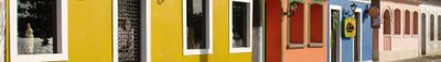
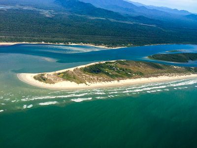
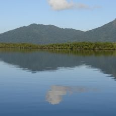
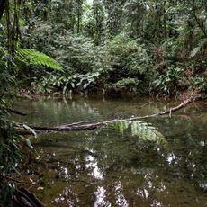
Cananéia is a coastal municipality in the southernmost part of São Paulo state in Brazil, spread across an island between the Atlantic and several river mouths. The town itself sits at the edge of a wide mosaic of mangroves, bays, and protected islands that separate the mainland from the open sea.
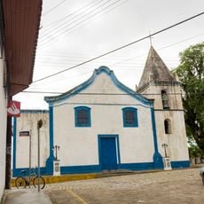
The first permanent European settlement at the site began in the early 16th century, when navigators used the bay as a stopover on routes heading south. The town later became an important port for rice and fish trade before shipping routes shifted westward.
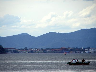
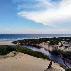
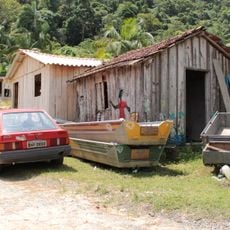
The name comes from a Tupi-language word meaning 'house of the sea,' reflecting the centuries-old bond between inhabitants and the water. Many families today still live from fishing and oyster farming, and you see boats moored at the dock or gliding through the canals everywhere.
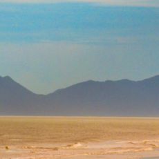
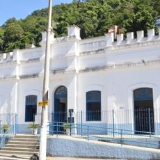
You reach the town by ferry or bridge, and most accommodations sit in the center or along the waterfront. The weather is humid and warm, so light clothing and insect repellent are recommended, especially near the mangroves.
Tucuxi dolphins swim in the bay, a small gray species that usually appears in groups near the islands and moves between the boats. The research station of the Oceanographic Institute also studies the conservation of the mangroves, which are among the largest in Brazil.
Location: São Paulo
Inception: August 12, 1892
Elevation above the sea: 18 m
Shares border with: Pariquera-Açu, Barra do Turvo, Guaraqueçaba, Iguape, Ilha Comprida, Jacupiranga
Website: http://cananeia.sp.gov.br
GPS coordinates: -25.01500,-47.92694
Latest update: December 5, 2025 16:36
Ilha do Mel
69.1 km
Ilha do Cardoso State Park
19.5 km
Fortaleza de Nossa Senhora dos Prazeres
67.5 km
Superagüi National Park
43.8 km
Guaraqueçaba Environmental Protection Area
52.6 km
Basilica of Our Lady of the Snows, Iguape
50.6 km
Salto Morato Private Natural Heritage Reserve
40.9 km
Caverna do Diabo State Park
66.4 km
Guaraqueçaba Ecological Station
58.5 km
Jacupiranga State Park
45.7 km
Cananéia-Iguape e Peruíbe Environmental Protection Area
19.1 km
Lagamar de Cananéia State Park
24.4 km
Cajati Environmental Protection Area
39.9 km
Ilha Comprida Environmental Protection Area
29.5 km
Jacupiranga Mosaic
37.5 km
Sebuí Private Natural Heritage Reserve
41.2 km
Campina do Encantado State Park
44.3 km
Iate Park
49.2 km
Kaigai Koygyo Kabushiki Kaisha
59.4 km
Igreja Matriz de Cananéia
124 m
Museu Municipal de Iguap
50.8 km
Capela Nossa Senhora do Rosário dos Homens Pretos
59.1 km
Igreja de São Benedito
50.8 km
Igreja do Rosário
50.3 km
Museu Histórico e Arqueológico de Iguape
50.8 km
Historic center of Cananeia
100 m
Historic center of Iguape
50.6 km
Quilombo Mandira
1.1 kmReviews
Visited this place? Tap the stars to rate it and share your experience / photos with the community! Try now! You can cancel it anytime.
Discover hidden gems everywhere you go!
From secret cafés to breathtaking viewpoints, skip the crowded tourist spots and find places that match your style. Our app makes it easy with voice search, smart filtering, route optimization, and insider tips from travelers worldwide. Download now for the complete mobile experience.
A unique approach to discovering new places❞
— Le Figaro
All the places worth exploring❞
— France Info
A tailor-made excursion in just a few clicks❞
— 20 Minutes