Enable Location

We need your location to show you interesting places around you

Discover nearby places

Find interesting locations and hidden gems around you

Precise directions

Get accurate directions and distances to places

Your location is never shared with other users. It's only used when you tap the location button.

Itapeva

Log in to your account

Start exploring — it's free

Trusted by 67,873 travelers worldwide

Continue with Google
Continue with Apple
or

We will send you a code to connect

By continuing, you accept our Terms and Conditions and our Privacy Policy

Check your inbox

We've sent a pincode in your inbox. Please enter the code below.

Discussion Reviews 5 Photos
53k Popularity

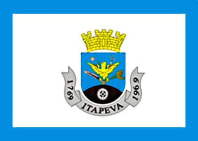
Itapeva, Municipality in São Paulo state, Brazil

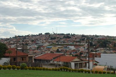
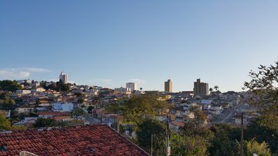
Itapeva is a municipality in São Paulo state, located at approximately 640 meters above sea level in southeastern Brazil. The area extends across roughly 1,826 square kilometers and includes several districts with a mix of rural and semi-urban character.

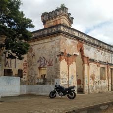
The area was separated from Sorocaba in 1769 and was originally known as Itapeva da Faxina. In 1910, it was renamed Faxina before eventually returning to its earlier name.

The name comes from Tupi language words meaning flat stone, a reference to natural rock formations visible in the landscape. This origin ties the place to its indigenous roots and the geological character of the region.

The municipality sits on highways SP-249 and SP-258, which provide connections to different parts of São Paulo state. These roads make it accessible from various directions and offer routes into the surrounding region.

The territory divides into three districts: Guarizinho, Alto da Brancal, and Areia Branca, each with its own local identity. These separate areas bring different characteristics to the overall municipality.

The community of curious travelers

AroundUs brings together thousands of curated places, local tips, and hidden gems, enriched daily by 60,000 contributors worldwide.

Start exploring
Location
Inception
1769
Elevation above the sea
640 m
Shares border with
Itaí, Ribeirão Branco, Nova Campina, Buri, Capão Bonito, Guapiara, Itaberá, Itararé, Paranapanema, Taquarivaí
GPS coordinates
-23.98194,-48.87583
Latest update
December 14, 2025 17:55
Reviews
Share your experience

No review yet

Discussions
Start a discussion...

No discussion yet

« Itapeva - Municipality in São Paulo state, Brazil » is provided by Around Us (aroundus.com). Images and texts are derived from Wikimedia project under a Creative Commons license. You are allowed to copy, distribute, and modify copies of this page, under the conditions set by the license, as long as this note is clearly visible.

Discover hidden gems everywhere you go!

From secret cafés to breathtaking viewpoints, skip the crowded tourist spots and find places that match your style. Our app makes it easy with voice search, smart filtering, route optimization, and insider tips from travelers worldwide. Download now for the complete mobile experience.

Around Us App Screenshot

A unique approach to discovering new places

Le Figaro

All the places worth exploring

France Info

A tailor-made excursion in just a few clicks

20 Minutes

Around Us
Travel Guide & Maps
Download

Send to your phone

QR Code
1

Open the camera app on your mobile.

2

Point at the QR code with your camera. A notification will appear.

3

Tap the notification to open the link.