Chest opened
+${chestReward.xp} XP
Explorer
NOUVEAU ×${chestReward.collectible.quantity}
tapez pour fermer
Chest locked

Open chests in the app

Around Us is built for your phone — chests unlock when you walk, explore and capture nearby places.

Enable Location

We need your location to show you interesting places around you

Discover nearby places

Find interesting locations and hidden gems around you

Precise directions

Get accurate directions and distances to places

Your location is never shared with other users. It's only used when you tap the location button.

Itirapina

Log in to your account

Start exploring — it's free

Trusted by 72,891 travelers worldwide

Continue with Google
Continue with Apple
or

We will send you a code to connect

By continuing, you accept our Terms and Conditions and our Privacy Policy

Check your inbox

We've sent a pincode in your inbox. Please enter the code below.

Discussion Reviews 2 Photos
19k Popularity

Itirapina, Municipality in São Paulo State, Brazil

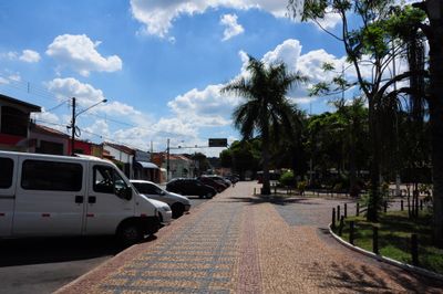
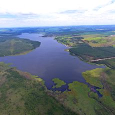
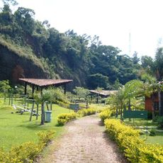
Itirapina is a municipality in São Paulo State situated across hilly terrain interspersed with valleys, lakes, rivers, and forested areas. The settlement sits at approximately 770 meters elevation, creating a landscape with natural variety.

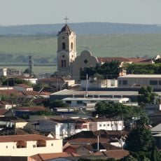
The settlement was founded in 1839 as Nossa Senhora da Conceição da Serra do Itaqueri in a region known for its mountain terrain. It gained official municipality status in 1935 as local growth warranted administrative recognition.

The settlement celebrates the Feast of Our Lady of Conception on December 8, when locals gather for religious services and community gatherings. This observance remains central to the town's annual rhythm and identity.

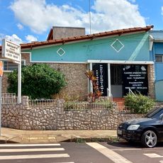
The municipal offices provide information services where visitors can learn about local healthcare facilities, schools, and other community services. Stopping by these offices can help orient you to available resources in town.

The Morro do Fogão rises to about 1,100 meters and dominates the local landscape with a distinctive red hue that intensifies during sunset. This coloring comes from the mountain's mineral composition and geological structure.

The community of curious travelers

AroundUs brings together thousands of curated places, local tips, and hidden gems, enriched daily by 60,000 contributors worldwide.

Start exploring
Location
Elevation above the sea
770 m
Shares border with
São Pedro, Analândia, Brotas, Charqueada, Corumbataí, Ipeúna, Rio Claro, São Carlos
GPS coordinates
-22.25278,-47.82278
Latest update
December 7, 2025 10:08
Reviews
Share your experience

No review yet

Discussions
Start a discussion...

No discussion yet

« Itirapina - Municipality in São Paulo State, Brazil » is provided by Around Us (aroundus.com). Images and texts are derived from Wikimedia project under a Creative Commons license. You are allowed to copy, distribute, and modify copies of this page, under the conditions set by the license, as long as this note is clearly visible.

Discover hidden gems everywhere you go!

From secret cafés to breathtaking viewpoints, skip the crowded tourist spots and find places that match your style. Our app makes it easy with voice search, smart filtering, route optimization, and insider tips from travelers worldwide. Download now for the complete mobile experience.

Around Us App Screenshot

A unique approach to discovering new places

Le Figaro

All the places worth exploring

France Info

A tailor-made excursion in just a few clicks

20 Minutes

Around Us
Travel Guide & Maps
Download

Send to your phone

QR Code
1

Open the camera app on your mobile.

2

Point at the QR code with your camera. A notification will appear.

3

Tap the notification to open the link.