Chest opened
+${chestReward.xp} XP
Explorer
NOUVEAU ×${chestReward.collectible.quantity}
tapez pour fermer
Chest locked

Open chests in the app

Around Us is built for your phone — chests unlock when you walk, explore and capture nearby places.

Enable Location

We need your location to show you interesting places around you

Discover nearby places

Find interesting locations and hidden gems around you

Precise directions

Get accurate directions and distances to places

Your location is never shared with other users. It's only used when you tap the location button.

Andradas

Log in to your account

Start exploring — it's free

Trusted by 72,889 travelers worldwide

Continue with Google
Continue with Apple
or

We will send you a code to connect

By continuing, you accept our Terms and Conditions and our Privacy Policy

Check your inbox

We've sent a pincode in your inbox. Please enter the code below.

Discussion Reviews 2 Photos
31.7k Popularity

Andradas, Administrative municipality in Minas Gerais, Brazil

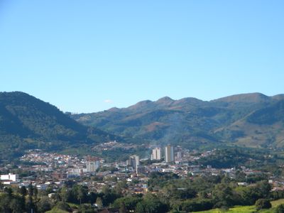
Andradas is a municipality in southwestern Minas Gerais with vineyards and farmland spread across rolling hills. The town is defined by wine production, with various estates and rural areas distributed over gently sloping terrain.

Italian immigrants brought winemaking tradition to Andradas during its early settlement period. These European roots led to the region's recognition as the Land of Wine and continue to shape its economy and identity today.

Wineries in the region maintain traditional production methods and invite visitors to learn about grape cultivation and fermentation firsthand. Tourists can observe how local winemakers carry out their work throughout the year and understand the importance of these practices to the community.

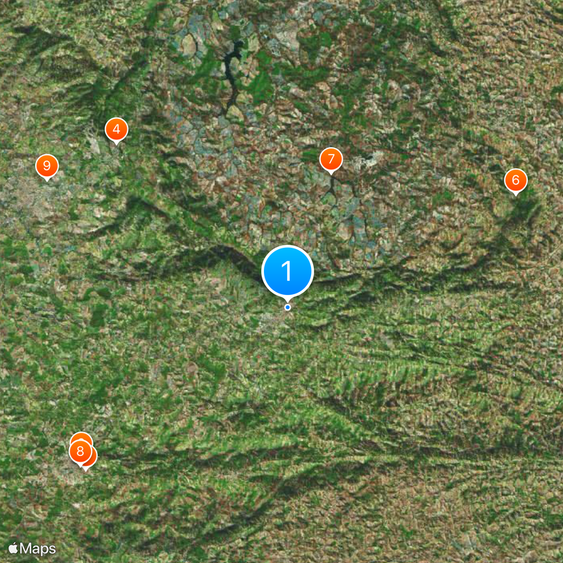
Highway BR 146 and road MG 455 connect Andradas to nearby towns like Poços de Caldas and São Paulo. Visitors should expect rural road conditions and plan ample time to explore the countryside.

The surrounding area features an extensive network of rural roads crossing varied terrain, offering opportunities for cycling and paragliding activities. This road system allows visitors to explore the region in unconventional ways.

The community of curious travelers

AroundUs brings together thousands of curated places, local tips, and hidden gems, enriched daily by 60,000 contributors worldwide.

Start exploring
Location
Elevation above the sea
888 m
Shares border with
Poços de Caldas, Jacutinga, Caldas, Santa Rita de Caldas, Albertina, Ibitiúra de Minas, Ouro Fino, Águas da Prata, Santo Antônio do Jardim, São João da Boa Vista
GPS coordinates
-22.06778,-46.56889
Latest update
December 20, 2025 01:09
Reviews
Share your experience

No review yet

Discussions
Start a discussion...

No discussion yet

« Andradas - Administrative municipality in Minas Gerais, Brazil » is provided by Around Us (aroundus.com). Images and texts are derived from Wikimedia project under a Creative Commons license. You are allowed to copy, distribute, and modify copies of this page, under the conditions set by the license, as long as this note is clearly visible.

Discover hidden gems everywhere you go!

From secret cafés to breathtaking viewpoints, skip the crowded tourist spots and find places that match your style. Our app makes it easy with voice search, smart filtering, route optimization, and insider tips from travelers worldwide. Download now for the complete mobile experience.

Around Us App Screenshot

A unique approach to discovering new places

Le Figaro

All the places worth exploring

France Info

A tailor-made excursion in just a few clicks

20 Minutes

Around Us
Travel Guide & Maps
Download

Send to your phone

QR Code
1

Open the camera app on your mobile.

2

Point at the QR code with your camera. A notification will appear.

3

Tap the notification to open the link.